Curated OER
Ecology of The Sonoran Desert Soil Crusts: Biology, Geology
This lesson is designed after research done on the ecology of soil lichen in the Tucson Basin area during the summers of 1997 and 1998. Its purpose is to guide students into adopting the problem solving thinking of ecologists. The lesson...
Curated OER
Rollin' on The River - the Hudson River!
Students examine how the Hudson River was important to the development of the United States. They examine the role of steamboats played in the development of the Hudson River Valley.
Curated OER
Physics Park
Students research and design a playground for a park or school in their community. They explore the physics concepts that are present in the design and, if applicable promote their ideas to city or school officials.
Curated OER
One Path
Students discover that charge movement through a circuit depends on the resistance and arrangement of the circuit components. In a hands-on activity, students build and investigate the characteristics of series circuits. In another...
Curated OER
How Texas is Planning To Manage Its Water
Students research water management strategies in Texas. They analyze projected demand for water in the year 2050, interpret graphs and tables and then discuss the data as part of a written report. They research and map the locations of...
Curated OER
Endangered Relationships
Students study the interrelationship between the horseshoe crab and red knot. In this ecology lesson, students explain why several species became extinct. They research about endangered species found in their region.
Curated OER
Island Biogeography and Evolution: Solving a Phylogenetic Puzzle With Molecular Genetics
Young scholars engage in solving a logic problem based on real organisms and real data. They develop phylogenies for seven related populations of lizards living on the Canary Islands.
Curated OER
How the Environment Affects Our Health
Ninth graders explore how the environment affects health. In this infectious disease lesson, 9th graders investigate what environmental situations cause infections diseases. Students study the symptoms, treatments, prevention, and...
Curated OER
Beaver, or not?
Students study the role of the beaver in Illinois during the 1800's and how overtrapping cause the near extinction of the beaver colonies in Illinois by 1900. Students role play various people in 1945 who have an opinion about the...
Curated OER
Ocean Floor Model
Students construct a simulated model of the ocean floor in a shoe box. They determine that the floor of the ocean is composed of hills, plains, ridges, trenches, and sea mounts. They draw out a plan for their ocean floor which includes...
Curated OER
Career & Technology Education Introduction to Farming: Seeds of Successful Marketing
Young scholars play an agronomy game. In this agriculture lesson plan, students explore modern farming practices pertaining to the cultivation of grains as they play a game that requires them to act as agronomy specialist as they...
Curated OER
Gettysburg Rocks Recycle to Win
Eighth graders use a geologic cross section to study the rock cycle of the Gettysburg battlefield. In this rock cycle lesson, 8th graders connect the rock cycle and continental rifting.
Curated OER
What Color is the Ocean?
Students view satellite pictures of the ocean, and discuss the presence of phytoplankton and the colors of the ocean. Students compare/contrast ocean satellite images with maps and globes, then color world maps to replicate the satellite...
Curated OER
Salad Tray 3D Topographic Model
Students explore the characteristics of topographical maps. They examine the relationship of contour lines and vertical elevation. Students create a three-dimensional model of a landscape represented by a topographic contour map.
Curated OER
Snack Search
Students make maps to show where the agricultural products used to produce various packaged snacks are grown. They bring in snacks from home and utlize a worksheet imbedded in this plan.
Curated OER
Mapping Lab and Lead Poisoning
Learners are introduced to GIS and its uses. They make predictions before viewing the actual lead poisoning cases by location of Dade County. Pupils use actual Miami-Dade County spatial data to explore basic principals. Students
Curated OER
Using Maps to Make Public Health Descisions Case Study: Harmful Algal Blooms in the Gulf of Mexico
Students are introduced to GIS and its uses. Students participate as public health scientists to deliberate a course of action to explore possible research questions. Pupils interpret spatial data, and make predictions based on GIS data,...
Curated OER
Classifying Living Things
Learners identify how to classify living things. They classify various concepts including family members, kinds of clothing, numbers, shapes, and vocabulary words. They discuss how to classify various concepts and classify pictures of...
Curated OER
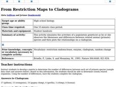
From Restriction Maps to Cladograms
Learners develop a matrix to determine the number of differences between each set of primate species. They determine closely related organisms then complete the cladogram and answer a set of questions.
Curated OER
Trouble in the Troposphere
Students create graphs using NASA data, compare ozone levels of several U.S. cities, analyze and evaluate the data and predict trends based on the data, and discuss and describe how human activities have modified Earth's air quality.
Curated OER
Classifying Life
In this classifying life worksheet, students review the 5 kingdoms of organisms by completing 10 matching and 7 fill in the blank questions.
Curated OER
Protists
In this protists instructional activity, students compare and contrast the different types of funguslike protists: slime molds, water molds, and downy mildews. This instructional activity has 1 short answer and 7 fill in the blank...
Curated OER
Passive and Active Transport
In this transport learning exercise, students compare and contrast the characteristics and examples of active transport and passive transport. This learning exercise has 1 graphic organizer and 11 short answer questions.
Curated OER
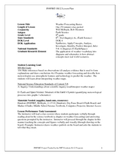
Weather Forecasting Basics
Eighth graders analyze weather diagrams and weather maps. In this earth science instructional activity, 8th graders explain why it is important to know the weather. They complete a handout at the end of the instructional activity.


