Rainforest Alliance
How Far Away Is a Tropical Rainforest?
If driving to school only takes 10 minutes, then how long does it take to drive to a tropical rainforest in Colombia? Explore the focus question in a lesson that uses measurement tools and formulas to figure out the time and distance...
Space Awareness
The Big Meltdown
Explore the world (our world) of melting ice caps. Why are these caps melting? What is the effect of melting ice caps? Dive into the ever-present issue of global warming with a resource that has learners looking at data and participating...
National Gardening Association
Migration Mishaps
Elementary ecologists pretend to be migratory hummingbirds. They fly between wintering and nesting grounds, trying to reach a habitat haven. In a musical-chair fashion, some birds will miss out, and are removed from the game. To further...
Chicago Botanic Garden
Faces of Climate Change
Sometimes, the best solution to a problem can be found by walking in someone else's shoes. Here, scholars use character cards to take on the roles of people around the world. They determine how their character's life affects our...
Space Awareness
How Light Pollution Affects the Stars: Magnitude Readers
Did you know light can decrease visibility? Light pollution absolutely makes it more difficult to see stars. Scholars build a simple magnitude reader to determine the magnitude of stars. They use these data to estimate the impact of...
Foundation for Water & Energy Education
What is the Water Cycle? Activity B
Curious physical scientists follow a lesson on the properties of water with this lesson on distillation. They observe a miniature water cycle model that filters dirty water into clean water. These two lessons combined are an enriching...
Howard Hughes Medical Institute
Zebrafish and Skin Color
You may not know if that zebrafish in your fish tank is a model citizen—but it is definitely a model organism! What can we learn about ourselves from a tiny zebrafish? Discover more about the polygenic trait of skin color through a...
Cold Spring Harbor Laboratory
Genes Get Shuffled When Chromosomes Exchange Pieces
Some genes link to others that have implications for inheritance. A set of resources lead pupils through the history of this discovery. They explain how chromosomes recombine and which parts are more susceptible to this linkage....
Curated OER
Plate Tectonics: Kindergarten Lesson Plans and Activities
This unit focuses primarily on plate tectonics and plate boundaries surrounding continents. It contains pre- and post-lab sections that walk young geologists through plate movements in order to visualize what's going on inside Earth.
Chicago Botanic Garden
Albedo, Reflectivity, and Absorption
What is reflectivity, and what does it have to do with the Earth's climate? As reflectivity is measured by albedo, scientists can gather information on Earth's energy balances that relate to global warming or climate change. Budding...
Polar Trec
Why Can’t I Eat This Fish?
Can turning on the television lead to toxins in the food supply? The instructional activity offers an opportunity for young scientists to complete guided research. A worksheet lists each question as well as the web page necessary to...
Howard Hughes Medical Institute
Lactase Persistence: Evidence for Selection
What's the link between lactase persistence and dairy farming? Biology scholars analyze data to find evidence of the connection, then relate this to human adaptation. Working individually and in small groups, learners view short video...
Curated OER
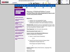
Planning A Railroad Online Lesson
Students plan a route across Donner Summit using topographical maps in order to understand the challenges involved in constructing the railroad in the Sierra Nevada Mountains. For this history lesson, students first discover how to read...
Curated OER
Arthur's Tooth
Students practice their reading comprehension by reading a story in their class. In this story map lesson, students read the Marc Brown book Arthur's Tooth and discuss the story, characters and setting. Students create a story map based...
Curated OER
Design an Island
Students make a map of an imaginary island using the topographic symbols provided from a worksheet. Students place lakes, dwellins, reefs, etc. in areas where they would logically be located from understanding how the topography of an...
Curated OER
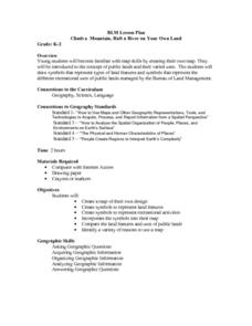
Climb a Mountain, Raft a River on Your Own Land
Students are introduced to the characteristics of a map. As a class, they discuss the uses of public lands in their community and develop symbols for each feature. They use the symbols to create a map showing the recreational uses of...
Curated OER
Continents and Oceans
Students identify oceans and continents and their locations on a map. They color-code and label their own map of the world's continents and oceans. They play the game Continents and Oceans to identify specific areas.
Curated OER
Anza and Font in Search of Latitude
This is an integrated lesson that incorporates Social Studies, Science, and Mathematics. In Social Studies, 7th graders complete an online interview and complete an online worksheet about latitude of sites on the Anza trail. In Science...
Curated OER
Using Maps To Make Public Health Decisions Case Study: Wildfires in Mexico 2000
Students study environmental health. Using actual NOAA satellite imagery, students investigate the basic concepts of mapping. They explore the relationship between monitoring satellite images and public health decision making.
Indian Land Tenure Foundation
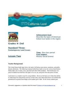
Indian Trust Lands
An important aspect of studying Native American history is understanding the nature of trust lands. Budding historians will learn that as Native Americans were removed from their home lands, trust lands were provided in the form of...
Teach Engineering
Magnetic Fields
Introduce your class to magnetic fields with an activity that demonstrates that a compass is affected by the magnetic field of the earth, unless a closer, stronger magnetic field is present. Pupils can use this fact in the associated...
Michigan Sea Grant
Exploring Watersheds
Collaboratively, students partake in a hands-on activity in which they build models of a watershed. Each group member draws an elevation map—a bird's eye view—of their model and predicts how water will flow from the high to low points....
Curated OER
Exploring Living Science Careers
Students explore a variety of agricultural careers that are available and look into them in terms of the economics and suitability to their interests. In this agriculture careers lesson students research the agriculture careers and...
Curated OER
Ancient Rome: Map Work
Seventh graders explore the Roman Empire. In this ancient Rome lesson, 7th graders use digital and print maps to examine the geography of the Roman empires. Students are assigned regions of the empire to analyze and present their...


