Flipped Math
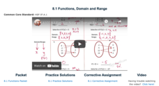
Functions, Domain and Range
Take a deeper dive into the notation of a function. The video presentation uses grocery store prices as an example to explain the concept of a function. Pupils determine whether mappings are functions or not and find the domain and...
Safe Drinking Water Foundation
Water Pollution
An introductory instructional activity to a unit on water pollution, young environmentalists are asked to brainstorm examples of pollutants in water. This instructional activity will help develop a sense of what water pollution is and...
Curated OER
Brazilian Animals
Young scholars research the animals of Brazil. For this animal science lesson, students locate Brazil on a map and discuss the types of animals that can live in its tropical climate. They research a Brazilian Carnaval and see the roll...
Curated OER
Weather Analysis - Lab Activity
Ninth graders perform research in the subject of weather to answer several key questions to increase comprehension of concepts. Students use weather prediction as an application for the research.
Curated OER
Title: Rivers as Borders
Students are introduced to the concept of borders. They read maps and identify rivers that separate different countries and states. They examine how or why a landform such as a river border might be the reason for different cultures.
Curated OER
Exploring Wyoming Species Habitats
Learners are introduced to the concept of species habitats and ranges. They introduced to ArcView GIS as a tool for mapping. Pupils use query data for species withina county, elevation, range, rivers and streams, land cover, and etc....
Curated OER
Organizing a Speech
Students discuss the elements of an effective speech. They use Inspiration to create a graphic organizer or map of how to effectively organize a speech. Students share their graphic organizer/map with the class.
Curated OER
Where is ? ? ? ?
Students explain and explain the concept of a grid system. They define absolute and relative location and develop an imaginary city on graph paper using a grid system.
Curated OER
Communication Skills: Special Education
Get to talking with your special needs class. In pairs, they take turns telling each other where to go on a schematic map. They work to ask questions, answer questions, and check if their partner understands their directions, or if he...
Curated OER
Essential Elements of Habitat
First graders compare their local area with the Belize landscape. They construct maps of the school area, adding descriptive information. They write haiku poems about their favorite outside places.
Curated OER
Learning Ratios and Proportions Through Scale Drawings
Middle and high schoolers explore the concept of scale drawings. They discuss what a scale is and that scales provide a ratio. Pupils construct a scale drawing of their classroom using graph paper.
Curated OER
Pizza and the Economy
Students become aware of the history behind pizza and how it was adapted to the economic and geographic conditions of the United States. They have a basic understanding of the concepts of supply and demand.
Curated OER
Wow! You're Eating Geography
Middle schoolers examine patterns of food producing areas, and identify foods that are grown locally, in the U.S., and around the world. They map and graph the major food crops of their local area, the U.S., and other countries, and...
Curated OER
The ABC's of Apportionment
Students are introduced to the terms of apportionment and redistricting. Using a Census map, they identify the states that had the highest and lowest numbers of change during the past ten years. They examine a map of voting districts and...
Curated OER
Proportions and Scale Factor for Measurement
Students explore the concept of proportion. In this proportion lesson, students use google maps to find the distance the their school is from home. Students discuss what a scale factor is through teacher led discussion. Students...
Curated OER
Puerto Rico: The 51st State?
Students research the history of Puerto Rico, its culture, and geography. In this Puerto Rico lesson, students find Puerto Rico on a map and find specific regions or cities. Students discuss Puerto Rico's statehood and listen to salsa...
Curated OER
Iraq, Where's That?
Students identify the Middle Eastern countries on the map and the oil-producing countries of OPEC in the region. They examine whether the presence of important producing oil fields qualifies as a characteristic of this region.
Curated OER
Westward Expansion
Young scholars locate California and New York on a map and explore available means of travel in the 19th century. Students explore the role of trade in pioneer America and simulate various barter transactions.
Curated OER
The Sweet Connection
Learners use maps to find what crops are dominant in areas where honey bees are raised and discuss possible correlations. They mark the top ten honey- producing states on a US map.
Curated OER
How Mountains Shape Climate
Students use raw data to make a climatograph; they explain the process of orographic precipitation and the concept of a rain shadow.
Curated OER
Quilt? What Quilt? I Don't See a Quilt!
Students analyze maps and cultures of major cities in the state of Arizona and designate different regions within the state according to geography and economy.
Curated OER
This Land Is Our Land
Students research federal land holdings. They explore how those lands are used. They map these lands and design their own legends. They discuss whether or not the land is being used accordingly.
Other popular searches
- Cell Transport Concept Map
- Blank Concept Maps
- Genetic Concept Map
- Weather Concept Map
- Krebs Cycle Concept Map
- Science Concept Map
- Phylum Chordata Concept Map
- Concept Map Rubrics
- Inspiration Concept Map
- Dna Structure Concept Map
- Concept Map in Science
- Rock Concept Maps


