Curated OER
MAPPING THE BLACK ATLANTIC
Learners examine the geographic characteristics of Western and Central Africa, the impact of geography on settlement patterns, cultural traits, and trade. They compare political, social, economic, and religious systems of...
Curated OER
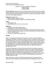
Learning from Maps and Timelines Time Travel
Students create timelines depicting the important events in the lives of the groups that arrived at the Fort St. Louis. They include the fate of La Salle and the colonists.
Curated OER
Your Map of Rights
Students explore the Bill of Rights, which rights have limitations on them, and how these rights apply to their personal lives. They write their own Bill of Rights for the class community.
Curated OER
Sonar Mapping
Students use a shoe box to create a seafloor model and use cardboard for layering inside of the shoe box to simulate the ocean floor. They probe the ocean floor to simulate sonar echoes. Finally, students graph their data to get a...
Curated OER
Mapping the Homunculus
Students determine the relative number of nerve endings located in the skin. By calculating the reciprocal of these measurements, students have the appropriate data for predicting the relative size of the homunculus found on the cerebral...
Curated OER
Creating Life Maps (Elementary, Reading/Writing)
Students create a personal life timeline to better explain how a historical timeline is effective in studying history. They also write a poem about themselves.
Curated OER
Mapping Out Summarization
Students summarize a selected piece of text using a a six step process. After reviewing the correct way to read silently, students read a selected piece of nonfiction text. They write a summary paragraph using the six step process...
Curated OER
Landforms By Hand: Geography, Map Skills
Young scholars experiment with landform vocabulary by using their own hands and a bar of soap as media.
Prairie Public Broadcasting
Egyptian Pyramids Virtual Field Trip!
A virtual field trip takes enthusiastic travelers to the pyramids of Giza. Using Google, scholars explore the grounds of the ancient pyramids found in Egypt then complete three worksheets: a photo analysis page, a reflection sheet, and a...
Curated OER
Do the Tallywalker
Students study the basics of mapmaking, then make a tally walker, (geographic location device used in secret).
Curated OER
Understanding Weather and Climate Patterns
Young scholars research the climate patterns of various locations and make predictions based on their findings. They determine the importance of latitude and longitude in weather and climate. Students create graphs displaying their...
Mathematics Assessment Project
College and Career Readiness Mathematics Test B1
Math was easier before it got mixed up with the alphabet. A 10-page test covers material from multiple years of high school math. Scholars demonstrate knowledge across domains with a mixture of short answer and applied problems.
Mathematics Assessment Project
Arithmetic with Polynomials and Rational Expressions
It all starts with arithmetic. An educational resource provides four items to use in summative assessments. The items reflect the basic skill level required by the standards in the domain and are designed to have...
Mathematics Assessment Project
College and Career Readiness Mathematics Test A2
A six-page evaluation covers material included in algebra, geometry, and algebra II. Applied word problems are mixed in with short answer questions. It also provides questions on mathematical reasoning.
Curated OER
Where Am I, and How Do I Get Where I am Going?
Students describe geographical places through art, music, writing, and math. They compile information in booklets which may be published.
Curated OER
Valentine Village
Students build a small city by using a half-gallon milk or juice carton to "build" a miniature home. They decorate their buildings with construction paper, yarn, beads, or whatever they have and become mailmen, delivering Valentine's to...
Foreign Policy Research Institute
A Geography Lesson
Fewer and fewer people have a strong grasp of world geography, but this activity helps students understand geopolitics by creating their own original historical map. The activity requires selecting a country from the list provided,...
Curated OER
Lesson Two: Writing Letters in Code
Combine your friendly letter lesson, grammar lesson, and technology lesson with this fun activity! Young writers compose letters to friends, and then convert the text to Webdings font. Their friends then decode the letter based on a key....
Curated OER
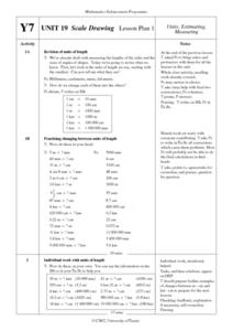
Scale Drawing Lesson Plan
Students calculate actual building measurements from a village map using concepts of ratios and scale in this ten instructional activity mini-unit. They practice measuring angles, multiplying decimals, estimating height and length, and...
Curated OER
Watershed Ways
Students connect the water cycle concept with local fresh water availability and consumption. They identify waterways in their own region. Students define, predict, research, and map local watershed areas. They research the positive...
National Research Center for Career and Technical Education
Information Technology: Photoshop Scale
Scaling is a practical skill as well as a topic to be addressed throughout the Common Core math standards. You are given three different presentations and a detailed teacher's guide to use while teaching proportion, as well as practice...
National Research Center for Career and Technical Education
Finance: Depreciation (Double Declining)
Of particular interest to a group of business and finance pupils, this lesson explores depreciation of automobile values by comparing the double declining balance to the straight line method. Mostly this is done through a slide...
University of Wisconsin
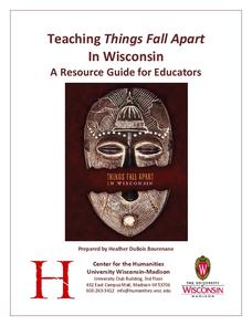
Teaching Things Fall Apart in Wisconsin: A Resource Guide for Educators
“There is no story that is not true, . . .” And uncovering the truths in Things Fall Apart is the focus of a 68-page resource packet designed to provide instructors with a wealth of materials that enhance understanding of Chinua Achebe’s...
Delegation of the European Union to the United States
Cultural Identity
How does cultural diversity impact political identity? That is the question researchers face as they continue their examination of the European Union and the programs it has developed in its attempt to achieve unity in diversity. To gain...
Other popular searches
- Cell Transport Concept Map
- Blank Concept Maps
- Genetic Concept Map
- Weather Concept Map
- Krebs Cycle Concept Map
- Science Concept Map
- Phylum Chordata Concept Map
- Concept Map Rubrics
- Inspiration Concept Map
- Dna Structure Concept Map
- Concept Map in Science
- Rock Concept Maps


