Curated OER
Lesson Two: Writing Letters in Code
Combine your friendly letter lesson, grammar lesson, and technology lesson with this fun activity! Young writers compose letters to friends, and then convert the text to Webdings font. Their friends then decode the letter based on a key....
Curated OER
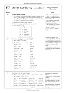
Scale Drawing Lesson Plan
Students calculate actual building measurements from a village map using concepts of ratios and scale in this ten lesson mini-unit. They practice measuring angles, multiplying decimals, estimating height and length, and converting metric...
Curated OER
Watershed Ways
Students connect the water cycle concept with local fresh water availability and consumption. They identify waterways in their own region. Students define, predict, research, and map local watershed areas. They research the positive...
National Research Center for Career and Technical Education
Information Technology: Photoshop Scale
Scaling is a practical skill as well as a topic to be addressed throughout the Common Core math standards. You are given three different presentations and a detailed teacher's guide to use while teaching proportion, as well as practice...
National Research Center for Career and Technical Education
Finance: Depreciation (Double Declining)
Of particular interest to a group of business and finance pupils, this lesson explores depreciation of automobile values by comparing the double declining balance to the straight line method. Mostly this is done through a slide...
University of Wisconsin
Teaching Things Fall Apart in Wisconsin: A Resource Guide for Educators
“There is no story that is not true, . . .” And uncovering the truths in Things Fall Apart is the focus of a 68-page resource packet designed to provide instructors with a wealth of materials that enhance understanding of Chinua Achebe’s...
Delegation of the European Union to the United States
Cultural Identity
How does cultural diversity impact political identity? That is the question researchers face as they continue their examination of the European Union and the programs it has developed in its attempt to achieve unity in diversity. To gain...
Science 4 Inquiry
An Investigative Look at Florida's Sinkholes
In May of 1981, the Winter Park Sinkhole in Florida first appeared and is now referred to as Lake Rose. Scholars learn about the causes of sinkholes through an inquiry project. Then, they analyze recent data and draw conclusions to...
NASA
Hurricanes and Hot Towers with TRMM
Take cover because a wild presentation on hurricanes is about to make landfall in your classroom! An outstanding PowerPoint presentation is the centerpiece of this lesson. Not only does it provide information and photographs, but several...
Curated OER
Rescue!
Middle schoolers explore movement and position concepts. They follow directions using left , right, up, down, North, South, East and West. Students draw and follow a path on a grid to show a route followed. They label and follow legends...
Curated OER
Geography: Map Making
Young scholars, working in groups, share notes and maps collected during a study of the Lewis and Clark Expedition. They draw large composite maps of the western United States on butcher paper including land formations, bodies of water,...
Curated OER
Interior of the Earth
Sixth graders identify and describe the composition and physical properties of the layers of the Earth. They also explain how scientists used the scientific process to know about the center of the Earth. Finally, 6th graders read a...
Curated OER
Cartography
Students research about cartography and how to be a cartographer. In this math activity, students draw a map of their classroom. They use a robot to explore navigation using a compass rose.
Curated OER
Around The Town
Students participate in alphabetizing letters, coming up with questions and concepts, and show the rules of phonics by playing a game for a unit opener. In this language arts lesson plan, students also come up with thinking maps.
Curated OER
Geo-Town
Second graders use a checklist to construct a Geo-Town map including a compass rose, a map key, and a paragraph about a walk around Geo-Town, using appropriate geometric and directional vocabulary to identify the two-dimensional figures...
Curated OER
Spatial Understanding of the Cities and Towns
Students engage in a fun stand up, move around activity that teaches some basics of geography. They develop concepts of distance between community locations and practice giving and taking directions in an organized manner.
Curated OER
Estimating Distances
Fifth graders explore the concept of estimating distances between two places on a map. In this estimating distances lesson plan, 5th graders interpret maps according to measuring distance. Students choose a place on a map and find the...
Curated OER
Running Water/Rivers-Life Cycle
Students explore the parts of a river system and use topographical maps to determine the stage of the river.
Curated OER
Exercise 23--the Regular Pentagon on a Given Side
Students examine and study how to recognize the characteristics of a regular pentagon and demonstrate how to construct one. They become aware of associating a regular pentagon to its term of a double map and practice the concept of line...
Curated OER
My Top Interdisciplinary Social Studies Lesson Plans
Here are some top social studies lesson plans and activities which present concepts in a memorable fashion.
Curated OER
TE Activity: Nidy-Gridy
Students make a grid and coordinate system map of their classroom as they investigate why it is important to have a common map making system. They look at how landmarks are used for navigating an area.
Curated OER
Comparing Time Periods in U.S. History: The Ashford Project
Fifth graders use a "fact book" comparing periods in American history then students create a picture to illustrate their assigned periods. # # students use their pictures and concept maps to write expository paragraphs about their...
Curated OER
Pablita Velarde: A Biography
Students listen to Pablita Velarde: Painting Her People, a story by Marcella J. Rich. They discuss the book and why they think the author wrote it. They make a concept map of their ideas using Kidspiration software.
Curated OER
Weathering and Erosion
Sixth graders discuss the differences between chemical and mechanical weathering. Using that information, they create a concept map showing the forces that cause these types of weathering. After participating in an activity, they...
Other popular searches
- Cell Transport Concept Map
- Blank Concept Maps
- Genetic Concept Map
- Weather Concept Map
- Krebs Cycle Concept Map
- Science Concept Map
- Phylum Chordata Concept Map
- Concept Map Rubrics
- Inspiration Concept Map
- Dna Structure Concept Map
- Concept Map in Science
- Rock Concept Maps


