Monroe City Schools
Clouds! Clouds! Clouds!
Here is a beautiful lesson plan on clouds designed for your 1st graders. Learners study three different types of clouds. They construct drawings of cumulus, cirrus, and stratus clouds. The Cloud Book, by Tommie dePaola is used to...
Annenberg Foundation
Geometry 3D Shapes: Surface Area and Volume
Whether you wrap it or fill it, you're using geometric concepts. Classmates use an interactive approach to learn how to find volume and surface area of cylinders and prisms in the second lesson in a five-part series. The online lesson...
Curated OER
Final Regents Review: Greece
Take your students on a free trip to Athens this year with this presentation, which tours the geography, history, and modern changes in the country of Greece. Clear, easy-to-understand maps and pictures help students to appreciate this...
Annenberg Foundation
Geometry 3D Shapes: Test Your Skills
Time to find out what they've learned! The final lesson of a five-part series has learners complete a 39-question multiple choice review. They use what they've learned in the previous lessons to complete questions that include concepts...
Curated OER
The Times and Life During the California Gold Rush
Fourth graders read about the era in their history books, write in their journals revolving around the Gold Rush, making crafts such as newspapers, and also play the part of the Forty-niners.
Curated OER
Thanksgiving
First graders summarize similarities and differences of life in England and America for the Pilgrims by reading a mini-book. Then, they write a journal entry in first person on what it is like to be a pilgrim in England and in America....
Curated OER
Special Traits: Alabama quarter reverse
Who knew a state quarter could say so much? Alabama's quarter is embossed with an image of Helen Keller, pupils will use this image to think about what the phrase "Spirit of courage" means. They will use a graphic organizer to...
Curated OER
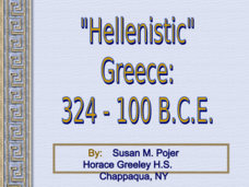
Alexander the Great and Hellenistic Greece
Visual images, maps, and notes on the great philosophers and scientists of Hellenistic Greece await your class. While light in terms of text, the presentation provides images that should help you to describe the area and reign of...
Channel Islands Film
Cache: Lesson Plan 2 - Grades 4-6
Class members will dig this activity that has them trying their hand at recovering artifacts. Groups are assigned a section of a sandbox, carefully uncover the artifacts in their section, and then develop theories about who might...
Society for Science & the Public
Easter Islanders Made Tools, Not War
When studying artifacts, especially tools, how do archaeologists determine what the devices were used for? In what ways might researchers' previous experiences influence their perception of an artifact? An article about researchers'...
Curated OER
The Bozeman Trail
Eighth graders are introduced to the Bozeman Trail. Using the internet, they research the trail to discover the forts located on its path. They must also locate and label landmarks on a map using symbols they create. They answer...
Curated OER
Draw A Coastline
Learners identify, locate and draw at least ten different geographical features on a map. Using the map, they must make it to scale and include their own legend and compass rose. They share their map with the class and answer questions.
Curated OER
Lahar Travel Time
Ninth graders analyze published geologic hazard maps of California and comprehend how to use the map's information to identify evidence of geologic events of the past and present and predict geologic changes in the future. They select...
Curated OER
Probes, Exploration and Application
Students examine the benefits of the space program to our life on earth. In this space exploration lesson students participate in a lab, answer questions and study radar mapping.
Curated OER
Wegener and Plate Tectonics: A Hands-On Lesson
Students are introduced to and experiment with the basic concepts of plate tectonic theory as well as assess the history of the theory of plate tectonics. They explain and illustrate the basic concepts through diagrams and models of...
Curated OER
"Hard" Data from Space
Young scholars use satellite images to analyze development patterns within Baltimore City. They prepare a land cover map for Baltimore indicating the prevalence of impervious surfaces and explore how these patterns affect water pollution.
Curated OER
Continents and Oceans on the Move
Students create an awareness of the vast percentage of water covering the earth. They relate similarities/differences between topographical maps and other maps of various time periods. Students examine how to use a topographical map.
Curated OER
Earthquakes And Volcanoes
Students investigate the concept of plate tectonics through focusing a research study upon the occurrence of earthquakes and volcanic eruptions. They find information that is used for class discussion. Students complete a mapping of...
Curated OER
Building A Topographic Model
Students visualize, in three dimensions, features represented by contour lines on a topographic map. They see that the different elevations shown on a two dimensional topographic map can be used to build a 3-D model.
Curated OER
The Great Continental Drift Mystery
Students stud the concept of Pangaea by using Wegener's clues to construct a map of the continents joined together. They determine how fossil distribution can be used to enhance the study of continental drift. They locate the...
Curated OER
What is a Dry Forest?
Students explore the importance of the dry forest. In this science lesson plan, students discuss the history of dry forests and changes that have occurred due to human interaction. Students create a map showing the historical range of...
Curated OER
Genetics
Students explain the difference between dominant and recessive genes, identify what causes differences in the traits of parents and their offspring, and explain how sex is determined. They will also improve their reading and...
Curated OER
Meteorology
Fourth graders study how atmospheric conditions change while naming the things that make the weather change. They investigate the affects of air masses, weather fronts and high/low pressure by looking at weather maps from newspapers.
Curated OER
Igneous Rock Formation
Fifth graders use the computer lab to search for answers to questions on their workshet. They discuss the creation of igneouss rocks and listen as the teacher lectures about lava. Students follow directions to mix a batch of salt dough...


