Curated OER
Shizuko's Daughter: Concept of Definition Word Map
Help your class use critical thinking when it comes to unfamiliar words. With vocabulary from Kyoko Mori's Shizuko's Daughter, kids write the word in the center of a graphic organizer, and find its category, comparisons,...
ReadWriteThink
Dear Librarian: Writing a Persuasive Letter
Everyone deserves to read a great book! Here, pupils write a persuasive letter to the school's librarian detailing their favorite story and why it should be found on the shelves. Class members' persuasive reading passages are shared with...
Sunburst Visual Media
Clouds
Support science instruction with a combination of engaging activities and skills-based worksheets that focus on clouds. Learners take part in grand discussions, write an acrostic poem, complete graphic organizers, solve word...
iCivics
Mini-Lesson: Gerrymandering
Who determines the structure of voting districts? The concept of gerrymandering brings to light the ongoing issue of how those running for office gain votes. Hands-on activities enable scholars to analyze the re-drawing of voting...
Curated OER
How Big is Big?
Geography learners compare and contrast population densities throughout the world. Using maps, they estimate the relative size of the world's regions and populations. They develop analogies to discover the world they live in and...
Curated OER
Observation and Inference
Assess your young scientists' understanding of the difference between observation and inference with this 20-question multiple choice quiz. It reviews a variety of physics and astronomy concepts, such as solar eclipses and sunspots, the...
Student Handouts
Christopher Columbus Workbook
Youngsters gain ample reading comprehension practice while studying the history of Christopher Columbus with this great workbook! It includes word puzzles and comprehension checks of multiple assessment styles, including multiple choice,...
Mathematics Vision Project
Module 7: Connecting Algebra and Geometry
The coordinate plane links key geometry and algebra concepts in this approachable but rigorous unit. The class starts by developing the distance formula from the Pythagorean Theorem, then moves to applications of slope. Activities...
CK-12 Foundation
Midpoint and Segment Bisectors: Midpoint Map
Discover how to find a midpoint with a conceptual exploration. Scholars manipulate a point to determine the location of a midpoint on a straight line distance between two locations. Later questions extend to determine the...
CK-12 Foundation
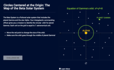
Circles Centered at the Origin: The Map of the Beta Solar System
Calculate galactic orbits in a far-out resource. Pupils drag a point on a circle to graph the orbit of a fictional planet. Using the equation, they find points through which the orbit passes. To finish the simulation, users determine the...
New York State Education Department
Global History and Geography Examination: January 2017
Global history and geography class members demonstrate their knowledge of and ability to analyze primary sources such as graphics, maps, political cartoons, and texts from important documents with an assessment that includes multiple...
PBS
The Last Generation
How does climate impact the town, city, or area where people live? Scholars research the concept of climate change as it pertains to the Marshall Islands. The opening lesson of a two-part series uses interactive online resources and...
NOAA
Investigating Sea Level Using Real Data
The news reports on rising sea level, but how do scientists measure this rise? Scholars use NOAA data including maps, apps, and images to work through five levels of activities related to sea level. Each level in the series adds a new...
New York State Education Department
Global History and Geography Examination: January 2016
What do the Inca Civilization, Wittenburg Church, and India's economy in the Mughal Period have in common? The well-rounded standardized test challenges scholars to remember all of them. They use different graphics and maps to answer...
Rice University
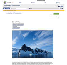
Algebra and Trigonometry
Move on into trigonometry. An informative eBook takes the content of a College Algebra course and adds more relating to trigonometry and trigonometric functions. The content organization allows pupils to build upon their learning by...
EngageNY
Forming a Research-Based Claim: Cascading Consequences Charts
Life is all about choices and consequences. Using a Cascading Consequences chart, scholars create a visual map of the effects of a particular choice or action related to water management. With their researcher's notebooks and copies of...
DocsTeach
From Dred Scott to the Civil Rights Act of 1875: Eighteen Years of Change
What do a photo of Abraham Lincoln, a map for the Battle of Antietam, and the Dred Scott decision all have in common? Learners consider the broader question as they examine documents related to civil rights during the Civil War and...
Anti-Defamation League
Viewing History from Multiple Perspectives
Celebration or protest song? The full text of Woody Guthrie's "This Land is Your Land" opens a study of the Lewis and Clark Expedition, the Louisiana Purchase, and Western Expansion from various perspectives. Middle schoolers examine...
K20 LEARN
Manifest Destiny: U.S. Territorial Expansion
A close examination of John Gast's painting "American Progress" launches a study of the concept of Manifest Destiny used to justify United States' policy of westward expansion. Young historians read statements from persons with different...
Curated OER
Put Me in My Place: Using Alphanumeric Grids to Locate Places
Students practice locating points on a large wall grid and create and label a neighborhood map. In this geography lesson, students spell and discuss places as the teacher places them on the map. They discuss the concept of an...
Curated OER
Leapin' Landmarks: Locating 10 Man-made Landmarks Around the World
Third graders label continents, oceans, and major mountain ranges on maps and use the maps to write an informational report about landmarks. In this landmarks lesson plan, 3rd graders write about 1 major landmark.
Curated OER
Getting to the Core of World and State Geography
Students create topography relief maps. In this geography skills lesson, students review geography core knowledge skills, design and make a state relief map, and compile a student atlas.
Curated OER
Maize to Maquiladoras: Movement from Mexico to Arizona
Fourth graders label maps of Arizona and Mexico to show the people, goods, and ideas that have moved between the two places. In this Arizona and Mexico lesson plan, 4th graders summarize the effects of the movement on Arizona life.
Curated OER
Lesson Ten: Direction
Students explore the concept of relative location. In this map lesson, students read I Hate English by Ellen Levine and consider how maps and globes help people to familiarize themselves with an area.


