Curated OER
If I Had Been at Ellis Island
Students examine what it was like to enter the U.S. as an immigrant. They conduct Internet research, develop a concept map, list the ways children occupied their time while at Ellis Island, and create a diorama.
Curated OER
Colonial Vacation Planner
Looking for a good lesson on the Colonial Period for your upper-elementary class? Then, this lesson is for you! They use website designs, U.S. travel publications, and maps to plan a family vacation to states which were part of the...
Curated OER
How Do I Get There? Planning a Safe Route to School
One much-needed skill for young learners is direction giving. Have your class plan and draw a safe route for them to travel from home to school. They will also draw places and items that are in between home and school in order to build a...
Indian Land Tenure Foundation
Indian Trust Lands
An important aspect of studying Native American history is understanding the nature of trust lands. Budding historians will learn that as Native Americans were removed from their home lands, trust lands were provided in the form of...
Curated OER
Christopher Columbus
Help first graders gain an understanding of the beginnings of our nation by learning more about Christopher Columbus. They begin by listening to a read aloud of Christopher Columbus and His Voyage to the New World (another title...
Curated OER
Orienteering - Lesson 7 - Compasses
More compass practice! This activity has your scholars practicing getting their bearings. They will participate in a schoolyard compass game where they will have a specific starting point and then navigate through the course according to...
Curated OER
Introducing Literacy Elements in Nonfiction
Explore nonfiction writing with your class. They will identify elements in nonfiction by reviewing elements of fiction. Then they use biographies, memoirs, menus, Time for Kids, and text books to identify elements of nonfiction. They...
Teach Engineering
Magnetic Fields
Introduce your class to magnetic fields with an activity that demonstrates that a compass is affected by the magnetic field of the earth, unless a closer, stronger magnetic field is present. Pupils can use this fact in the...
It's About Time
Organizing a Store
When provided with multiple objects, how many ways can the class organize and display them based on predetermined factors? Assist class members with a handy activity—theoretically teaching them concepts to understand periodic...
Curated OER
Direction and Angle: Positions and Directions
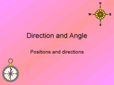
This is an interesting mix of concepts. Half of this presentation provides double-digit addition and subtraction practice and the other half has students discuss cardinal directions and right angles. Use these together, or use them on...
Curated OER
Water Contamination Mapping Lab
Students are introduced briefly to the Biscayne Bay Ecosystem, observed microbe distributions and water current maps are introduced. They measure water current speeds to predict the movement of pollutants based on the type of the tidal...
Curated OER
TOPSY TURVY MAPS
Eighth graders use the data analyzer and motion detector to collect data and measure distances. They create topographic maps drawn to scale of a given setup and relate the concepts to the creation of historical ocean maps.
Curated OER
Flatworms
In this biology worksheet, students complete the concept map using the given terms. They fill in 10 blanks with the correct answer.
Curated OER
MAP UNIT
First graders investigate how maps are used to identify different locations. They will also appreciate how there are different types of maps for their purposes. Finally students study how maps contain symbols that represent real places.
Curated OER
Neighborhood Map Machine
Second graders study building placements in a neighborhood. They discuss businesses, roads, houses, rivers, police/fire stations, and use Neighborhood Map Machine to create a new map. They complete an exploratory map and community of...
Curated OER
Geography - Mapping the Holocaust
Eighth graders map the important locations of the Holocaust. In this Holocaust lesson, 8th graders research the location of countries involved in the Holocaust as well as the location of concentration camps. Students mark the locations...
Curated OER
Color Enhanced Maps
Students download or create maps with numerical weather data. They add isolines and color to create regions on their maps. They explore the visual properties of color palettes and create a visualization applying their knowledge.
Curated OER
Mapping with a Compass: A Simulated Survey
Students use compasses and grids to map the locations of artifacts found in a simulated dig site. In groups, they role-play as future archeologists excavating a school site. Groups begin at their assigned datum and site the artifacts...
Curated OER
From Hypothesis to Conclusion...Reading Maps to Understand Proofs
Tenth graders explore the concept of proof. In this proof lesson, 10th graders work in groups to collectively write proofs for directions to places on a map. Students give directions to specific places in big cities such as from the New...
Curated OER
Echinoderms
In this biology activity, students complete a concept map on echinoderms using the terms provided. They fill in the 7 blanks with the correct answer.
Curated OER
Coordinate Grid: Mapping Archeological Sites
Fourth graders discover how to apply the Cartesian coordinate system by figuring out the length and width of their school playground. They determine that pacing is an important tool for the initial mapping of a site. Students conduct a...
Curated OER
The Grand Excursion GPS Map
Eighth graders investigate the uses of a global positioning system. They create waypoints and have to find them using the system. Students must review the geographical concepts of latitude and longitude. The media requirements of the...
Curated OER
The Power of Maps & Native American Cultures
Sixth graders discover where and how five Native American cultures lived in North America in what is currently the United States. They examine their way of life and the regions they inhabited. Additionally, 6th graders will understand...
Curated OER
Using Maps to Uncover a Soldier's Life
Students investigate maps to examine the life of a Confederate soldier based on troop movements as well as letters and diaries.


