Curated OER
The Map of Summarization
Students review the concept of silent reading. Through modeling and guided practice, they follow six given steps in summarizing a chapter from "Charlotte's Web." Then they follow the same steps in summarizing the next chapter on their own.
Curated OER
Ancient Rome: Map Work
Seventh graders explore the Roman Empire. In this ancient Rome lesson, 7th graders use digital and print maps to examine the geography of the Roman empires. Students are assigned regions of the empire to analyze and present their...
Curated OER
Tooling Around Arizona: Reading Arizona Maps
Students study geography. For this Arizona maps lesson, students develop their map reading skills. They have class discussions and work independently with various copies of Arizona maps to practice those skills. This lesson mentions...
Curated OER
Minnesota-China Connections: Mental Maps
Students examine the concept of mental mapping. They draw a map of their school, before and after touring the space they draw. Then they draw mental maps of China and Minnesota, before and after seeing actual maps of the areas.
Curated OER
Mud Maps
Young scholars discuss the location of stores, buildings, and homes in their community. Afterwards, they create a 'mud map' demonstrating the route from one point to another. In pairs, students read travel directions from a brochure,...
Curated OER
Minnesota Floor Map
Students examine the physical geography of Minnesota, work cooperatively to design a map of Minnesota and develop spatial and relative location of Minnesota landmarks and physical characteristics.
Curated OER
Mapping the Cold War Arms Race
Seventh graders create a visual representation of the Cold War Arms Race. Using a map of the world, they identify where the events where the Cold War to place.
Students analyze the events and create a journal entry explaining how a...
Curated OER
Map Studies - Estimate And Measure Distance
First graders explore estimating and measuring distances. They analyze and discuss a map of New York State, make estimations, measure distances using yarn, and calculate total distances between cities on the map.
Curated OER
Map It Out!
Students open their Alabama history book to the chapter on the Civil Rights Movement noticing how the chapter is broken into headings. They read a passage and as a class, create a story map focusing on the main ideas and details.
Curated OER
Making a Region Map of a State
Fourth graders create salt maps of a state and indicate its regions. They include topographical elements including mountains, valleys, lowlands and major water bodies and a compass rose.
Hastings Prince Edward Public Health
What is Health?
Many indicators of health are beyond a teenager's control, but there are many changes they can make in their daily life that can improve their health. Middle schoolers think about their physical, social, and mental health status before...
Mathematics Assessment Project
Representing Probabilities: Medical Testing
Test probability concepts with an activity that asks pupils to first complete a task investigating false positive in medical testing and then to evaluate sample responses to the same task.
Mathematics Assessment Project
Sorting Equations and Identities
Identify the identity. Learners first solve equations to find the number of solutions. Scholars then determine if given equations are always, sometimes, or never true, leading to the concept of identities.
Science Matters
Finding the Epicenter
The epicenter is the point on the ground above the initial point of rupture. The 10th instructional activity in a series of 20 encourages scholars to learn to triangulate the epicenter of an earthquake based on the arrival times of...
Do2Learn
Organizer Tree
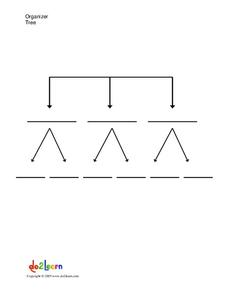
Help your pupils organize their thoughts, gain a greater understanding of a topic by laying it out clearly, or plan for writing with this graphic organizer. Learners can write in three larger topics and then two subtopics for each.
Penguin Books
A Teacher's Guide to the Signet Classics Edition of Cyrano de Bergerac by Edmond Rostand
Edmond Rostand's Cyrano de Bergerac has enjoyed popularity since its debut in 1897 due in large part to the themes it addresses. Instructors planning on using the play with their classes will find much to like in this teaching guide. The...
Curated OER
We've got the whole world in our hands
Students explore spatial sense in regards to maps about the globe. In this maps lesson plan, students label oceans, locate the continents and poles, follow directions, and explain the symbols on a map.
Curated OER
Plan a Trip
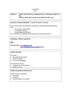
Students plan for a trip. They use map quest and / or road maps to decide on an address for their trip. They determine the mileage, lodging, gasoline to be used, shortest distance and fastest distance.
Curated OER
Mesopotamia
Young scholars map Mesopotamia. In this Geography lesson, students are introduced to Ancient Mesopotamia. Young scholars use an atlas to label the defining features and areas of Mesopotamia on a map.
Curated OER
Design an Island
Learners explore islands. They create a two- or three-dimensional map of an island. They explain how the topography of an area influences the location of water sources, ecosystems, and human settlements. Lesson includes adaptations for...
Curated OER
Putting the World in Perspective
Students work in small groups to: make a mental map of the world by tearing paper shapes of the seven continents and locating them on a flat surface in their relative positions, compare their finished mental map to a reference world map,...
Curated OER
Relative Location
First graders use landmarks to describe relative locations of a place. For this geography and mapping lesson plan, 1st graders draw picture maps of their bedrooms to show an object's location in relation to other objects. As an...
Curated OER
Geography and Culture in South Carolina
Students explore South Carolina. In this cultural heritage lesson, students investigate the topography of South Carolina using maps. Students are engaged in identifying the different regions of the state and examine the cultural heritage...
Curated OER
European Exploration, Trade and Colonization
Students complete many activities including mapping, reading books, and Internet research to learn about European exploration. In this European lesson plan, students study geographical mapping, trade, and colonization.


