Curated OER
Nursery Rhymes
Students recall details of nursery rhyme read by teacher, identify main characters, and demonstrate knowledge of poem by creating concept map about story that includes title, clip art, and changes in font and color.
Curated OER
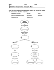
Cellular Respiration Concept Map
In this respiration worksheet students complete a concept map using the vocabulary words that are used in the respiration cycle.
Curated OER
Chromosomes Concept Map
In this biology worksheet, students complete a concept map on different types of mutations. They fill in 7 blanks with the correct word from the list.
Curated OER
Seed Plant Concept Map
For this seed plant worksheet, students complete the concept map showing vascular plants characteristics. They fill in the 10 blanks with appropriate words from the word list.
Curated OER
Bacteria Concept Map
In this life science worksheet, students complete a concept map on bacteria. They fill in 7 blanks with the appropriate answer from the word list.
Curated OER
Class Amphibia Concept Map
In this class amphibia worksheet, students complete the concept map using words or phrases provided. They fill in 11 blanks with the correct answers.
Curated OER
Modern Reptiles Concept Map
For this life science worksheet, students complete a concept map on modern reptiles. They answer 13 fill in the blank questions using words from the list.
Curated OER
Arthropod and Echinoderm Concept Map
In this biology activity, learners complete a concept map using the terms and phrases provided. They fill in 13 blanks with the appropriate words.
Curated OER
Phylum Arthropoda Concept Map
In this biology learning exercise, students complete a concept map of the Phylum Arthropoda using the word list given. They fill in the 10 blanks with correct answers.
Curated OER
A Map as a Tool
Students study the concept of using a map as a tool with the usage of a balloon designed to mimic the features of the Earth with the major features marked and shown on the balloon.
KOG Ranger Program
Fire Behavior in Forests
Understanding the ways a fire will act is a key factor in fire safety and fire prevention. Young campers focus on how the weather and terrain can affect the behavior of a fire with topographic maps and different scenarios.
Curated OER
Mapping My World
First graders make two maps. For this developing and reading maps lesson, 1st graders read Mapping Penny's World, discuss the parts of a map, create a map of their classroom, and create a list of directions of how to get to various...
Curated OER
Maps and Globes
First graders complete a unit on map skills and the globe. They label maps, create a styrofoam ball globe, create a map of their community, sing a continent song, and complete a map and globe assessment worksheet.
Curated OER
Mapping National and Geographic Identity
Students analyze geographic maps. In this map analysis lesson plan, students analyze the symbols in geographic maps and the impact of cultural, historical, and political concepts. Students compare and contrast maps in various mediums by...
Curated OER
Handy Map
Students become familiar with the purpose of maps through a hand mapping instructional activity. In this hand mapping instructional activity, students draw their hand and use it to explain directions and labeling on a map.
Curated OER
Mapping the News
Students explore cartography. In this map skills and map making lesson, Students work in groups to create wall size world maps including legends, compass roses, latitude and longitude, and physical features. Students collect current...
Curated OER
Fairy Tale Maps
Students study direction as they listen to the stories of Little Red Riding Hood and The Jolly Postman. In this cardinal direction lesson, learners create a map to show the path Little Red Riding Hood took in the story and label the path...
Curated OER
Charts, Maps, and Graphs Lesson on the Holocaust
Students practice interpreting data. In this Holocaust lesson, students research selected Internet sources and examine charts, maps, and graphs regarding the Jewish populations in and out of Europe. Students respond to questions about...
Curated OER
Understanding Latitude and Longitude
Teaching learners about latitude and longitude can get a little complicated. Present the concept by first representing it as a graph. Just like finding a location on a graph using the x and y-axis, learners will be able to locate items...
Curated OER
Linear Systems Review for Exam 1
In this math activity, students practice reviewing for the exam that focuses upon the concept of linear systems. They draw a concept map for the review topics listed.
Curated OER
Story Map Book Report
This is an example of what a story map book report can look like using mind wing teaching concepts. Consider this idea as a way to provide special needs or those with learning disabilities a way to communicate what they know or learned...
Curated OER
Map Scale
Third and fourth graders are introduced to the concept of map scale. Using an illustration, they discuss if it shows the actual size of the object and why scale is used to represent areas. They use some items in the illustration to...
Curated OER
As the Kids Come and Go: Mapping a Classroom
Map the classroom with your kids to help them understand how maps work and how to read them. The lesson starts off with a story about animals living and moving around the globe, and then kids create maps of their classroom to show how...
Curated OER
A Walk Around the School: Mapping Places Near and Far
After reading Pat Hutchins’ Rosie’s Walk, have your young cartographers create a map of Rosie’s walk. Then lead them on a walk around the school. When you return class members sequence the walk by making a list of how the class got from...


