Curated OER
Mapping Out the Story
Discuss the reading comprehension strategy of summarization with your elementary schoolers! They read a chapter from their social studies textbook, Regions Near and Far, and create a map, or word web, for the chapter. They identify...
Curated OER
Using Color as a Pre-Writing Tool
To better understand how to compose a clear and well-organized paper, learners read short passages, write summaries, and make colored graphic organizers. This is a fully developed three-day lesson with suggested assessments.
Curated OER
Read a Fall Foliage Map
Students examine the purpose of a color key and use a color key to help them read a map.
Curated OER
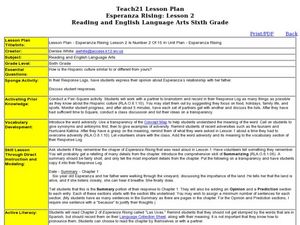
Esperanza Rising: Lesson 2
Sixth graders explore adversity. For this summarizing lesson students compare their culture to the Hispanic culture. Students reflect on a time they were met with adversity. Students summarize Chapter 1 of Esperanza Rising.
Curated OER
Electronic Mapping
Young scholars identify countries, oceans, and capitals by building an electronic map.
Curated OER
Orienteering - Lesson 8 - Map and Compass
Put your high schoolers' orienteering skills together. Reading a compass and reading a map. In this assignment the class will use their compass and the map scale to determine the distance of a given route. If they finish their...
Curated OER
Introducing the Concept: Proportions
Young scholars measure distances. In this proportions lesson, students use a map to find how far it is between different cities. Young scholars use their knowledge of measurement, multiplication and fractions to find the distances.
Curated OER
Exploring Maps: Navigation
Students engage in a lesson that is concerned with the concept of navigation while research is conducted with the use of a variety of resources. The information is used to expand their perspective of the applications for navigation. The...
Curated OER
Unit III: Worksheet 2 - Motion Maps
Make motion maps, draw graphical representations, and determine displacement. These are the activities included in this physics assignment. This is a great review of velocity, position, acceleration, and displacement concepts.
Do2Learn
Brainstorming Map Clusters
Get your class thinking with a graphic organizer made for brainstorming. Pupils note down a topic in the middle and then branch out to write down more ideas in each of the three circles that form the cluster around the topic.
Consortium for Ocean Science Exploration and Engagement (COSEE)
Climate Change Impacts on Blue King Crabs
Carbon dioxide is not only causing global temperatures to increase, it causes the oceans to become more acidic. Lesson focuses on the blue king crab and the fragility of the habitat due to climate change. Scholars create a concept map...
Novelinks
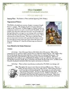
The Hobbit: Concept/Vocabulary Analysis
Considering using Tolkien's The Hobbit for book circles or whole-class reading? Check out this packet that provides an overview of the novel, some interesting background materials, and links to additional resources.
Curated OER
Using Social Studies in Five Shared Reading Lessons: Geography
After several short 15-minute mini-lessons, your learners will gain an understanding of the characteristics of a non-fiction text. Using the book Map It by Elspeth Leacock, your class will become acquainted with non-fiction terms...
Curated OER
Geography and Culture of China
Take out a map, a paper, a ruler, and those coveted colored pencils for a lesson on Chinese culture and geography. This is a multifaceted approach to basic geography skills that incorporate story telling, class discussion, primary source...
Curated OER
Christopher Columbus: The Man, the Myth, the Legend
Learn more about maps by examining Christopher Columbus's voyage to the New World. Kindergartners will learn about basic map skills and how to identify the compass rose, oceans, and land masses. They will also discover the purpose of...
Curated OER
Understanding "The Stans"
Students explore and locate "The Stans" in Central Asia to create, write and illustrate maps, graphs and charts to organize geographic information. They analyze the historical and physical characteristics of Central Asia via graphic...
Student Handouts
Compare and Contrast Chart with Bubble Map
Take your traditional Venn diagrams and mind maps to the next level with this unique bubble map! The graphic organizer allows students to compare and contrast several aspects of two concepts, encouraging a more in-depth analysis...
Curated OER
Producing a concept map for governance of countries in the EU
Students explore, examine and study the terminology associated with governance and discover the types of governance within each EU country. They produce a mind map that concentrates on UK government and monarchy and critique the...
Curated OER
The Four-Color Problem: Concept and Solution
Take a walk through time, 1852 to 1994, following the mathematical history and development of the Four-Color Theorem. Learners take on the role of cartographers to study an imaginary world of countries that need to be...
Indian Land Tenure Foundation
Maps and Homelands
You are never too young to learn about maps. To better understand the concept of a homeland, students work together to construct a map of their local area out of paper puzzle pieces. They'll put the maps together and then add details by...
Curated OER
Weather Adjectives
How would you describe that twisting, powerful, destructive, ferocious tornado? Have your scholars analyze a tornado using adjectives: students write six adjectives on a graphic organizer, and then use each in a sentence below. This...
Curated OER
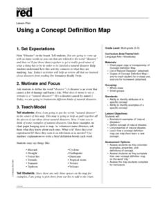
Using a Concept Definition Map
Learners define "natural disaster" by offering examples and charting them to discover what a concept definition map is. Then students create their own maps using the word "city".
Curated OER
Mapping Colonial New England: Looking at the Landscape of New England
Students understand the similarities and differences between English and Native American conceptions of the land and town settlement. They understand how the colony of Massachusetts developed and expanded. Students understand the...
Edgate
Journal Maps
Inspire your class to look at their environments as if they were seeing them for the first time in order to gain a better understanding of the concept of perspective. After exploring their communities and keeping a journal of major...


