Curated OER
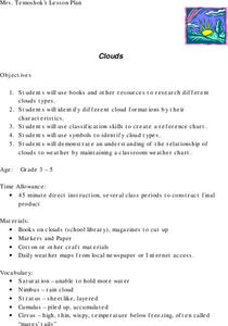
Clouds
Students explore the characteristics of clouds, their formation, symbols used in their identification, and the relationship of clouds to weather. The lesson plan focuses on how they are formed and their classification.
Curated OER
Under The Sea
Second graders study how a tsunami is formed by underwater events such as earthquakes, volcanoes or landslides. They discuss what they knew about living and non-living things in the ocean.
Curated OER
Treasure Hunt Region
Students are introduced to new geography related vocabulary words. In groups, they focus on a different region of the school and develop a new name for it. They create a treasure map for another group to use in the region of the school...
Curated OER
Stratigraphy -- Layers of Time in the Earth
Students are introduced to the process of stratification. Using the internet, they read about the Richard Beene archeological site near San Antonio. Using a map, they color code the different layers present at this site and answer...
Curated OER
"Across Oregon On The 45th N Parallel" A Transect of Oregon
Students explore the physical geography of Oregon. In groups, students collect weather and elevation information on Oregon. They organize the data and create maps and graphs of the information. Afterward, students compare the...
Curated OER
Science: Hurricanes As Heat Engines
Students conduct Internet research to track the path of Hurricane Rita. They record the sea surface temperature of the Gulf of Mexico during and after the hurricane and draw conclusions about how hurricanes extract heat energy from the...
Curated OER
Coral Bleaching in the Caribbean
Students use authentic satellite data on the NASA website to determine when the sea surface temperature meets the criteria to induce coral bleaching.
Curated OER
Harvest the Wind
Wind is a natural resource available around the world. Help your pupils appreciate the power and importance of wind by researching wind farms, making pinwheels, and designing windmills.
Curated OER
Writing the Wind
Students make a windmill. In this wind lesson, students learn background information about the windmill, complete an activity where they create a windmill, discuss using wind as a natural resource and brainstorm other inventions that...
Discovery Education
Sonar & Echolocation
A well-designed, comprehensive, and attractive slide show supports direct instruction on how sonar and echolocation work. Contained within the slides are links to interactive websites and instructions for using apps on a mobile device to...
Calvin Crest Outdoor School
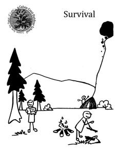
Survival
Equip young campers with important survival knowledge with a set of engaging lessons. Teammates work together to complete three outdoor activities, which include building a shelter, starting a campfire, and finding directions in the...
Texas State University
Earth: Deposition and Lithification
Geology geniuses analyze sediment samples with a hand lens and sort according to physical characteristics. They also learn about the processes of cementation, compaction, and lithification within the rock cycle. The lesson plan is...
It's About Time
How Do Plate Tectonics and Ocean Currents Affect Global Climate?
What do plate tectonics and ocean currents have to do with global climate? This fourth installment in a six-part series focuses on how plate tectonics and ocean currents affect global climate, both now and in the past, outlines an...
Curated OER
Trends of Snow Cover and Temperature in Alaska
Students gather historical snow cover and temperature data from the MY NASA DATA Web site. They compare this data to data gathered using ground measurements from the ALISON Web site for Shageluk Lake. They graph both sets of data and...
Aurora Trust
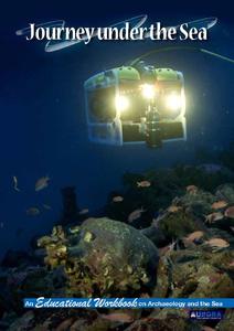
Journey Under the Sea
Discover the interesting world of maritime archaeology and explorations under the sea with this nice set of worksheets, which cover such topics as search tools and techniques of underwater archaeology, carbon dating, vessel types, and...
Curated OER
Travelogs
Students make travelog journals to send to acquaintances in other states in order to receive mail in return. They make scrapbooks with the return mail they receive.
Curated OER
My Home of North Dakota
Discuss the people, history and geography of North Dakota using this resource. Learners use a variety of sources to do research on North Dakota and present their findings in a PowerPoint presentation. They answer questions involving...
Curated OER
Tissue Paper Geography
Students explore geographic features of the desert and apply their understanding of the topography of the desert by creating a tissue paper painting.
Curated OER
What is the Rock Cycle and Its Processes?
Geology beginners examine three different rock samples and determine their origin by their characteristics. By making and recording observations, they become familiar with features of igneous, metamorphic, and sedimentary rock types....
Curated OER
What's Up With the Water Cycle?
Students explore the water cycle. Students identify the stages in a water cycle and create a PowerPoint presentation based on their knowledge.
Curated OER
Analysis of Atmospheric Conditions for a High Mountain Retreat
Students examine the relationship between altitude, atmospheric pressure, temperature and humidity at a particular location. They practice science and math in real world applications. They write reports detailing their scientific...
Curated OER
High Mountain Retreat
Learners explore and analyze atmospheric conditions for a high mountain retreat. They examine the relationship between altitude, atmospheric pressure, temperature and humidity at a particular location. In addition, they write reports...
Curated OER
Using Vegetation, Precipitation, and Surface Temperature to Study Climate Zones
Middle schoolers begin their examination of the climate zones found around the world. Using a software program, they identify the relationship between the vegetation, climate and temperatures of the different zones. They also plot...
Curated OER
Barrier Islands
Third graders explore how barrier islands work. In this erosion lesson, 3rd graders create barrier islands in stream tables and simulate wave action to see how it affects their island.


