Curated OER
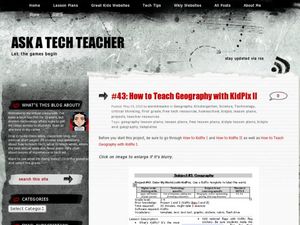
How to Teach Geography with KidPix II
Students use the computer program KidPix II to color a map of the world. In this world map lesson plan, students fill in different colors for different continents that are told to them on the program KidPix II.
Curated OER
Telecommunications and the Whole Language Program
Young writers use technology and other media to research information on a chosen topic. They explore countries where keypals and e-mail friends are located. Using their writing skills, they correspond with their e-mail friend and...
Curated OER
Maps that Teach
Students study maps to locate the states and capital on the US map. Students locate continents, major world physical features and historical monuments. Students locate the provinces and territories of Canada.
Curated OER
Social Studies: African Folklore and Geography
Students discover the connection between geography and folklore in several African nations. In groups, they record information from maps of their assigned countries. Students observe the pictures in books and match the geographic...
Curated OER
Latitude & Longitude Bingo
Pupils practice map reading skills through a reinforcement game of bingo. They select any 24 of 30 listed cities to write on blank bingo cards. Then using atlases, locate a city based on the latitude and longitudinal coordinates called...
Curated OER
Studying the Caribbean Immigration
Students use the site maps and other resources to research one of the influential Caribbean immigrants or descendents of immigrants mentioned in a narrative they have read. They write an essay about an influential immigrant.
Curated OER
Incorporating Reading Comprehension Using Cinderella Stories from Different Lands
First graders investigate Cinderella tales from different lands to discover their commonalities in this unit. They perform their favorite Cinderella story.
Curated OER
Fossil Evidence for Plate Tectonics
Students draw maps of counties that were important to the discovery of plate tectonic theory. In this plate tectonics lesson students excavate constructed fossil sites from matching coastlines and discuss the possible explanations for...
Curated OER
Zoobilation
Students research and use their findings to design a PowerPoint presentation and zoo-type habitat with the correct ecosystem for their animal group using a variety of materials such as cardboard boxes, aquariums etc.
Curated OER
Geography and World History
Students build off of their current knowledge of geography and world history, while being introduced to new concepts and ideas.
Curated OER
Tour Of South America
Students explore South America. In this geography lesson, students research landmarks of historical or national significance and use their findings to create slideshows.
Curated OER
Garb and Grub Across the Globe
First graders discuss what part of the world their ancestors came from. They locate the locations on a map and discuss the differences and similarities of each continent and their people. They become familiar with the traditional...
Curated OER
Geography and Culture
Students explore African geography, study the overall continent of Africa and its individual countries, discuss demographics, and participate in research and class activities.
Curated OER
Dinosaurs
Second graders classify and analyze living things by structure and function and make predictions based on observations rather than random guesses. They make predictions about where dinosaurs lived and correctly place their databases onto...
Curated OER
A Book Is A Window To the World
Second graders listen to pieces of literature that take place in different regions of the world. Using a map, they identify and locate the continents and oceans mentioned in the story. They describe the physical and human characteristics...
Curated OER
Prehistoric Mesosaurus
Students draw conclusions why Mesosaurus has only been found in Africa and Brazil and how its fossil remains serve as important evidence that shows where two continents were once joined together.
Curated OER
Globe Game
Learners are arranged into groups and are given a map or globe. Students select a location on the map. Learners as yes and no questions to guess the specific place that was chosen.
Curated OER
Ring of Fire
Students locate some of the 1,500 active volcanoes on a world map. Then by comparing their maps with a map of the world's tectonic plates, they discover that volcanoes occur because of the dynamic nature of the Earth's lithosphere.
Curated OER
March of the Polar Bears: Global Change, Sea Ice, and Wildlife Migration
Students study global change and how these changes impact wildlife. For this polar bears lesson students analyze maps and data to understand climate change.
Curated OER
Comparison of Juan Bautista de Anza and George Washington
Fifth graders discover that Anza and Washington lived at the same time but on opposite sides of the American Continent. They identify differences and similarities in their lives. They present the data in an illustrated time line
Curated OER
Carnavals and Colonialization
Ninth graders compare and contrast different Carnavals throughout Latin America. For this Latin American lesson, 9th graders study the geography and colonial history of Latin America.
Curated OER
The Importance of Imports
Learners explore world trade by examining items they find at home and listing countries those items came from. Data is displayed on a map and charted according to continent. They discuss how products are transported.
Curated OER
"Planet" Vacation
Young scholars research a location of their choice using the internet. They list the characteristics of the location and why they chose it as their ideal vacation spot. Using maps, they pinpoint their destination and trace their route....
Curated OER
Expanding Children's Geographic and Economic Worlds
Students learn their addresses and gain a sense of connection between their neighborhood and the rest of the world and the universe.


