Owl Teacher
Introduction to World of Geography Test
Assess your learners on the five themes of geography and the most important key terms and concepts from an introductory geography unit. Here you'll find an assessment with 15 fill-in-the-blank and 14 multiple-choice questions, sections...
Curriculum Corner
Earth Day Book
This Earth Day, celebrate our beautiful planet with an activity book that challenges scholars to show off their map skills, complete a crossword puzzle, write acrostic poems, alphabetize, and reflect on their personal Earth-friendly habits.
Curated OER
Maps Reinforcement
In this map worksheet, students complete 6 multiple choice questions and 5 short answer questions about 3 different map figures.
Curated OER
Continents and Oceans
In this geography worksheet, students read a paragraph and learn about the seven continents and five oceans of the world. Students study a map of the world and answer 12 short answer questions. This is an online interactive worksheet.
Curated OER
World Continents Map Quiz
In this online interactive geography quiz worksheet, students respond to 7 identification questions regarding the continents of the world.
Curated OER
Continents and Islands Map Quiz
In this online interactive geography quiz worksheet, students respond to 17 identification questions about the continents and islands of the world.
Curated OER
Design Your Own Imaginary Continent
In this continent activity, students design their own continent and include latitudes, mountain ranged, river, wind patterns, and temperature highs and lows. They also include a variety of cities in specified locations.
Curated OER
Word Pair Analogies 2
Analogies deepen the understanding of words. Help your English language learners (or native speakers studying vocabulary) develop their understanding of words like agoraphobia, brevity, and hieroglyphics. A bridge sentence is provided...
Curated OER
Middle East Quiz
In this geography skills quiz learning exercise, students take 1 of the 3 provided outline map quizzes on the 23 Middle Eastern countries. Three separate quizzes are offered.
Curated OER
Sub-Saharan Africa: Physical Geography
In this geography skills worksheet, students respond to 22 short answer and map skills questions about the location and geographic features of sub-Saharan Africa.
Curated OER
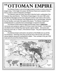
The Ottoman Empire
In this Ottoman Empire worksheet, students read a 1-page selection about the empire and examine a map. Students then respond to 5 short answer questions about the reading selection and the map.
Curated OER
North American Biomes
In this Science worksheet, learners color a biome map of North America. Students color the map by solving the clues listed on a separate sheet of paper.
Curated OER
Geography Worksheet
In this geography skills worksheet, students respond to 14 short answer questions by using maps and atlases. The maps and atlases are not included.
Curated OER
Latitude and Longitude- Online Interactive
In this maps instructional activity, students learn about longitude and latitude by reading a two paragraph text and studying two maps. Students answer 9 fill in the blank questions. This is an online interactive instructional activity.
Curated OER
Drifting Continents
In this plate tectonics instructional activity, students study the continents map and complete 8 short answer questions related to them. They predict what the Earth will look like millions from now.
Curated OER
South American Outline Map
In this blank outline map worksheet, students study the political boundaries of the continent of North America and those of the countries located there.
Curated OER
Outline Map of Japan
In this geography worksheet, students examine a black line outline map of Japan. There is a compass rose on the page. There are no labeled cities.
Curated OER
4th Grade Spelling: Continents and Nationalities
In this 4th grade home connection spelling practice worksheet, 4th graders examine 20 spelling words that feature continents and nationalities. Students write the words 1 time each.
Cornell University
Too Much of a Good Thing?
Continuing their study of beneficial insects, young entomologists discover where in the world some of these bugs are. By labeling, coloring, and using the scale on a map, pupils explore the territories and arrival of the Asian lady...
Curated OER
North America Outline Map
In this blank North America outline map worksheet, students study the political boundaries of the continent. This outline map may be used for a variety of geographic activities.
Texas State Energy Conservation Office
Investigation: Tour de Texas
Teams of Texas tourists gather into groups to analyze what they can do with $50 worth of an alternative fuel. They write checks, keep a balance sheet, and map out their sight-seeing route taking into consideration the location of...
Curated OER
Antarctica Map
In this Antarctica worksheet, students study a very detailed map of this continent. Important features on this map are labeled.
Curated OER
The Physical World: Continents and Oceans
In this world map activity, study the map of the continents and oceans. Students label each of the 12 sections of the world map.
Curated OER
Europe Map
In this world geography activity, learners study the map of Europe and locate the 48 countries within the continent. Students write the names on the provided lines.


