Curated OER
What's Holding Up the Water?
Students read about the history and locate dams in Arizona. In this Arizona dams lesson plan, students write a summary about what they read focusing on word choice, ideas, conventions, and geography content.
Curated OER
Plate Tectonics & Land Forms
Fourth graders discuss the different interactions of plates and the ways mountains are created. In this plate tectonics activity students complete an activity in groups.
Port Jefferson School District
Climate Patterns
Young climatologists explore the factors that contribute to a region's climate in this two-part earth science activity. To begin, learners are provided with a map of an imaginary planet and are asked to label global wind and ocean...
Curated OER
Clothes World: Beginning ESL lesson
Take a tour around the world with this ESL presentation about international clothes. From South African tribal wear to Scottish kilts, your English learners will appreciate the vivid pictures and clear country labels for each slide. The...
Curated OER
American Journeys: Right Place, Right Time
Sixth graders measure distances on a map using string and a ruler. They complete mathematical word problems about measurement.
Curated OER
Changing Borders
Students explain that the boundaries between countries are not permanent, then analyze current events and stories as examples of cooperation and conflict. They describe a place using physical and human characteristics.
Curated OER
Where Am I, and How Do I Get Where I am Going?
Students describe geographical places through art, music, writing, and math. They compile information in booklets which may be published.
Curated OER
Canada, O Canada
Students study the similarities and differences between Canada and the United State in this unit. They examine geography, government and culture as they "travel" through Canada.
Curated OER
Pets Around the World
Students communicate via e-mail with other students to learn about pets, animals of interest , and geography from different parts of the world. Vocabulary focuses on rural, urban, and suburban areas.
Curated OER
Planetary Surface Evolution and Resurfacing
Students are provided with drawings of planet surfaces in order to investigate different types of planetary terrain. They make observations for each planet and discuss the characteristics observed. The lesson includes background...
Curated OER
"What If The Earth Were Made Of Sand
Students examine the most common characteristics of clay and sand, and to understand how the properties of these materials affect the erosion of the landscape and the formation of the many landforms. They explore clay and sand through...
Curated OER
Tracking Ocean Ecology
Students look at the data maps given to them about how chlorophyll affects the algae blooms and make predictions about the harm they will cause. In this data maps lesson plan, students manipulate data sets from the website.
North Iowa
Identifying Kinds of Pronouns
Provide your ESL or ELA pupils with some skills practice for identifying various kinds of pronouns. Comprised of 40 problems and broken into four parts, pupils first underline all the pronouns in each sentence, then identify them as...
Curated OER
A Line Graph of the Ocean Floor
Students develop a spreadsheet and import the information into a line graph. For this spreadsheet and line graph lesson, students develop a spreadsheet of ocean depths. They import the information into a word processed document. They...
Curated OER
The Southern Ocean
It this reading for comprehension worksheet, students read an informational article about the Southern Ocean and answer questions about it. Students answer 10 true and false questions.
Curated OER
Forces That Shape the Earth: Plate Movement
For this tectonic plate worksheet, students learn about the movement of the plates that make up the earth's crust. They read about the Theory of Pangaea, lithosphere, divergence, convergence, and plate transformation. Students then...
Curated OER
Shifting Coastlines
Learners study North Carolina's changing coastline during the Paleoindian and Archaic periods and determine the positions of the coastline at different times and decide what types of archaeological information has been lost due to rising...
Curated OER
High Up in the Himalayas
Have your class supplement their knowledge on the Himalaya mountain range. In a brief handout, they read about the land masses that collided to form the Himalayas and other mountain ranges. It also touches briefly on the Earth's crust...
Curated OER
Investigating Our Place in the World
Students study the concept of geography in a year long unit. In this geography unit, students participate in different activities that explain the spatial sense of the world, the physical landmasses and bodies of water, geographic...
Curated OER
Giving Students a Little Latitude
Students use a world outline map to locate places using coordinates of latitude and longitude. They answer questions about places based on their knowledge of the map and on their research and make up more questions of this sort for each...
Curated OER
Early Explorers
Fifth graders investigate the routes taken by the early explorers. In this explorers lesson, 5th graders use interactive notebooks, discussion and maps to discover the routes taken. Students get into pairs and label maps, and create...
Curated OER
Do You Have a Sinking Feeling
Learners determine how marine archaeologists use historical and archaeological data to draw inferences about shipwrecks. Students plot the position of a shipwrecked vessel, and draw inferences about the shipwreck from artifacts that have...
Curated OER
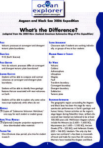
What's the Difference?
Students investigate volcanic processes at convergent and divergent
tectonic plate boundaries. They read and analyze diagrams, complete a worksheet, and write an essay.
Curated OER
I Robot, Can Do That
High schoolers examine how underwater robots can be used to assist scientific explorations. They read and discuss an article, conduct Internet research, complete a worksheet, and present an oral report.
Other popular searches
- Oceans and Continents
- 7 Continents and Oceans
- Continents and Oceans Map
- Continents Oceans Landforms
- Label Oceans and Continents
- World Continents and Oceans
- Identify Continents Oceans
- Earths Oceans and Continents
- Canada Oceans and Continents
- Oceans and Continents Maps
- Continents Oceans Rating=3
- Map of Continents and Oceans


