Curated OER
Design an Island
Young scholars explore islands. They create a two- or three-dimensional map of an island. They explain how the topography of an area influences the location of water sources, ecosystems, and human settlements. Lesson includes adaptations...
Curated OER
Natural Resources
Learners explore Iowa geography and topographic maps. In this geography and topographic maps lesson, student investigate maps, newspapers, Iowa flora and fauna. Students gain an understanding of how different landforms can be identified...
Curated OER
TOPSY TURVY MAPS
Eighth graders use the data analyzer and motion detector to collect data and measure distances. They create topographic maps drawn to scale of a given setup and relate the concepts to the creation of historical ocean maps.
Curated OER
Planning a Railroad Online Lesson
Students design a train route using a topographical map. For this historical and spatial thinking lesson plan, students must plan a route through the Sierra Nevada mountains that a train could physically travel. Links to printable...
Curated OER
Introduction of the Lunar Relief Map Project
Students investigate the geographic features of the surface of the moon. For this lunar relief map lesson, students watch and discuss the Apollo II Moon landing and make preliminary plans for their lunar maps.
Curated OER
Water Monitoring Vocabulary
As the title implies, this is a list of vocabulary terms relating to water monitoring. If your ecology class is learning about how to test water quality, this will be an appropriate reference sheet for them. As a bonus, if you live in...
Curated OER
Understanding a Geological Map
Students identify different types of maps and observe a geological map. In this geology lesson students create a replica map of a geological area that includes a key.
Curated OER
Common Themes
Tenth graders test usefulness of a model Earth by comparing its predictions to observations in the real world. In this landforms lesson students construct an island from a contour map using model clay then analyze the landscape features...
Curated OER
Cookie Mapping
Students study the components of a bedrock geology map through a hands-on activity involving a cookie and graph paper.
Curated OER
Viewing Earth and Sky
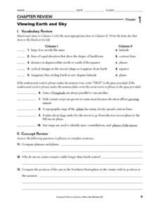
In this earth and sky learning exercise, students review terms associated with map reading. Students also review topographic maps and how contour lines represent elevation. This learning exercise has 5 matching, 5 true or false, 5 fill...
Curated OER
Watershed Delineation
Students use topographic maps to delineate a watershed.In this ecology lesson, students draw the boundaries of a watershed onto a map using contour lines as a guide. Their resulting maps are used to evaluate their understanding.
Curated OER
The Great Topo Race
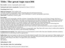
Students create a three dimensional island out of cardboard to examine how to read and use a topographical map. They make sure that their island can sustain life and that it has one volcanic mountain peak. They trace the parts of their...
Curated OER
Topo Triangulation
Students investigate how to read a topographical map and triangulate with just a map. They convert a compass measurement to a protractor measurement, reverse a bearing direction, and using a worksheet take a bearing of certain landmarks...
Curated OER
A Thoreau Look at Our Environment
Sixth graders write journal entries o school site at least once during each season, including sketched and written observations of present environment. They can use sample topographical maps and student's own maps. Students can use...
Curated OER
Geography: examining the Glacial Features of Cape Cod
Students examine satellite images of the glacial features of Cape Cod. They analyze where human activity is located in terms of those features. Students make models of the features, including kettle holes. They also use contour maps...
Curated OER
Design an Island
Students make a map of an imaginary island using the topographic symbols provided from a worksheet. Students place lakes, dwellins, reefs, etc. in areas where they would logically be located from understanding how the topography of an...
Curated OER
Mapping Seamounts in the Gulf of Alaska
Pupils describe major topographic features on the Patton Seamount, and interpret two-dimensional topographic data. They create three-dimensional models of landforms from two-dimensional topographic data.
Curated OER
Geologic cross section of Manhattan, NYC
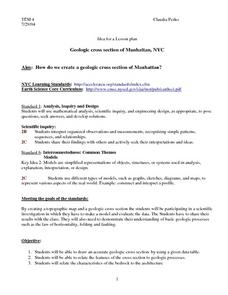
Students draw an accurate geologic cross section by using a given data table. They relate the features of the cross section to geologic processes. Students then relate the characteristics of the bedrock to the architecture.
Curated OER
Topography: Know the topography of your neighborhood
Pupils read and identify features on a topography map. In this topography lesson plan, students learn how to read a topography map, and then go out and take pictures of their own and discuss the topography pictures they took.
Curated OER
States with Attitude, Latitude and Longitude Dude
Sixth graders identify states whose boundaries are formed by lines of latitude and longitude or natural borders such as rivers. They trace a map of the U.S., and fill in borders, rivers and lines of latitude and longitude.
Curated OER
Exploring Our Watershed System
Students examine how watershed systems are made up, and visit the Susquehanna watershed system and map out the system. They evaluate the order of watercourses in their area.
Curated OER
Understanding Watersheds
Students should learn how their actions on land can affect the water quality of lakes and rivers.
Curated OER
Cherishing the Water of Life
Students work in small groups to brainstorm a list of all creatures, plants, natural, and artificial processes that use or depend on fresh water. The class views an aquarium filled with water representing all the water in the world. The...
Curated OER
What's Its Slope
Students identify the slope of a lines.In this algebra lesson, students define the meaning of slope and write an equation given the slope. They graph linear functions using the slope and y-intercept.


