Curated OER
Treasure Hunt
For this treasure hunt worksheet, students fill in the blanks with the correct coordinates. As students fill in the coordinates, they trace their route on a treasure map.
Curated OER
Navigation, Working With Coordinates
Students view a polar view map and discuss ways of telling locations on the map. They view a copy of the map superimposed on a coordinate grid, then discuss ways of telling the locations. Students practice as a class and then...
Curated OER
Identify and Graph Linear Equations
Students investigate linear functions. In this mathematics instructional activity, students plot points onto a graph by solving the equations y=x and y=mx+b by being given numbers for x and solving for y.
Curated OER
Coordinate Graphs
Students use coordinate graphs in order to identify objects and their locations. They are shown how to plot the x and y coordinates and then are given values to be plotted during guided and independent practice. Students are assessed on...
Curated OER
Play Battleship with Coordinates on a Grid
In this play battleship with coordinates on a grid activity, students follow directions to mark their ships on their map, then guess where their opponent's ships are on the grid.
Curated OER
INTERPRETING MAGNETIC FIELD MAPS
Students interpret magnetic field maps, rotate the coordinates to obtain different views, change the coordinate representation, and produce alternate graphical representations.
Curated OER
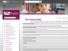
The Treasure Map
Third graders problem solve using drawings and map interpretations. They preview graphs and Cartesian geometry. They follow directions on a map using a grid and compass references while simulating they are reading a pirate map.
Curated OER
Maps: Latitude and Longitude
Students visit interactive sites focusing on latitude and longitude. They participate in activities about the prime meridian, time zones, and equator. They view the coordinates of states and cities.
Curated OER
Maps, Charts, and Graphs
Students define key geographic terms and track a hurricane on a map. They examine various types of maps and find locations on them,including rivers, cities and mountains.
Curated OER
Grid it, Map it
Students participate in designing a city layout using grids and coordinates. They work on a city space and create a grid on a life size layout on the gym floor.
Curated OER
Mapping with a Compass: A Simulated Survey
Students use compasses and grids to map the locations of artifacts found in a simulated dig site. In groups, they role-play as future archeologists excavating a school site. Groups begin at their assigned datum and site the artifacts...
Mathed Up!
Translations
Introduce translations as transformations that move figures in horizontal and vertical distances with a video that shows how to translate the figures. A second video covers how to determine the translation that has occurred. Pupils...
Curated OER
Using Star Charts and Maps
Students study star charts and describe locations of objects. In this scientific models lesson students use coordinates and identify characteristics.
Curated OER
Plotting Grids Using Battleship
Students coordinate grid points on X and Y axises to plot a physical location. The game of "Battleship is used to present first hand knowledge of this skill.
Mathematics Assessment Project
Representing Inequalities Graphically
A new, improved version of the game Battleship? Learners graph linear inequalities on the coordinate plane, then participate in a game where they have to guess coordinate points based on the solution to a system of linear...
Bowland
Outbreak: Infection Detection
Explore the mathematics of infection outbreaks with activities that ask learners to use coordinate grids to locate infected patients. They calculate amounts of ingredients for antidotes and determine which groups of people should be...
Curated OER
World War II
Offering a comprehensive overview of the beginning of World War II, this resource could be a useful addition to a unit on this topic. It could be used as a way to lead a discussion on the war, or as a review tool before a test. Either...
Curated OER
LAND USE ISSUES
Students relate math with real life situations. They identify and plot points on a grid map. They identify and locate the Drop Box Sites.
Curated OER
Using Concept Maps to Design 3D Spheres
Learners create three dimensional shapes using concept maps. In this geometry lesson, students investigate the impact of mental schemas on humans. They collect data on this topic and plot their data on a coordinate plane.
Curated OER
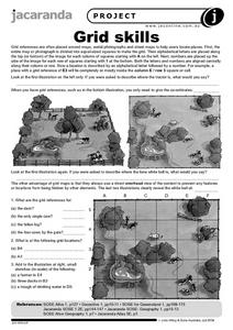
Grid Skills
In this geography activity, students use grid references on a map to locate places in the pictures given. They also identify another advantage of using a grid map, which they have an overhead view of the content to prevent any features...
Curated OER
Plotting Points
In this coordinate pairs worksheet, students learn to plot points on a graph. Students study the examples and then complete 20 questions. This is intended as an online activity, but may be completed with pencil and paper.
Mathematics Assessment Project
Classifying Equations of Parallel and Perpendicular Lines
Parallel parking might be difficult, but finding parallel lines is fairly simple. In this lesson, learners first complete an assessment task involving parallel and perpendicular lines in the coordinate plane. Individuals then take part...
Mathematics Assessment Project
Representing and Combining Transformations
Transform your learners into master geometers with an activity that asks them to first complete an assessment task drawing the result after transformation of a given shape in the coordinate plane. They then use cards to...
CK-12 Foundation
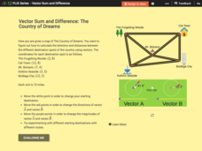
Vector Sum and Difference: The Country of Dreams
Find your way around using vectors. Scholars use an interactive to learn about vector addition. They answer a set of questions about modeling a route on a map using vectors.


