Curated OER
Rescue!
Students explore movement and position concepts. They follow directions using left , right, up, down, North, South, East and West. Students draw and follow a path on a grid to show a route followed. They label and follow legends on a map.
Curated OER
"it's All in the Cellar"
Seventh graders examine the process of constructing a site plan map at archaeological sites. They discuss the process of mapping techniques and calculation of percentages, create a plan site map of a cellar at Jamestown, and calculate...
Curated OER
Quad Squad
Students pretend they have visited a forest research station on an overnight field trip. They study forest fires, use compass directions, read maps, interpret imagery, and think about the impact of fire on ecosystems.
Curated OER
Distance Formula
Students watch teacher demonstration of distance formula, view non-collinear cities on maps, plot points on coordinate plane, evaluate square roots, compute distance between two points, and use Heron's formula to find area of triangles.
Curated OER
Small European Countries
Students examine the advantages and disadvantages of being a very small European country in today's world. They locate each country on a map using the coordinates, discuss the governments of each country, and develop a list of...
Curated OER
Using Vegetation, Precipitation, and Surface Temperature to Study Climate Zones
Students begin their examination of the climate zones found around the world. Using a software program, they identify the relationship between the vegetation, climate and temperatures of the different zones. They also plot coordinates...
Curated OER
The Wannsee Conference
Twelfth graders examine what occured at the Wannsee Conference during World War II. Using documents, they discover how the conference fits into the final solution of the Jewish question. They analyze the language used and the attitudes...
Curated OER
Where is Here?
Students are shown the very basics of navigation. The concepts of relative and absolute location, latitude, longitude and cardinal directions are discussed, as well as the use and principles of a map and compass.
Curated OER
Topo Triangulation
Students investigate how to read a topographical map and triangulate with just a map. They convert a compass measurement to a protractor measurement, reverse a bearing direction, and using a worksheet take a bearing of certain landmarks...
Curated OER
Carbon Monoxide and Population Density
Tenth graders investigate the carbon monoxide level at a fixed latitude to determine if there is a relationship to population density. They download data sets and generate a graph, and find locations using the Earth's coordinate system....
Curated OER
Osprey Journey
Students investigate the migration route of one bird, Osprey B4, using information gathered from satellites to track birds over a two-year period. They coimpare their graphs with maps of B4's migrations that have been plotted by...
Curated OER
Geometry Standardized Test Practice
In this figures and graphs review worksheet, 10th graders solve and complete 23 various types of problems that include identifying various figures and graphs. First, they name the transformation that maps the unshaded figure or preimage...
Curated OER
Rubber Duckies and Ocean Currents
Students explore marine life by conducting a rubber duck experiment. In this water currents lesson, students practice identifying latitude and longitude coordinates on a map and define the currents of major oceans. Students discuss the...
Curated OER
Relations and Functions
Students differentiate between a relation and a function. In this algebra lesson, students identify a pair of coordinates as being a relation or a function. They analyze graphs for function as they solve word problems.
Curated OER
Storm That Drowned a City
Students use a map to locate New Orleans and watch a video on the destruction of Hurricane Katrina. As a class, they watch a demonstration on how a wetland can reduce the impact of a hurricane. In groups, they perform their own...
Curated OER
How Far From the Fountain?
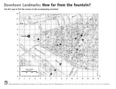
In this estimation worksheet, students estimate and measure ten landmarks from the fountain in inches. Students also answer two word problems involving coordinates.
Curated OER
Geometric Transformations
Learners examine images and preimages of a mapping and identify isometry. They view images by M.C. Escher, observe teacher demonstrations, and create a translation image, a rotation image, and a dilation.
Curated OER
Latitude & Longitude Bingo
Students practice map reading skills through a reinforcement game of bingo. They select any 24 of 30 listed cities to write on blank bingo cards. Then using atlases, locate a city based on the latitude and longitudinal coordinates...
Curated OER
Where Did It Come From?
Students research island formation, plot locations on a map and make an analysis of why some islands are formed where they are.
Curated OER
Pirate Treasure Maze
In this hand eye coordination and logic worksheet, students trace a path from the pirate to the treasure chest in a maze puzzle.
EngageNY
Rotations of 180 Degrees
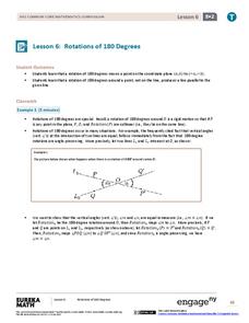
What happens when rotating an image 180 degrees? The sixth instructional activity in the series of 18 takes a look at this question. Learners discover the pattern associated with 180-degree rotations. They then use transparency paper to...
Teach Engineering
Searching for Bigfoot and Others Like Him
Individuals create a GIS data layer in Google Earth that displays information about where one might find seven different cryptids. The class members research to find data on cryptid sightings they can include in their data...
EngageNY
The Geometric Effect of Some Complex Arithmetic 1
Translating complex numbers is as simple as adding 1, 2, 3. In the ninth instructional activity in a 32-part series, the class takes a deeper look at the geometric effect of adding and subtracting complex numbers. The resource leads...
Illustrative Mathematics
Why Does SSS Work?
While it may seem incredibly obvious to the geometry student that congruent sides make congruent triangles, the proving of this by definition actually takes a bit of work. This exercise steps the class through this kind of proof by...
Other popular searches
- Treasure Map Coordinates
- Grid Coordinates Map
- Map Coordinates
- Reading Maps and Coordinates
- Math Map Coordinates
- Coordinates Map Skills
- Map Coordinates Test
- Reading Map Coordinates
- Map Coordinates Way Points
- Mapping Coordinates


