Curated OER
THE GULF STREAM
Learners explore how to describe the Gulf Stream, how Benjamin Franklin charted it, and correctly plot it on a map.
Mathed Up!
Translations
Introduce translations as transformations that move figures in horizontal and vertical distances with a video that shows how to translate the figures. A second video covers how to determine the translation that has occurred. Pupils...
Mathematics Assessment Project
Representing and Combining Transformations
Transform your learners into master geometers with an activity that asks them to first complete an assessment task drawing the result after transformation of a given shape in the coordinate plane. They then use cards to...
Curated OER
Name That Town
Students demonstrate how to locate places on a map using coordinates. In this map skills lesson, students work in small groups and select a name from a map index to locate. Students use coordinates to identify the location on a map....
Curated OER
Tracking a Hurricane
Students play the role of amateur meteorologists and track a hurricane. In this hurricane instructional activity, learners follow a hurricane by tracking its coordinates on an overhead map. Students work in small groups to place dots on...
Curated OER
Where is it?
Students use a coordinate grid. They investigate and discuss what caused certain objects to be in specific places. They choose a room in their home to map and place objects in specific locations.
Curated OER
Data Analysis and Measurement: Ahead, Above the Clouds
Young scholars explore and discuss hurricanes, and examine how meteorologists, weather officers, and NASA researchers use measurement and data analysis to predict severe weather. They plot points on coordinate map, classify hurricanes...
Curated OER
Name That Town
Students explore geographic locations and locate towns on a map using map coordinates.
Curated OER
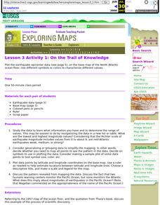
Lesson 3 Activity 1: On the Trail of Knowledge
Students plot the earthquake epicenter data on the base map of the North Atlantic ocean floor using different symbols or colors to characterize different values.
Curated OER
Fossils and Lithologic Units
Practicing paleontologists map the geologic time scale, simulate the formation of sedimentary rock, and analyze fossil data. Instructions for four activities and five assessment choices are provided for the teacher. This comprehensive...
Curated OER
Solar Heating in the Himalayas
A fascinating instructional activity on how solar power is utilized by people who live in the Himalayas is here for you. In it, learners perform a case study which will help them understand that solar energy is a renewable resource, that...
Curated OER
Air Pollution in Mexico City
A fantastic lesson plan on urban air pollution problems throughout the world is here for you. Learners understand that there are many factors involved in creating pollution, that there are many health effects brought on by air pollution,...
Curated OER
Itaipu Dam and Power Plant (Brazil and Paraguay)
Learners study South America's Itaipu Dam and Power Plant in order to gain an understanding that hydroelectric power is a major means of generating electricity throughout the world. They also look into the environmental impacts that...
Curated OER
The Zabbaleen, Cairo's Garbage Workers
Here is a fascinating human geography study of the Zabbaleen. They are a sub-class of people who work as garbage collectors in Cairo, Egypt. I can't say enough good things about this resource in my limited space here. It is fabulous! If...
Curated OER
Where in the World
Students explore the global grid system. In this globe lesson, students identify latitude and longitude lines and how these can tell the coordinates of any place. They use the Internet to find the exact coordinates for their town.
Curated OER
Giving Students a Little Latitude
Young scholars use a world outline map to locate places using coordinates of latitude and longitude. They answer questions about places based on their knowledge of the map and on their research and make up more questions of this sort...
Curated OER
Where in the World? The Basics of Latitude and Longitude
Students are introduced to the concepts of latitude and longitude. In groups, they identify the Earth's magnetic field and the disadvantages of using compasses for navigation. They identify the major lines of latitude and longitude on a...
Curated OER
Musical Plates-Earthquakes
In this plotting earthquake data worksheet, students use a large world map and given web sites showing the latitude and longitude for the epicenter of recent earthquakes around the world. Students plot 2 weeks of earthquake data...
Curated OER
GPS Sports Field Activity
Students practice using GPS receivers and explore how knowing the coordinates of two locations allows them to determine the distance between those two points. They use the theory that they already had knowledge of and apply it to a...
Curated OER
Red Dirt Groundbreakers
Discover Oklahoma's first farmers. Read about 14 different agriculture workers and their contribution to Oklahoma's farming. After reading, have your class complete several activities such as researching an agriculturist, writing a...
Curated OER
The Coldest Place at the Bottom of the World
Students examine Ernest Shackleton's journey through the Antarctic and trace Shackleton's Actual Route on a map using longitude and latitude coordinates. Students compare his intended route with his actual and determine how far off...
Curated OER
Where Did Everyone Go?
Fifth graders view a video, and perform related activities on prehistoric archaeology to gain an understanding about the importance of careful data collection. They develop a system of cataloging objects using coordinate mapping to...
Mathematics Assessment Project
Aaron's Designs
Learners first create designs for greeting cards by applying transformations of shapes on a coordinate plane, and then determine a sequence of transformations that produces a given design.
Curated OER
A Real Life Example of the Distance Formula
Young scholars answer the following question: "Using the lines of latitude and longitude, what is the distance (in degrees) if you were to travel from NASA Dryden to NASA Ames?" They use the distance formula to find the distance...
Other popular searches
- Treasure Map Coordinates
- Grid Coordinates Map
- Map Coordinates
- Reading Maps and Coordinates
- Math Map Coordinates
- Coordinates Map Skills
- Map Coordinates Test
- Reading Map Coordinates
- Map Coordinates Way Points
- Mapping Coordinates


