Curated OER
Name That Town
Learners demonstrate how to locate places on a map using coordinates. In this map skills lesson, students work in small groups and select a name from a map index to locate. Learners use coordinates to identify the location on a map....
CK-12 Foundation
CK-12 Middle School Math Concepts - Grade 6
Twelve chapters cover a multitude of math concepts found in the Common Core standards for sixth grade. Each title provides a brief explanation of what you will find inside the chapter—concepts from which you can click on and learn more...
CK-12 Foundation
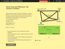
Vector Sum and Difference: The Country of Dreams
Find your way around using vectors. Scholars use an interactive to learn about vector addition. They answer a set of questions about modeling a route on a map using vectors.
Curated OER
The Treasure Map
Third graders problem solve using drawings and map interpretations. They preview graphs and Cartesian geometry. They follow directions on a map using a grid and compass references while simulating they are reading a pirate map.
Curated OER
Latitude and Longitude
Students demonstrate how to locate places on a map using a grid. In this map skills activity, students are introduced to latitude and longitude lines. Students define these terms and view a large map of a state. Students come up to the...
Curated OER
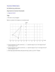
Reflecting Reflections
A triangle rests in quadrant two, from which your class members must draw reflections, both over x=2 and x=-2. This focused exercise strengthens learners' skills when it comes to reflection on the coordinate plane.
Mr. Head's 6th Grade Classroom
Absolute Location
How do we know where we are in the world? A presentation for middle schoolers explains absolute location and other geography terms such as relative location. It also gives scholars the opportunity to practice finding absolute location on...
Curated OER
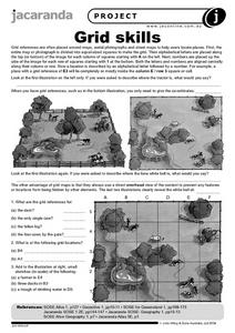
Grid Skills
In this geography activity, students use grid references on a map to locate places in the pictures given. They also identify another advantage of using a grid map, which they have an overhead view of the content to prevent any features...
Curated OER
Where in the Latitude Are You? A Longitude Here.
Students distinguish between latitude and longitude on the map. In this mapping lesson, students participate in mapping skills to recognize spatial relationships, and where to find natural resources on the map. Students create...
Curated OER
Where are We?
Fifth graders explore places visited by Lewis and Clark. For this geographical concepts lesson, 5th graders plot places on a map and put events in chronological order. Students find locations on a map using longitude and latitude....
ReadWriteThink
A High-Interest Novel Helps Struggling Readers Confront Bullying in Schools
Paul Langan's novel The Bully is the core text in a six-session unit plan that engages high schoolers in an in-depth examination of bullying and its effects on bullies, victims, and bystanders. The richly textured and carefully...
EngageNY
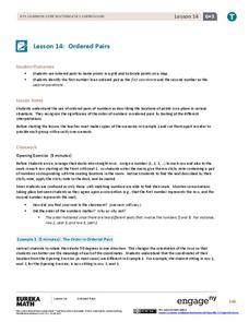
Ordered Pairs
Scholars learn to plot points on the coordinate plane. The lesson plan introduces the idea that the first coordinate of a coordinate pair represents the horizontal distance and the second coordinate represents the vertical distance.
EngageNY
How Do Dilations Map Segments?
Do you view proofs as an essential geometric skill? The resource builds on an understanding of dilations by proving the Dilation Theorem of Segments. Pupils learn to question and verify rather than make assumptions.
Curated OER
THE GULF STREAM
Students explore how to describe the Gulf Stream, how Benjamin Franklin charted it, and correctly plot it on a map.
Curated OER
You Can Find It!
Students, in groups, use longitude and latitude to locate various places on a map.
Curated OER
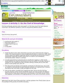
Lesson 3 Activity 1: On the Trail of Knowledge
Students plot the earthquake epicenter data on the base map of the North Atlantic ocean floor using different symbols or colors to characterize different values.
Curated OER
Coordinate Grid: Mapping an Archaeological Site
Students examine how archaeologists preserve context of sites through use of rectangular grid or Cartesian coordinate system, and develop sense of distance by pacing off and estimating distances.
Curated OER
Where Am I? Map Activity
In this map activity worksheet, students determine which countries are shown on a set of 16 maps, then read facts about each country designed to help with a report on that country.
Curated OER
Coordinates
Students identify and label the coordinate planes by the four different quadrants. In this geometry activity, students plot an ordered pair correctly. They identify and differentiate between rational and irrational numbers.
Curated OER
Maps: Latitude and Longitude
Pupils visit interactive sites focusing on latitude and longitude. They participate in activities about the prime meridian, time zones, and equator. They view the coordinates of states and cities.
Bowland
Outbreak: Infection Detection
Explore the mathematics of infection outbreaks with activities that ask learners to use coordinate grids to locate infected patients. They calculate amounts of ingredients for antidotes and determine which groups of people should be...
It's About Time
Volcanic Landforms
Did you know the word volcano comes from the name of the Roman god of fire, Vulcan? During this activity, scholars make a topographic map, interpret topographic maps, and infer how lava will flow based on their analysis.
Concord Consortium
School Bus Routes
Plan the way to school. Given a map of a school district, class members portray a transportation consultant hired to develop a bus transportation plan that will pick up the eligible riders and get them to school. The plan must contain...
Curated OER
INTERPRETING MAGNETIC FIELD MAPS
Students interpret magnetic field maps, rotate the coordinates to obtain different views, change the coordinate representation, and produce alternate graphical representations.


