Curated OER
Peace Bridge Game
Students examine the border between the United States and Canada. As a class, they are introduced to the purpose of the Peace Bridge which is located from New York into Canada. In groups, they use the internet to research the...
Curated OER
Rice Is All Around Us!
Students grasp the complexity and similarities of traditional foods in various countries and cultures. Then they compare and contrast family food traditions with their classmates. Students also create a decorated box to store recipes...
Curated OER
Unknown Soldier Diorama
Students research history of honoring unknown soldiers in United States, Canada, France, and Australia, research origins and building of tombs for unknown soldiers in country of their choice, and create diorama depicting national...
Discovery Education
Election in the News
Young people are the future voices of the country. In order to be knowledgeable about local and federal elections, future voters must first become aware. Bring an informative lesson plan to your social studies class, in which middle...
Science Matters
Earthquake Building/Shaking Contest
Japan is one of only a handful of countries that constructs buildings that are almost earthquake proof. The 13th lesson in the 20-part series challenges scholars to build structures to test against earthquakes. With limited materials and...
Curated OER
Investigating World Cultures
Students, in groups, write research reports and create visuals about countries, put on a culture fair, and use PowerPoint to present their information.
Curated OER
Let's Travel
Students engage in Internet search. They find answers to questions concerning an assigned country. They create a video presentation about a foreign country. They design a display about the foreign country.
Curated OER
And the Winner Is...
Learners read the sports section of the daily newspaper to find daily totals of what countries have won medals and find articles to keep in their journal (notebook) on the different events and athletes. They then create a spreadsheet to...
Curated OER
Narrative Cartoons
Learners create narrative cartoons based on the activities of the Peace Corps. In this narrative cartoons lesson plan, students create comic strips where they draw and write about various activities that the Peace Corps is involved in.
Curated OER
Where in the World Do Those Cookies Come From?
Students discuss exports and imports by discovering where the ingredients come from for making chocolate chip cookies. They take a survey of their favorite cookies and create a bar graph to represent the information.
Curated OER
What Does It Mean To Be a Good Citizen?
Students study citizenship and what it means to be a good sitizen. They create their own country and determine its citizenship rules. They work together to create a visual representation of what makes a good citizen.
Curated OER
I Wonder What Other Dangerous Diseases Insects Spread...
Students use the internet to research diseases spread by insects. They create a brochure using the information they gathered. They present their project to the class.
Curated OER
Come to My Resort
Young scholars in a French II class use new vocabulary terms that are related to items and activities found in summer and winter resorts to create a brochure about a resort in a French-speaking country.
Curated OER
International Trade Web Pages
Learners describe how a country is currently engaging in international trade in terms of both imports and exports, as well as identifying trade barriers. They conduct research to identify the institutions and culture of a country. Using...
Curated OER
Japan
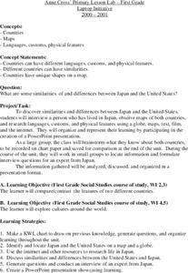
First graders investigate the similarities and differences between Japan and the United States. They develop a KWL chart, locate Japan and the U.S. on a globe, conduct Internet research on life in Japan, conduct an interview, and create...
Curated OER
Researching Another Country's Holiday: Focusing and Gathering Information
Fifth graders brainstorm a list of holidays celebrated by a majority of people in the United States. They each select an American holiday from the list as well as another country that may have a holiday that is similar. Next, they...
Curated OER
This Land Is Your Land
Learners explore the many faces of America through the video, "This Land Is Your Land." They discuss places they may have visited and record their responses. Students create symbols that respresent the riches of America.
Curated OER
Hungary: The Landscape
Pupils work in small groups to create a topographic map of Hungary. The map will include labeled line drawing of the bordering countries. Hungary should be three dimensional, made of salt and flour clay. The mountains, plains and...
Curated OER
Italy: The Landscape
Students work in small groups to create a topographic map of Italy. They must include labeled line drawings of bordering countries and bodies of water. Students use salt and flour clay to make Italy three dimensional, showing the many...
Curated OER
Malta: The Landscape
Pupils work in small groups to create a topographic map of Malta. They must include labeled line drawings of bordering countries and bodies of water. Students use salt and flour clay to make Malta three dimensional, showing the nearest...
Curated OER
Corn Exports Visually
Learners study imports and exports and the countries that import the most corn from the U.S. They construct mini paper corn plants and label a map with these plants to represent the amount of corn the U.S. exports to countries around the...
Curated OER
Influence of Beauty, The Beauty of Influence
Tenth graders explore the influence of art on modern societies. Through the internet, they assess paintings of advertisements for commercial products and social-political beliefs. Using spreadsheet software, the class compares and...
Curated OER
Global Economy: A Simple Activity
Students explore the global economy. In this economics instructional activity, students examine clothing labels in search of the countries the clothing was made in. Students consider the implications of a global economy.
Curated OER
Geography of China (Tibet)
Sixth graders study the geography of Tibet. They create maps of Tibet. Students predict population, land area, water area and coastline length of the United States and Tibet. Students compare and contrast the day-to-day lives of people...
Other popular searches
- Create a Country Project
- Create a Country Geography
- Create a Country Book
- Create a Country Lesson Plan


