Curated OER
Push/Pull Factors and Welsh Emigration
Students view and discuss short sections of movies that relate to immigration. Working in groups, students create a map that shows directions of internal migration in their assigned geographical area. Students review ads/booklets created...
Curated OER
Enduring Understanding
Fourth graders explore indigenous people of rainforest and examine their customs and ways of life. They discuss how rainforests should be protected not only for their plants and animals, but also for indigenous people who live in them,...
Curated OER
Weathering the War
Learners research maps, weapons and weather from a variety of wars, then create a presentation showing the impact weather and topography has had on military operations.
Curated OER
Old Kids From The Bloc
Learners study about wide scale construction and development in Moscow and its impact on cultural and historic preservation. They research the political, social, economic, and cultural changes in the former Eastern Bloc and create a...
Curated OER
The Sound of Music in Kenya
Students study Kenya's culture and see how people and things can be different and similar at the same time. They create a pictograph of objects from each culture that are used in similar ways and examine a few Swahili words.
Curated OER
Passport to Stories Around the World
Young scholars read stories from various cultures and create a passport indicating the completion and comprehension of the story. The template for the passport is included. The instructional activity can be used for a broad range of...
Curated OER
Only Skin Deep
Students examine and compare notions of beauty in cultures around the world and explore the connection between what is deemed 'beautiful' and cultural history. They Develop a "Beauty Around the World" collage representing beauty...
Curated OER
For Sale!
Students give an oral presentation. In this Spanish lesson, students work in groups to describe a house for sale using Spanish. Students use a digital camera to take pictures of their house and create a newsletter/flyer using Publisher....
Curated OER
Reader's Theater: Presenting Asian Folktales
Students create and perform folktale plays. In this reader's theater and Asian literature instructional activity, students work in groups to rewrite Asian folktales into scripts and perform the folktales for their class in a Reader's...
Curated OER
Money Matters: The Importance of Global Cooperation
Learners prepare for a visit to the International Monetary Fund (IMF). In this activity students create a concept map of money. They discuss the goals of the IMF. Learners research countries currently changing into market economies....
Curated OER
Diversity
Students work in groups to research and prepare an oral report about a region. For this regions lesson, students find out about the geography, population, state capitals, and landmarks. Students assign attributes to the...
Curated OER
The Vikings: Sea Raiders, Land Raiders
The geography of northern Europe, as well as the technological advancements in the nautical world, allowed the ferocity of the Vikings to arrive on the shores of faraway countries. Pupils study Viking history in an instructional activity...
Curated OER
Journeys...The Voices of Change
Students trace the immigration patterns of their ancestors. They plot information on a world map, develop a timeline of target immigration patterns, research and write a report on immigration and participate in a class play.
Curated OER
Geograophy of Mexico And Central America
Learners create a chart comparing the terrain, climate, economy, environmental issues and natural disasters for Mexico and the Central American countries. They view and discuss a video on the region then compile research on the internet.
Curated OER
Why do people mover where they do?
Students read factual stories of migration to Hawaii, analyze and explain push and pull factors, interview parents about their cultural heritage, identify countried of origin of their ancestors, graph migration patterns on an world map,...
Curated OER
Learning About Maps
Students investigate the many uses and features of maps and globes and locate where they live on both. In this map lesson, student play a travel game and create their own maps to explore states, continents, countries, and islands.
Curated OER
"Pass the Potatoes" (But, where did they come from?)
Eighth graders explore various cultures around the world. In this cultural lesson, 8th graders prepare foods that belong to different cultures. Students examine the climate in the places of origin of their foods using a...
Core Knowledge Foundation
Year 2: Northern Europe
How is life in Northern Europe different from other areas of the world? Historians journey through the various regions of Northern Europe discovering what type of climate, animals, and lifestyles exist in that section of the world. They...
Cornell University
Too Much of a Good Thing?
Continuing their study of beneficial insects, young entomologists discover where in the world some of these bugs are. By labeling, coloring, and using the scale on a map, pupils explore the territories and arrival of the Asian lady...
Quaver
World Percussion — Latin America Project Book
What's the most popular music style in Brazil? What about Cuba? Or the Dominican Republic? An immersive project teaches young learners about the salsa, the samba, and the merengue with research assignments and dance performances.
Curated OER
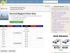
Second Biggest Cities Quiz
For this online interactive geography quiz worksheet, students examine the chart that includes details about 20 major cities in the world. Students identify the names of the cities in 4 minutes.
Curated OER
Canadian Provinces Quiz
In this online interactive geography quiz worksheet, learners examine the map that includes 13 Canadian provinces. Students identify the names of the provinces in 3 minutes.
Curated OER
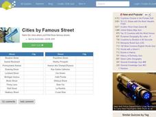
Famous Streets Quiz
In this online interactive geography quiz worksheet, learners examine the chart that includes the names of 18 famous streets in the world. Students have 4 minutes to identify the names of the cities where the streets...
Curated OER
Canada Map Quiz
In this online interactive geography quiz worksheet, students examine the map that includes 13 Canadian provinces and territories. Students identify the names of the provinces and territories in 2...


