Curated OER
Africa Unite!
Students work in pairs to research assigned African countries. They compile their research to label a continent map of Africa, present their research to the class and design a game of trivia using their findings.
Curated OER
The Fifty States
Learners become familiar with the states. They study capitols, mottos, nicknames, and other various details. They create group projects that be presented to the class.
Curated OER
Maps
Maps, globes, and computer software aid young explorers as they locate state capitols, major cities, geographic features, and attractions for states they are researching. They then use desktop publishing software to create a map to share...
Curated OER
Oaxaca Geography and the Climate
Students examine the diverse geography of the country of Mexico and the state of Oaxaca. They analyze how the geography of the state of Oaxaca affects its climate and create maps showing the different climate areas.
Channel Islands Film
Once Upon A Time (Saxipak’a): Lesson Plan 1
As part of a study of the history of the Chumash on California's Channel Island chain, class members view the documentary Once Upon a Time, respond to discussion questions, and create a timeline for the different waves of migration.
Curated OER
Country Cookbook
Young scholars, in groups, create menus for five traditional meals from a country of their choice. They create a cookbook that includes all the recipes and describes when the traditional dish would be served.
Curated OER
The Time Has Come: Poetry and Drama Use in the Geography Class
Students use drama and poetry in their Geography class. In groups, they role play an interviewer or the interviewee in various plays that were presented to them. In their role, they must locate and label where the countries mentioned...
Curated OER
Comparing Countries
Students use a graphic organizer to research, compare and contrast two countries. They write a brief (or detailed - depending on age) report of their findings.
Curated OER
China - the Geography of European Imperialism - Spheres of Influence in China
Ninth graders create a map of China. They identify the various spheres of influence carved out by the Imperialist powers of Europe as well as locating geographical features of china and major cities. They explain the global impact of...
Curated OER
Go Maryland! Our State's Geography & Economy
Fifth graders design and create a brochure that may be used by the Maryland Department of Business and Economic Development to attract visitors in the 3 different regions of the state. In this Maryland state lesson, 5th graders research...
Curated OER
Popcorn Geography
Students use kernels to create a "Top Corn-Producing States" map or graph. They read and round off numbers. Students identify on a U.S. outline map the location of corn-growing states. They create a visual (map or graph) illustration...
Curated OER
Geography Booklet
Sixth graders explore geography terms. Students use resources to find real examples of landforms in the world. They create a map showing the landform. students label the surrounding features, countries and states. Students use each...
Curated OER
NATO Geography & Language
The class receives background information on NATO, an atlas, and a blank world map. They color the original 1949 countries in red, the 1952 additions in green, and the 1990 additions in blue. This exercise would be a good starting point...
Curated OER
Tracing Our Own Family Pilgrimages
The Pilgrims may have arrived in North America by way of the Mayflower, but chances are, your class members' ancestors came to the United States in another way. Guide them through an exploration of their own heritage, countries of...
Sharp School
Travel Brochure Project
Designing a travel brochure is a classic project that will help your class members develop a variety of skills, such as researching informational texts, designing creative visual products, and communicating what you have learned.
Scholastic
Owl Moon Teaching Plan
Capture the engagement of young readers with this collection of activities based on Jane Yolen's book, Owl Moon. Following a shared reading of this children's story, the class explores the geography of the American Northeast,...
Freecloud Design
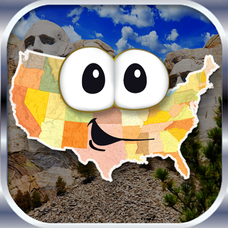
Stack the States™
Kids have fun learning US geography and state facts, including capitals, nicknames, major cities, and landmarks. They can choose between the game, or informational flashcards for each state.
Curated OER
Tears of Joy Theatre Presents Anansi the Spider
Accompany the African folktale, Anansi the Spider, with a collection of five lessons, each equipped with supplemental activities. Lessons offer multidisciplinary reinforcement in English language arts, social studies, science,...
Denver Public Schools
Kung-hsi Fa-ts' ai! – A Chinese New Year Celebration
Looking for ideas for your Lunar New Year celebration? Check out an interdisciplinary unit of study that includes lessons in counting, calligraphy, culture, geography, literature, art, and music. Kung-hsi Fa-ts' ai! (May you...
K20 Learn
Beyond the Zombie Wars: Understanding Culture
The zombies have invaded! Only a few safe regions remain, and class members must decide where they and the remaining world refugees should flee. After researching the cultures and creating poster presentations of various parts of the...
Curated OER
Video Boxes
Young scholars create a video box about a Central American country. In this world history lesson, student research Central America and pick a country they want to investigate. They work in groups to create a video box that shows images...
Curated OER
Geography of the United States
Students examine the population growth of the United States. In this Geography lesson, students construct a map of the fifty states. Students create a graph of the population of the USA.
Curated OER
Why Not Visit My Country?
Learners research a country using the Travel Languages Web site. Using MS Publisher, they create a travel flyer about the country. Using Inspiration, they develop a concept map of what they learned about their country.
Curated OER
The Countries of Slave Trade
Learners create graphs, routes, and write an essay based on their research of the slave trade. In this slave trade lesson plan, students research the Middle Passage and how slave trade happened in the United States.


