Space Awareness
Let's Map the Earth
Before maps went mobile, people actually had to learn how to read maps. Pupils look at map elements in order to understand how to read them and locate specific locations. Finally, young cartographers discover how to make aerial maps.
Curated OER
Oh, What A Day
Students listen as the teacher reads A Country Far Away. They predict what they will do and what they think their partner student will be doing. Students create a KWL chart for Japan. They collect information about their activities on an...
Curated OER
Middle East Map Quiz
In this online interactive geography quiz worksheet, students examine the map that includes 26 Middle Eastern countries. Students identify the names of the countries in 4 minutes.
Curated OER
South America Map Quiz
In this online interactive geography quiz worksheet, students examine the map that includes all of South America's countries. Students identify the 13 countries in 2 minutes.
Curated OER
Central America Map Quiz
In this online interactive geography quiz instructional activity, students examine the map that includes 22 Central American countries. Students identify the names of the countries in 3 minutes.
Curated OER
Flags Of Latin America
Middle schoolers determine the symbolism of Latin American flags. In this Latin America lesson, students research the cultures and histories of countries as well as the history behind their flags. Middle schoolers recreate the flags and...
Curated OER
Mapping South America
Students explore South America. In this South American instructional activity, students use their geography skills to create population, terrain, biomes/vegetation, and major exports maps. Students present their finished maps to their...
Curated OER
Oh, the Places You'll Go!
Students read about and discuss the fifty-three recommended travel destinations for 2008 from the Travel section of The New York Times. They list three places they would each like to visit, read and discuss the news article, and create...
Curated OER
Postcards from Somewhere
Students correspond with e-pals about their community. In this cross curriculum geography, technology, and literacy lesson, students complete a postcard webquest about their home location including local photographs. Students e-mail...
Curated OER
Asia's Global Influence
Middle schoolers explore Hong Kong. In this geography skills lesson, students watch "Asia's Global Influence," and then research the culture, landmarks, and geographic features of Hong Kong. Middle schoolers use their research findings...
Curated OER
Florida Cities Map Quiz
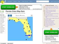
In this online interactive geography activity, students examine a map of Florida and identify the 12 noted cities on the map using a pull down menu within 3 minutes.
Curated OER
Texas Cities Map Quiz
In this online interactive geography worksheet, students examine a map of Texas and identify the 15 noted cities on the map using a pull down menu within 3 minutes.
Curated OER
New York Cities Map Quiz
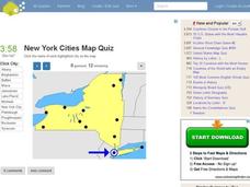
In this online interactive geography activity, students examine a map of New York and identify the 11 noted cities on the map using a pull down menu within 3 minutes.
Curated OER
Great Lakes Cities Quiz
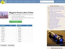
In this online interactive geography worksheet, students examine a map of the Great Lakes region and identify the 20 noted cities on the map using a pull down menu within 4 minutes.
Curated OER
City Life In Europe
Middle schoolers explore Paris. In this geography skills lesson, students watch "City Life in Europe," and conduct further research on the city of Paris and the country of France. Middle schoolers create postcards that feature Parisian...
Curated OER
Molas from South America
Third graders research world geography by creating a class presentation. In this South American lesson, 3rd graders read assigned text regarding the customs and traditions of different Indian communities in South America. Students...
Curated OER
Iceland
Fourth graders discover the country of Iceland. They investigate Iceland's history, culture, and geography using hands-on materials. They engage in a multi-day lesson. Each day focuses on a different aspect of Iceland. A most-impressive...
Curated OER
Mary Todd Tours the World
Pupils analyze how distinguishing another culture encourages us to respect each other. They research culture and all its avenues, recognizing and comprehending the relationship between people and geography. Ultimately, they can apply...
MENSA Education & Research Foundation
Connecting Africa: A Project-Based Learning Adventure
Mission Possible: Your task is to design a new highway route from Tunis, Tunisia to Cape Town, South Africa. If you accept the challenge, you must create a small map of the route that has already been rejected, a...
Curated OER
Capturing the Reader With Vivid Images
Young scholars examine the use of imagery to hold a reader's attention in an excerpt from John Deever's memoir "Mr. John and the Day of Knowledge". They are introduced to background information about the Ukraine and create original imagery.
Curated OER
Bank Loans Money to Start Businesses
After locating Latin American countries on a world map, children read about how microbanks are loaning money to help start small businesses. Involving both current events and economics, the teacher introduces the article with a map...
Curated OER
Giant Smelly Plant Attracts Thousands
Read and discuss a news article about a rare corpse plant that bloomed in Washington D.C. Because this native Indonesian plant blooms so rarely, people flock to see it. After reading the article, your class answers comprehension...
Curated OER
Continents
In this geography worksheet, learners identify the 7 continents by creating a color key. Students also research a country from each continent.
Curated OER
Majestic Murals
Albert Bierstadt is a highly celebrated artist who was able to capture the beauty of the American landscape. The class will first learn how Bierstadt explored America during the 1800s and painted the majestic countryside. Then, they will...


