Curated OER
Australia Cities Map Quiz
In this online interactive geography quiz worksheet, students respond to 17 identification questions regarding Australian cities. Students have 3 minutes to finish the timed quiz.
Curated OER
Chinese Cities Map Quiz
In this online interactive geography quiz instructional activity, students respond to 10 identification questions about Chinese cities. Students have 3 minutes to complete the quiz.
Curated OER
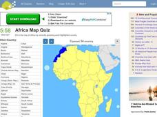
Africa Map Quiz
In this online interactive geography quiz worksheet, students respond to 53 identification questions about the countries of Africa. Students have 6 minutes to complete the quiz.
Curated OER
Spanish Cities Map Quiz
In this online interactive geography quiz worksheet, students respond to 11 identification questions about Spanish cities. Students have 3 minutes to complete the quiz.
Curated OER
Nursery Rhymes
Learners recall details of nursery rhyme read by teacher, identify main characters, and demonstrate knowledge of poem by creating concept map about story that includes title, clip art, and changes in font and color.
Curated OER
Our World With MapsQ
Students examine and compare different types of maps. In this map skill instructional activity, students look at neighborhood and national maps on the overhead projector while making comparisons of the symbols and locations. They use a...
Curated OER
Regions of South Carolina
Third graders explore the 5 regions of South Carolina. In this regions lesson, 3rd graders locate the regions on a map and compare and contrast the areas. Students have sentence strips that have facts about the regions on them, students...
Annenberg Foundation
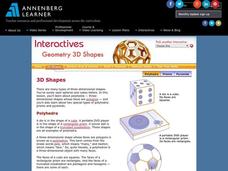
Geometry 3D Shapes: 3D Shapes
Explore vocabulary related to three-dimensional shapes. An instructional website describes the characteristics of different geometric solids. Learners can use an interactive component to view nets, faces, vertices, and edges of common...
Curated OER
Sand Explorations
Young scholars experiment with different samples of sand from Maui leeward and windward beaches. They create a sand map to suggest at least one contributing factor for the formation of each beach sample. They test the samples to...
Virginia Department of Education
A Designed Organism
How can you encourage pupils to demonstrate creativity while still meeting the objective of applying technical knowledge? This activity is your answer! Scientists will create an imaginary creature and prepare a graphic organizer with...
Curated OER
Map Readng And Giving Directions
Students read a story to create the context for the lesson. Then they are given or create a community map. Then students use the scenario of being lost in order to role play giving directions to a partner to find a destination. The...
Curated OER
Using Picture Mapping to Improve Student Comprehension
Students draw pictoral representations of a reading selection they read in order to recall information. For this picture mapping lesson plan, students use pictures to comprehend what they read and sequence the pictures as well.
Curated OER
Physical Features
Students draw physical land features using ClarisWorks or Kid Pix, write their definitions, create slideshow, and create class geography book.
Curated OER
The Gift of the Nile: Egypt and its River
Students begin with a piece of a puzzle that shows an artifact from ancient Egypt. They find others who have pieces that go with their puzzle piece. Students work in these groups to construct a relief map of the Nile River Valley.
Curated OER
Silk Roads Big Map
Students create an oversized map from Europe to East Asia. They include information such as Silk Roads, geographical features, major cities and cultural information on their map.
NOAA
Watching in 3D
Bring the ocean floor to life! Earth science scholars discover the process of deep sea mapping in the third installment in a series of five lessons about ocean exploration. The teacher's guide includes helpful resources, worksheets, and...
Chicago Botanic Garden
Climate Change Around the World
Look at climate change around the world using graphical representations and a hands-on learning simulation specified to particular cities around the world. Using an interactive website, young scientists follow the provided...
Curated OER
Using Concept Maps to Teach Evolution
Students encounter concept maps for reviewing evolution. Concept maps provides an alternative method of interacting with the information and a forum for asking questions about vocabulary, concepts and interrelationships. A quiz is...
Curated OER
Create a Weather Newscast
Fourth graders explore and study basic weather terms, strengthen research skill on the web and create a weather newscast. They choose a weather site on the web, copy weather maps and create a videotape based on a written script to...
Curated OER
Learning about Maps and Colors
First graders discuss "Harold and the Purple Crayon" and his drawings. In this neighborhood geography instructional activity, 1st graders learn to detect and classify places on a map including their home. Students recognize their address...
Curated OER
Get into the Flow with an Interactive Volcano
Students research the structural elements of a volcano. They make a PowerPoint slide that contains five facts which will be added to a whole class slideshow. They add an interactive table of contents using action buttons.
Curated OER
Mapping India
Students participate in an activity in which they place placards listing geographic features, landmarks, etc. in the correct place on a large fabric map of a given country. They also examine artifacts, photos, sounds/music, etc. from...
Curated OER
Scarcity of Land Throughout the World and in Hawaii
Students discuss the importance of "land." They review the four types of land classification--urban, rural, agricultural and conservation--and participate in an activity involving an apple that demonstrates the use of land in Hawaii....
Curated OER
Mapping the Border
Students create maps of the borderland region. They decorate their maps with colors, pictures, icons, scenes, words that reflect their understanding of the character and history of the borderland.


