Curated OER
The American War for Independence
Students complete a unit of lessons that examine the goals of the Americans during the Revolutionary War. They explore an online interactive map of major campaigns, read and analyze primary source documents, and analyze diplomatic and...
Curated OER
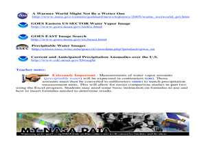
A Comparison Study of Water Vapor Data to Precipitation over North America
Students use NASA satellite data to compare water vapor over the United States. In this data analysis lesson students use an Excel spreadsheet to map their data.
Rainer Goebel
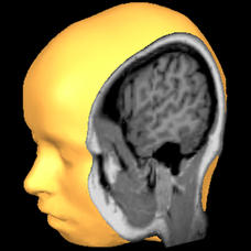
Brain Tutor 3D
The human brain is staggeringly complex, and its structure can seem impossible to grasp. This user-friendly app allows for exploration of the brain's anatomy, providing nomenclature, 3-D mapping, and functions.
Office of the New Jersey State Climatologist
Play Ball! – Or Not…Making a Decision Using Weather Data
Should the game go on or not? An engaging instructional activity asks small groups to make a decision using weather data. After analyzing a map, an updated forecast, and radar information, groups have to decide whether to cancel a...
American Museum of Natural History
Inca Investigation
A fascinating interactive resource lets young archaeologists dig through the history of Huanuco Pampa. The Inca city, located high in the Andes mountains of Peru, was once a thriving community. Craig Morris has spent years researching...
Curated OER
Geographic Landscapes and Interstate Freeway Development
Students investigate the topography of the United States through a discovery lesson. They create a hypothetical route for a highway across the United States. Students also conduct research major landforms and define geographic terms.
Curated OER
Mapping Human Rights in Our Community
Students work in groups to draw a map of their town or neighborhood. They include their homes, major public buildings and places. Students analyze their maps from a human rights perspective.
Curated OER
Social Studies
Third graders explore maps and models. They discuss communities and the buildings within their community. Students construct a model of the downtown area of their town. They construct a map of their town and write facts about the...
Curated OER
Eager to Get to Ancient Egypt
Seventh graders explore the geography of Ancient Egypt, read a story and answer questions on a web site.
Curated OER
Geotagging in school
Students create a digital photo map of the world. In this digital photo map lesson plan, students pick topics such as the Olympics, natural disasters, or trip planning and create a photo map on the computer.
Curated OER
5 Themes Awareness of Current Event Issues
Students analyze newspaper articles for the 5 themes of geography. They create a colorful portfolio explaining how each theme: location, place, etc. is relevant in a chosen current event.
Curated OER
Gainging Perspective
Seventh graders examine and evaluate different perspectives of human and wolf interactions. They develop a conclusion based on research through the use of electronic resources.
Curated OER
Biggest Metro Areas in the USA
In this online interactive geography quiz worksheet, students respond to 100 identification questions about metropolitan areas in the United States. Students have 10 minutes to complete the quiz.
Curated OER
Biggest Muslim Cities Quiz
In this online interactive geography quiz worksheet, learners respond to 34 identification questions about the largest Muslim cities. Students have 5 minutes to complete the quiz.
Curated OER
Monument Museum
Students design monuments, taking into account what is known about geometric shapes and measuring. Students create a museum complete with monuments and descritions of the monuments. Students provide guides at each monument in order to...
Curated OER
Schools
First graders complete a unit of lessons on school and how schools have changed. They read a Laura Ingalls Wilder excerpt, view and discuss a Norman Rockwell painting, conduct an interview, construct a school map, and create an ABC book...
Curated OER
World Capitals Quiz
In this online interactive geography quiz activity, learners respond to 195 identification questions about the capital cities of countries in the world. Students have 12 minutes to complete the quiz.
Curated OER
European Capitals Quiz
In this online interactive geography quiz worksheet, students respond to 45 identification questions about the capitals cities of European countries. Students have 5 minutes to complete the quiz.
Curated OER
Most Populous Countries Quiz
In this online interactive geography quiz worksheet, learners respond to 20 identification questions about the world's most populous countries. Students have 3 minutes to complete the quiz.
Curated OER
Top World Languages Quiz
In this online interactive geography quiz worksheet, students respond to 50 identification questions about world languages. Students have 5 minutes to complete the quiz.
Curated OER
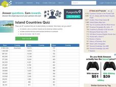
Island Countries Quiz
In this online interactive geography quiz worksheet, students respond to 48 identification questions about island nations in the world. Students have 5 minutes to complete the quiz.
Curated OER
People from Places Quiz
In this online interactive geography quiz worksheet, students respond to 20 identification questions about what people from certain areas of the world are known as. Students have 4 minutes to complete the quiz.
Curated OER
English-Speaking Countries Quiz
In this online interactive geography quiz worksheet, students respond to 17 identification questions regarding English-speaking countries. Students have 4 minutes to complete the quiz.
Curated OER
Countries w/ Biggest Economies Quiz
In this online interactive geography quiz worksheet, students respond to 20 identification questions about the economies of countries in the world. Students have 4 minutes to complete the quiz.


