Curated OER
To Protect Your Streams, Protect Your Mountains
Students build and experiment with a watershed to understand the effects of pollution. For this movement of water lesson, students work in groups creating rock formations and change the viscosity of the liquids falling down the mountain....
CK-12 Foundation
CK-12 Earth Science Concepts for Middle School
Explore a variety of science concepts in an interactive textbook created for middle school scholars. A lengthy table of contents takes readers to pages comprised of a subject overview, outline, and summary. Follow links further to find...
Curated OER
Restoring and Protecting Chesapeake Bay and River Water Quality
A professional and comprehensive presentation on Chesapeake Bay water quality is in store for your ecology class. If you live in the Chesapeake Bay region and want to get learners involved in conservation efforts, this slide show will do...
Curated OER
The Great Water Hunt
Students create a model of the land to water ratio in a large group and search for all the places water is used at their school while on a Great Water Hunt. They identify where water can be found and compare how much of world is covered...
Curated OER
What is a Watershed?
Students create a classroom size model of a landscape to define the concept of a river watersheds. They spread crumbled newspapers around the floor to simulate different elevations then cover the whole landscape with a sheet. They pour...
Curated OER
Natural Features
Students identify natural features on a map. In this geography lesson plan, students identify six physical features and create pictorial definitions for each term. The terms which are listed in this lesson plan are mountain, hill,...
Curated OER
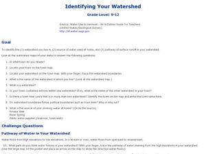
Identifying Your Watershed
Students identify the watershed where they live and how it is related to their own water consumption. In this watershed lesson students locate their watershed on their town map. The students find the source of their water that they use...
Curated OER
The Life and Times of the West River 1776-1896: A Study of Early Industry in Westville
Students examine the role of the West River in Connecticut in providing water power to local industries. In groups, they determine and discuss what needs to be considered before building along a river. They also research the other...
University of Southern California
Wave Erosion Lab
Using a stream table, erosion enthusiasts examine how the density of sediment and how the slope of land contribute to the amount moved by waves. You will not be able to use this entire resource as is; there are teachers' names and...
Curated OER
River Reflections
Sixth graders create podcasts and video public service announcements. In this environmental advocacy lesson, 6th graders study the local watershed and become advocates for their local environment. In the process, they create podcasts and...
Curated OER
TE Activity: Stream Consciousness
Fourth graders study how environmental engineers monitor water quality. They use environmental indicators to determine the quality of stream water in their area. They count the number of macroinverabrates and use the information they...
Curated OER
Piece Like a River
Students investigate water formations by creating a puzzle. In this water properties lesson, students create a giant river puzzle by drawing on large butcher paper as a class, then dividing the image up into many pieces. ...
Curated OER
FOLLOW THAT WATER
High schoolers build simple stream tables and vary the angle of the stream tables in order to simulate different flow rates and compare the results. They observe various features formed in a stream table by flowing water and compare...
Curated OER
Mapmaker, Make Me a Map!
Here is a well-designed, very thorough lesson plan on mapping for very young children. Within the six-page plan, you will find everything you need to implement the instructional activity. They will identify various landforms found in...
California Academy of Science
Pollution in Our Watershed
The concept of a how pesticides and other chemicals pass through a watershed can be difficult for younger learners to grasp without a concrete example. In the activity here, some blank paper, markers, and a spray bottle are all you need...
Curated OER
The Water Cycle
A short, but nicely done, presentation on the basics of the water cycle. In it, learners view slides which describe the fascinating process of how the sun creates water vapor, which creates clouds, which create rain, which flows into...
Curated OER
Lao Design: Lotus Flower Constructions
Students create lotus flowers in 3-D designs applying Lao art techniques. Following a teacher demonstration, they assemble their own lotus flower candleholders and the teacher arranges a group flotation in a body of water. Students...
Curated OER
Unit 2: Global to Local: Understanding My Place in the Hydrosphere
What does the ground around your home have to do with water pollution? Young ecologists learn about their local watershed and create their own cause-and-effect models of the hydrosphere.
Curated OER
Landforms of Illinois
Fifth and sixth graders are introduced to the primary landforms of Illinois and discover how they were created. Landform cards are made for each pupil. They use the twenty-questions format until they have identified each one. Then,...
Curated OER
Forecasting the Path of Mudflows
Students watch a demonstration to introduce them to the consistency of mudflows and how they move. In groups, they compare and contrast volcanic avalanches and mudflows. They create their own model of a volcano, simulate how it erupts...
Curated OER
Gliding Glaciers
Glaciers are the star of the show in this Earth science lesson. In it, learners gain an understanding of how glaciers are formed, how they move, and what types of landforms they create. This lesson plan is written in the classic format,...
Curated OER
Survey of the Louisiana Purchase in 1815
Learners explore the survey of the Louisiana Purchase by creating their own surveying and mapping techniques such as natural maps, pace maps, and orienting. Other students then try to follow the maps.
Curated OER
Volcanoes!: Forecasting the Path of Mudflows
Students construct a mockup of a volcano by crumbling up newspapers and piling them into the shape of a volcano. They place a tarp over the newspapers making sure the tarp is large enough to simulate a flat area at the volcano's base....
Indian Land Tenure Foundation
Relationships to Places
Young historians take a look at how the Indian tribes of California promoted a mindful relationship between people and the land. They begin to understand how the Indians were champions of conservation, and at preserving the natural...


