Curated OER
Mexico: One Land, Many Cultures
Students, through a variety of activities, discover the geography and culture of Mexico. They make maps, read folktales, write a journal, create pinatas and other artistic pieces, and review the history of Mexico.
Curated OER
Where in the Latitude Are You? A Longitude Here.
Students distinguish between latitude and longitude on the map. In this mapping lesson, students participate in mapping skills to recognize spatial relationships, and where to find natural resources on the map. Students create...
Curated OER
Indiana Travel Guide
Fourth graders share their information about their home state. In this research lesson, 4th graders use graphic organizers to make a travel guide about the state of Indiana. This lesson could be modified for use with any state, it also...
Curated OER
Who Wants to Be a Millionaire in the U.S.A.?
Students research the states, gathering information and creating questions and answers. They play a form of Who Wants to be a Millionaire? using the student-generated questions and answers.
Curated OER
Regions of South Carolina
Third graders explore the 5 regions of South Carolina. In this regions lesson, 3rd graders locate the regions on a map and compare and contrast the areas. Students have sentence strips that have facts about the regions on them, students...
Curated OER
Our World With MapsQ
Students examine and compare different types of maps. In this map skill instructional activity, students look at neighborhood and national maps on the overhead projector while making comparisons of the symbols and locations. They use a...
Curated OER
Memories from the National Sites
Students write a virtual postcard. In this logo instructional activity students are introduced to the concept of postcard writing. Students research the national sites and states highlighted on quarters for that year. Students take a...
Curated OER
It's Time to Rhyme
Students listen to rhyming book, identify rhyming pairs, guess what rhyme words mean, and create list of rhyming pairs on chart paper. They then discuss Fifty States Quarters Program, identify objects on backs of state coins, and...
Curated OER
Lewis and Clark
Fifth graders use the Internet to research a topic. In this expeditions lesson, 5th graders answer questions about Lewis and Clark based on the movie they watched previously, use the Internet to research Lewis and Clark, write a...
Curated OER
States Research Project
Eighth graders create an in-depth research report on a state. They conduct Internet research, write a comparison essay about New York State and their assigned state, create a 3-dimensional map, and develop a Powerpoint presentation.
Curated OER
Map Creation
Second graders identify a map, symbol, key, and compass rose. Students create and print a map for teacher evaluation using the computer. Students identify the symbols on their map and orally present them to the class.
Curated OER
Reading distance on maps
Eighth graders complete worksheets on reading the distance on maps in miles or kilometers. In this maps lesson plan, 8th graders use a calculator and ruler.
Curated OER
Texas, Our Texas
Students explore U.S. geography by completing a coloring activity in class. In this Texas history lesson plan, students utilize the web to locate Texas on a map of the U.S. Students view a PowerPoint presentation which showcases the...
Curated OER
Where Did My Lunch Come From? A U.S. Regional Tour
Students explore the regions from which their food comes. For this social studies lesson, students identify the different agricultural products that are found in the major regions of the United States. Students create a lunch menu.
Curated OER
Be a Watershed - Create a Living River
Students investigate water ways by conducting an experiment with classmates. In this natural resources lesson, students define a watershed and identify where large ones are located within the United States. Students utilize...
Illustrative Mathematics
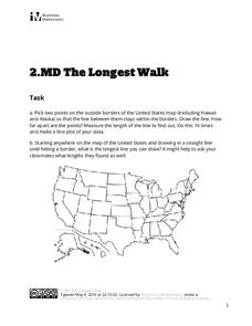
The Longest Walk
How long of a line can you draw within this activity? Learners pick two points outside and within the map to create the longest line they can. After drawing 10 lines, learners plot the length of each line on a line plot. Then they...
Curated OER
Understanding Weather and Climate Patterns
Young scholars research the climate patterns of various locations and make predictions based on their findings. They determine the importance of latitude and longitude in weather and climate. Students create graphs displaying their...
Houghton Mifflin Harcourt
Journeys: Challenge Activities (Theme 1)
This nine-page packet, the first in the series of support materials for the Houghton Mifflin Harcourt thematic units on journeys, contains enrichment activities for learners who have mastered the basic concepts of the lessons....
Curated OER
Japan
First graders investigate the similarities and differences between Japan and the United States. They develop a KWL chart, locate Japan and the U.S. on a globe, conduct Internet research on life in Japan, conduct an interview, and create...
Curated OER
Canada, O Canada
Students study the similarities and differences between Canada and the United State in this unit. They examine geography, government and culture as they "travel" through Canada.
Curated OER
ESRI Live Earthquake Site
Students examine a World map and find earthquakes near plate boundaries. They locate and describe earthquakes in the United States and California.
Curated OER
Migrating to Texas
Fourth graders explore the migration to Texas from other parts of the United States. Through journal entries they write about the trip as if they were the settlers coming to a new and foreign country. Working in small groups, 4th graders...
Curated OER
Oh, the Regions
Focus on the geography of Oklahoma. In this activity, learners compare different geographic regions in Oklahoma, create a collage to share their results, and identify important landforms throughout the United States, such as the...
Curated OER
Geography of China (Tibet)
Sixth graders study the geography of Tibet. They create maps of Tibet. Students predict population, land area, water area and coastline length of the United States and Tibet. Students compare and contrast the day-to-day lives of people...


