Curated OER
Mapmaker, Make Me a Map!
Here is a well-designed, very thorough lesson plan on mapping for very young children. Within the six-page plan, you will find everything you need to implement the activity. They will identify various landforms found in Colorado on a...
Curated OER
The Great State!
The creation of state home pages is the focus of this lesson. Learners research one of15 states for which special State Quarters have been released, and create a home page for that state. They also perform Internet research and utilize...
Curated OER
The Fifty States
Students become familiar with the states. They study capitols, mottos, nicknames, and other various details. They create group projects that be presented to the class.
Curated OER
Bunyans Lesson Plan
Students practice their map skills. In this early childhood lesson plan, students use a map of the United States and identify the location of several natural wonders included in the book The Bunyans by Audrey Wood.
Curated OER
Where the Parks Are
Students research major league baseball in United States and Canada. In this baseball history lesson, students use a map of the United States and Canada to find and label each major league team. Students then color the home cities of the...
US Mint
Symbols in My Eyes
Explore the hidden meanings behind the images on US currency with this elementary school lesson on symbolism. Starting with a class discussion about symbols, children go on to brainstorm different objects that represent the Unites States...
Curated OER
United States Map: March 31
In this calendar dates worksheet, students learn that March 31st was the day the first map of the United States was published. Students then create a map of either their classroom or school.
Curated OER
U.S. Geography for Children: State Capitals
In this United States map skills activity, students locate and label specified states and their capitals, and create icons and a map key to show something for each state that is famous. Students answer 5 questions.
EngageNY
Mid-Unit Assessment: Research Simulation
As part of a mid-unit assessment, scholars complete a research simulation about food deserts to mimic the research process. Afterward, they engage in a think-pair-share to discuss what they've learned throughout the unit.
Curated OER
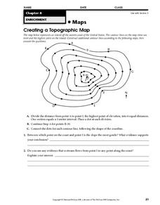
Creating a Topographic Map
In this topographic map instructional activity, students add contour lines to a topographic map using instructions provided. Once topographic map is finished, students complete 2 follow-up short answer questions.
Curated OER
Mapping Electricity
Students complete Internet research and use their map reading skills to learn about how the United States creates and uses electricity in different states. In this energy sources lesson, students study the mini map of energy usage in the...
Curated OER
Mapping Population Changes In The United States
Students create a choropleth map to illustrate the population growth rate of the United States. They explore how to construct a choropleth map, and discuss the impact of population changes for the future.
Curated OER
Exploring Arizona's Biotic Communities Lesson 1: Mapping Biotic Communities
As part of a unit on Arizona's biotic communities, young ecology learners create a map. They describe how humans and animals adapt in their habitat. They take notes and create graphic organizers from articles they read. Beautiful maps,...
Curated OER
Mapping West Virginia
Fourth graders explore West Virginia. In this Unites States geography lesson, 4th graders discuss the type of land and the cities in West Virginia. Students create two overlays, with transparencies, that show the natural land and the...
Curated OER
U.S. Puzzle Map Bulletin Board
Students create cutouts of each state. They research different states noting their similarities and differences. They describe each state's location in relation to the state's surrounding them.
Curated OER
N is for Natural State
For any pupils who live in the state of Arkansas, this would be a fabulous educational experience to help them get to know their state better. Through the use of activities in literature, art, mathematics, science, social studies, and...
Curated OER
Learning About Maps
Students investigate the many uses and features of maps and globes and locate where they live on both. In this map lesson, student play a travel game and create their own maps to explore states, continents, countries, and islands.
Curated OER
The Nifty Fifty- Facts and Figures
Students explore an assigned state. In this United States geography lesson, students identify facts and figures related to a particular state. Students use the Internet for research and create a PowerPoint presentation displaying these...
Curated OER
State Information
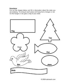
In these research worksheets, students will discover facts about one of the fifty United States. They are asked to research seven facts about their state including the state bird, state motto, and state flower. Students then create a...
Curated OER
North Carolina Salt Dough Map Social Studies Project
In this lesson, North Carolina Salt Dough Map, 4th graders create a salt dough map of North Carolina, Students use dough to form the shape of the state of North Carolina. Students label the three regions of North Carolina and all of...
Curated OER
Mapping the News
Students explore cartography. In this map skills and map making lesson, Students work in groups to create wall size world maps including legends, compass roses, latitude and longitude, and physical features. Students collect current...
Curated OER
A High-Interest Novel Helps Struggling Readers Confront Bullying in Schools
Bully, bullied, or bystander? Paul Langan's The Bully is the anchor text in a unit that examines bullying and violence. After a close reading of the text, readers imagine themselves as the characters and consider how they would react in...
Curated OER
Understanding "The Stans"
Students explore and locate "The Stans" in Central Asia to create, write and illustrate maps, graphs and charts to organize geographic information. They analyze the historical and physical characteristics of Central Asia via graphic...
Curated OER
E-mailing the Chamber of Commerce
Encourage effective internet research and e-mail correspondence as scholars investigate a US capital city they've never visited to find pertinent and relevant information. They begin by picking a city, then visit that city's chamber of...


