Curated OER
The Hajj: Muslim Pilgrimage in a Geographic Perspective
Students read information on the Hajj. They discuss pilgrimage and ways it differs from going to a church, mosque or synagogue. Students discuss logistical problems that might be posed for the host country of a pilgrimage. Students do an...
Curated OER
Ratios And Scale
students investigate the concept of using a ratio in the work of construction and solve problems using real life applications. They read descriptions of how various types of construction professionals use ratios on the job. The lesson...
EngageNY
Dilations as Transformations of the Plane
Compare and contrast the four types of transformations through constructions! Individuals are expected to construct the each of the different transformations. Although meant for a review, these examples are excellent for initial...
Curated OER
Conejito
Third graders read the story "Conejito" and write a descriptive story about the rainforest in Panama. They answer story comprehension questions, complete worksheet questions about a map of Panama, and rewrite a paragraph changing the...
Curated OER
Planning a Garden Using a Grid
Third graders plan for a garden. In this garden planning lesson, 3rd graders investigate the use of a grid to accurately map out and plan for a vegetable garden. Students predict the space requirements for different vegetables.
National Wildlife Federation
Massive Migrations
Turn your students into flocks of migratory birds for this fun lesson on animal migration. Prior to the activity, the teacher creates four different migration routes in the classroom or any available open space, labeling nesting...
NOAA
Fishy Deep-sea Designs!
Oceans represent more than 80 percent of all habitats, yet we know less about them than most other habitats on the planet. The instructor introduces the epipelagic, mesopelagic, bathypelagic, twilight, and midnight zones in the ocean....
Curated OER
How Do Artists Effectively Relate Historic Events?
Students explore African American migration. In this black culture and history lesson plan, students use a map to identify northern and southern states in which African Americans lived in the 1900s. Students observe and describe objects...
Curated OER
Understanding Growth of the Phoenix Area
Students study the growth of the Phoenix area using geographic images, maps, tables, and graphs. They study the idea of community.
Curated OER
Locate Key Information in Nonfiction Text
Interpret nonfiction text with your class. Readers use key information found in nonfiction text to answer questions and problem solve. They utilize the chapter headings, diagrams, glossary, maps, and captions as well as the table of...
Curated OER
Upwelling in the World Ocean
Here is a fascinating topic: the upwelling of ocean waters. Oceanography pupils learn what mechanisms cause upwelling, types of upwelling, and the effects on marine life. Colorful satellite imagery and informative diagrams bring this...
Sea World
Endangered Species
Study different endangered species with several activities that incorporate math, science, language arts, and research strategies. A great addition to your lesson on conservation or Earth Day.
Polar Bears International
Top of the World
Learn about polar bears and the Arctic circle with a lesson about the countries and conditions of the region. After examining how the area differs from Antarctica, kids explore climates, animals, and geographical position...
EngageNY
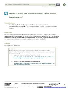
Which Real Number Functions Define a Linear Transformation?
Not all linear functions are linear transformations, only those that go through the origin. The third instructional activity in the 32-part unit proves that linear transformations are of the form f(x) = ax. The lesson plan takes another...
Teaching Adapted PE
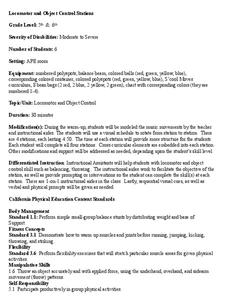
Locomotor and Object Control Stations
Develop children's basic locomotor and object control skills with an invigorating Adaptive PE lesson. A series of four, timed stations engaged the class in playing a game of Twister, walking on a balance beam,...
Curated OER
Sorting the Loyalist Documents
Students organize the Canadian Loyalist primary source documents and add more information to their primary source document concept maps.
Curated OER
Fish Around the World
Students use a globe to answer questions such as which continent they live in and the country in which they live. They identify at least two bodies of water near their state and two foreign countries. In groups, they complete a...
Curated OER
Knowing Where You Are
Students work together to research the names of places in their state. They divide up their state so that each group can research a different section and complete a chart of the different names. They create a key for the map to explain...
Curated OER
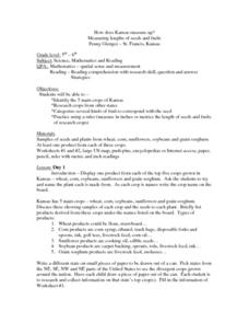
How Does Kansas Measure Up?
Students identify the five main crops of Kansas and crops that are produced in other states. The categorize the types of fruits and seeds of each plant and measure each to compare the length of each.
Curated OER
Using Story Structure to Enhance Comprehension
In these story structure worksheets, learners review story structure and learn how to use story maps to help with their reading comprehension. Students review an example story map and then study three different graphic organizer versions...
Curated OER
Breads Around the World
Pupils read about bread. In this lesson studying bread, students read about the history of bread and it's significance around the world. Pupils identify the three main crops used to make bread and ten common types of bread from different...
Curated OER
Places and Production
High schoolers calculate United States GDP and GDP per capita, use a choropleth map to acquire information, and create choropleth maps of GDP per capita in South America. They identify regions with high and low GDP per capita
Curated OER
Scale Factors
In this scale factors worksheet, 6th graders solve 10 different problems that include types of scale factors. First, they determine the missing dimensions in each problem. Then, students round their responses to the nearest tenth before...
Curated OER
Cities of the World
Students identify the symbol for cities on a political map. In this world map lesson, students identify specific cities on the World Political Map. Students should identify the country in which the city is located. Students discuss the...


