Curated OER
Los Trenes de Espa¿¿a
High schoolers identify and read correctly the symbols of a Spanish train schedule. Using maps, they identify and locate major cities and landforms of Spain and practice using a twenty-four hour clock. Using the internet, they navigate...
Curated OER
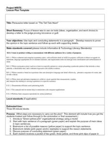
Persuasive Letters and The Tell Tale Heart
Pupils write persuasive letters based on "The Tell Tale Heart." They brainstorm topic sentences, main ideas, and details. They analyze the character and determine if he is innocent or guilty. They create a map listing their reasons to...
Curated OER
Inferring Themes
Fifth graders practice making inferences on various types of reading material. As a class, they develop a definition of the word "theme" and discuss themes for some of their favorite stories. They use the context of the reading...
Curated OER
Biodiversity
Students explore the diversity of different marine sanctuaries. In this biodiversity lesson students work in groups to explore a sanctuary.
Curated OER
Spherical Geometry: A Global Perspective
Learners investigate spherical geometry using a globe and an apple. In this spherical geometry lesson plan, students translate Euclidean geometry terms to spherical geometry terms using a globe. They answer 3 questions about spherical...
Curated OER
Social Studies For Elementary School
Fourth graders become familar with maps and work in groups to get an overview of what Europe is like. The real assignment is in the form of students creating their own trip if it could really be taken.
Curated OER
Roller Coaster Mania
Fifth graders extend their knowledge of developing maps. They work in cooperative groups to develop an amusement park display and a brochure.
Curated OER
Our State Road Trip
Learners take a virtual tour of the country of China instead of a state. Using the Internet, they examine the differences between a political and physical map and use latitude and longitude to locate specific places. They also research...
Curated OER
Places and Production
Students investigate the economy and the market value of goods. In this algebra lesson, students differentiate between domestic goods value and international good value. The define and identify the importance of GDP or Gross Domestic...
Curated OER
Silicates
In this silicates worksheet, students are given the names of 6 different silicates in the form of a concept map. Students define each type of silicate in the map.
Curated OER
Erosion: On the Move...Defending the Coast Against Wave Attack
Students study how people have tried to save beaches from wave erosion. They examine what has occurred to Cape Hatteras as a result of beach erosion and the efforts to reduce the erosion.
Curated OER
Lori Schmidt's Lovely Lesson
Students color code a world map by region to show the different amphibians and reptiles that live there. They discuss the Nile Crocodile, Snapping Turtle, Komodo Dragon, Indian Python, and Lacertidae. When completed, they create a key...
Curated OER
Clouds and Solar Radiation
Students use satellite imaging and Mesonet solar radiation maps to answer questions given to them by the teacher and look for differences and similiarities in the data.
Curated OER
A Coin Out of Water
Students examine the Michigan state quarter and identify land and water on the quarter. They locate the Great Lakes and other bodies of water on a map. They compare and contrast streams, rivers, ponds, lakes, and oceans.
Curated OER
Boats Graph
Learners read from the Bible about the travels of Paul, particularly the boat rides. They trace Paul's travels on a map of Asia Minor. Students review a field trip they took and make a graph showing the numbers of each type of boat they...
Curated OER
Oregon Rainshadows
Students brainstorm list of possible highest locations in Oregon, identify and label places from list on map using color code, and discuss and identify causes of a rain shadow.
Curated OER
What is an Explorer
Students become explorers. They examine a picture of an explorer and create props to explore within the classroom. Students are studying the Louisiana Purchase of 1803. They explore how to read a map and create a map of the classroom...
Curated OER
Hit The Road Jack(or Jill)
Students find the approximate area of the court order on a current map of Delaware. They draw a layout of their school and decide where a new hallway or outside pathway would be most needed.
Curated OER
Math: Road Trip
Twelfth graders use road maps to calculate the distance between two locations. They estimate the cost for fuel and the miles per gallon. They consider other factors such as geography, road conditions, and traffic that may impact the cost.
Curated OER
Hatching Chicks to Agriculture - Where does the feed come from?
Second graders examine the types of grain that goes into feed for chickens. They study other grain crops grown in Kansas and the foods that are made from them.
Curated OER
Immigrants & Community
Students examine how different groups of immigrants contributed to the growth of specific communities. After reading a novel, they keep a journal on the important elements found and create a map of the community portrayed. Using the...
Curated OER
Lesson L - Hit The Road Jack (or Jill)
Students discuss forms of transportation in Delaware during 18th Century, find approximate area of court order on current map of state, draw layout of their school, and decide where new hallway or outside pathway would be most needed.
Curated OER
OaxacaTurtles
Students identify types of turtles off the coast of Oaxaca. They become acquainted with the Mexican Turtle Center. They create a project (mural, map, panel discussion, logo/design) to communicate researched information.
Curated OER
Ancient Highways-Native Byways of Salmon Lake State Park
Eighth graders investigate the concept of the trail system used by the Native Americans. They compare and contrast the trails to modern transportation roadways of today. Students also define the types of information archaeologists use to...


