Curated OER
Africa Map Spatial Analysis
In this map skills worksheet, students complete a graphic organizer that requires them to examine what is represented on different types of maps of Africa.
Space Awareness
Valleys Deep and Mountains High
Sometimes the best view is from the farthest distance. Satellite imaging makes it possible to create altitude maps from far above the earth. A three-part activity has your young scientists play the role of the satellite and then use...
Big History Project
Human Migration Patterns II
While humans have always been on the move, the period between 1400 and 1800 saw vast migrations of people between the East and the West. These migrations—whether through slavery or a desire to colonize new lands—shaped the modern world....
Curated OER
United States Map- Map Legend/City Symbols
Students investigate the United States map. In this map skills geography lesson, students explore city symbols on the map legend and identify them. Students use post-it notes to mark various symbols.
MARS - Mathematics Assessment Resource Service
Applying Properties of Exponents
The properties of exponents are all linked together and it is your mathematicians' job to discover and apply those rules. The comprehensive lesson plan begins with a pre-assessment task to check for prior knowledge and then goes into a...
Curated OER
Learning Lesson: Analyzing a Weather Map
Students use weather maps to locate warm and cold fronts. They discover the different types of weather associated with these fronts. They also observe the weather in their local area.
Curated OER
Semantic Mapping In Biochemistry
Learners create a semantic map utilizing material learned in previous biochemistry lessons. Their maps will include material on the four types of organic compunds previously explored in class.
Curated OER
Orienteering - Lesson 3 - Topographical Maps and Contour Lines
Learn how to read a topographical map and understand what the contour lines mean. Explore longitude and latitude. Find a cliff, a valley, a mountain peak, and more. This is just one of the ten lessons in this unit on oreinteering....
Curated OER
Surveying the Land
Students explore the different kinds of maps and the purpose of each. In this Geography lesson, students work in small groups to create a map which includes the use of a map key.
Curated OER
Symmetries of a Quadrilateral I
Learners examine the properties of quadrilaterals from the point of view of rigid motion. Different types of quadrilaterals are characterized by their symmetries, so learners explore the symmetries of a described quadrilateral to...
Shakespeare Globe Trust
Fact Sheet: Playhouses
Laborers used common materials to build London's first performance venues, including sticks, plaster, and ... hair? Using an informational handout, scholars learn about the construction of different types of playhouses where actors...
Compton Unified School District
How Can We Locate Places?
How can we locate places? Maps, of course! Expose second graders to the tools available in maps and discuss how these tools can help people find locations. Students also look at communities, including what makes a community and the...
Curated OER
The Water Around Us
Students discuss importance of reading maps and knowing about the geography of the United States, and locate bodies of water on different types of maps and examine how they are used in the state or local community.
Curated OER
Putting It on the Map
Students consider the purpose of various types of maps and their different uses throughout history. They create their own maps and reflect on the map-making process.
Curated OER
Draw a Map
Students draw a map. In this map drawing lesson students draw a map to show where a character is from and where they are going in the story. Students are writing an odyssey.
Curated OER
This Land Is Your Land, This Land Is My Land
Students review and evaluate the ways land is covered and used in their local community. They consider the environmental effects of the different types of land use. Students act as community planning engineers to determine where to place...
Curated OER
Waldseemuller's Map: World 1507
Learners investigate the 1507 word map. For this world geography lesson, students examine the details of each section of the map and then draw conclusions about how the people of 1507 understood the world. Learners are evalated on...
Curated OER
A Visit to Hogwarts
Students collaborate in groups to read excerpts or entire selections from two Harry Potter books, use educational software to create concept maps detailing similarities and differences between first two Harry Potter books, and analyze...
US Environmental Protection Agency
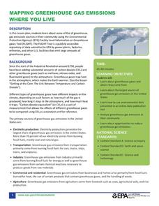
Mapping Greenhouse Gas Emissions Where You Live
After investigating the US Environmental Protection Agency's climate change website, your environmental studies learners discuss greenhouse gas emissions. They use an online interactive tool to look at data from power production...
National Wildlife Federation
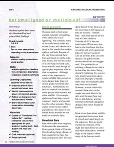
Bats: Maligned or Malicious?
Most people couldn't name the positive qualities of bats. Learners discover how bats benefit the environment and then create a concept map to summarize the information. After their reading, they identify misconceptions people have about...
Curated OER
Learning About Maps
Students investigate the many uses and features of maps and globes and locate where they live on both. In this map lesson plan, student play a travel game and create their own maps to explore states, continents, countries, and islands.
Curated OER
MAP UNIT
First graders investigate how maps are used to identify different locations. They will also appreciate how there are different types of maps for their purposes. Finally students study how maps contain symbols that represent real places.
Curated OER
Chromosomes Concept Map
In this biology worksheet, students complete a concept map on different types of mutations. They fill in 7 blanks with the correct word from the list.
Curated OER
Fishes Concept Map
For this marine science worksheet, learners complete a concept map on the different types of fish. They fill in 8 blanks with the correct answer from the word list.


