Curated OER
Waldseemuller's Map: World 1507
Seventh graders analyze various maps. In this Geography lesson, 7th graders create a large map as a whole class. Students write a letter to Mr. Waldseemuller.
Curated OER
Maps with a "Spin"
Students, in groups, research and map the effects of a proposed airport three miles outside of town. They prepare a presentation based on a set of maps they make and explains its different points of view from the viewpoints of the town...
Curated OER
Introduction to WorldWatcher: Coloring Temperature Maps
Young scholars are introduced to the software program WorldWatcher. In groups, they discover the temperature variations throughout the world and color a map according to the temperatures. They also practice using visualization to...
Curated OER
Outline Map of Japan
In this geography worksheet, students examine a black line outline map of Japan. There is a compass rose on the page. There are no labeled cities.
It's About Time
Volcanic History of Your Community
Did you know there are 20 volcanoes erupting at any given time? Pupils look at various igneous rocks, read local geologic maps, and determine if their area has a history of volcanic activity. A reading passage and analysis questions...
Carnegie Mellon University
Renewables Workshop
Youngsters examine resource maps to find out which states are using solar and wind power and discuss as a class various other renewable energy sources. They use a provided data table to record pros and cons to each technology, build and...
Curated OER
Plate Tectonics: First Grade Lesson Plans and Activities
A set of first grade geology lessons focuses on plate tectonics and movement of plate boundaries. During the pre-lab, learners experience three types of plate movement through a kinesthetic demonstration. The lab...
Council for Economic Education
Banks and Credit Unions (Part 1)
Imagine you have money you want to save ... where do you put it? Pupils investigate the similarities and differences of banks and credit unions as they determine where exactly to place their hard-earned money. Through a WebQuest,...
Annenberg Foundation
Geometry 3D Shapes: 3D Shapes
Explore vocabulary related to three-dimensional shapes. An instructional website describes the characteristics of different geometric solids. Learners can use an interactive component to view nets, faces, vertices, and edges of common...
NOAA
Plate Tectonics I
Young geologists get a glimpse beneath the earth's surface in this plate tectonics investigation. After first learning about the different layers of the earth and the constant movement of its plates, young...
Columbus City Schools
It’s Electric!
Shocking! Who knew so many great ideas existed for teaching middle schoolers about electricity? Find them all within this energetic framework. You'll light up at the variety of printable and web-based resources within! After building...
Rice University
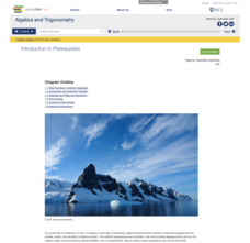
Algebra and Trigonometry
Move on into trigonometry. An informative eBook takes the content of a College Algebra course and adds more relating to trigonometry and trigonometric functions. The content organization allows pupils to build upon their learning by...
Curated OER
Are We There Yet?
Young scholars discover how to use maps and why they are important when using a map. They calculate distance using a map scale and time using travel speed and a map scale.
Curated OER
The Earth is an Orange
Students examine and identify the various types of maps. Using two types of maps, they compare the data that can be gathered from each one. They also identify and locate the continents and the oceans. They review the purposes of each...
Curated OER
Flash Flood!
Students study floods and flash floods. The About Floods page explains the difference between floods and flash floods, and why flash floods occur. The Flood Types page explores some of the different types of floods that occur. There is...
Curated OER
Coasts
Middle schoolers explain the different types of marine coasts and where they are located in the United States and its territories. They explain and identify some of the life forms that inhabit different marine coastal regions.
Curated OER
What Is a Primary-Source Document?
Students discover what a primary-source document is, what different types there were back in 1867, and what newer kinds there are today. They play a form of bingo using printed cards that reproduce documents related to Confederation.
Curated OER
Earthquakes: Getting Ready For The Big One
Students devise a plan to prepare a city for an earthquake. In this lesson on earthquakes, students differentiate between the different types of earthquakes, examine the impact they can have on a city, and write a proposal on how to...
Curated OER
Importance of Water
Students complete a KWL chart on what they comprehend about water. They complete a water activity determining how much usable water is available, and they determine the water usage in their households. Students take notes on water and...
Curated OER
Let's Rock
Students investigate the property of rocks and how to distinguish among the different types. They explore the hardness of rocks and perform streak tests to determine mineral color. They classify rocks according to their properties.
Curated OER
Money
Third graders review the values of quarters, dimes, nickels, and pennies. They discuss how the different types of coins can equal the same amount. Students give examples of ways to make a given amount under $1.00. They explain what the...
Curated OER
Using Graphic Organizers for Sensemaking
Students create concept maps in order to assess the information that they have gathered during research. They study the concept map to determine if the research is complete.
Curated OER
Ancient Egypt: Connecting Literature and Geography
Students brainstorm prior knowledge of Ancient Egypt, locate Egypt on map of Africa and on world map, watch King Tut film, discuss term biography, and map geographical information mentioned in stories and documentaries about Ancient Egypt.
Curated OER
Homes Around the World
Learners investigate houses and homes from around the world and create a map collage. They compare how the homes are similar and different and why houses match the weather and geography.


