Curated OER
Carving Mountains
Students explore geography by participating in an illustration activity. In this land-form lesson, students define vocabulary terms associated with glaciers and forests. Students utilize pens, cardboard and pottery clay to draw and...
Curated OER
Land Use Over Time
Students view aerial photos and topographic maps of their local area. They compare and contrast major land use patterns over time by comparing these images to maps that are at least 50 years old. They analyze them using the four land use...
Curated OER
Give Me Back My School: A Back to Basics Approach to Ecological Restoration
Ninth graders research local geography to create successful, ecological school landscaping. They determine soil type, average weather patterns and temperature graphs and use the information to select ideal plants and plant maintenance...
Curated OER
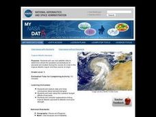
Troical Atlantic Aerosols
Students explore the effect aerosols have upon he weather and climate. They observe NASA satellite images to explore and draw conclusions about aerosol transport. From studying the images, students track the path of aerosols. They...
Curated OER
It's Happening, Where? Find the Absolute and Relative Location of News Articles
Young scholars read newspaper articles. In this social studies activity, students locate the latitude and longitude of the location where the news article takes place. Young scholars write a summary of the news article.
Curated OER
If You Build It, Will They Come?
Students examine the city of Duluth, Minnesota. In groups, they use the internet to discover its current state of urban geography. After their research, they create and plan their own redeveloping of the city. They share their results...
Curated OER
Students Become Mapmakers
Students practice making a map of a continent and correctly plotting five cities on that map. They place latitude and longitude lines on a map, determine the need for various map projections and explain why map scales are necessary.
Curated OER
What Are The Characteristics of Your Neighborhood?
Students make a mental map of their neighborhood. Using a software program, they make an aerial and digital map of their school and locate their school on given maps. In groups, they calculate the distances to various locations and...
Curated OER
From Home to School, GPS Style
Young scholars are introduced and increase proficiency in the use of the hand held GPS system. They explore the meaning of longitude and latitude lines, then identify the parts of the map.
Curated OER
Lewis and Clark
Fourth graders research the Lewis and Clark expedition and the Corps of Discovery. They explore a variety of websites and complete a WebQuest, analyze maps, and answer comprehension questions. Students also write journal entries and...
Curated OER
Attu Battlefield: U.S. Army and Navy Airfields on Attu
Students use maps, readings, drawings and photos to research the World War II Battle of Attu. They explain the importance of the battle, discuss the valor and loyalty of both American and Japanese troops and analyze sources of historical...
Curated OER
Strawberry Girl: Lesson 3 - Trains, Sails, and Trails
Young scholars read two chapters of Strawberry Girl by Lois Lenski and complete activities about Florida's transportation history. In this literacy and economics lesson, students read two chapters of the book, talk about their journal...
Curated OER
Sam Houston for President...Again
Fourth graders discover the political career of Sam Houston. In this Texas history lesson, 4th graders research primary resources and create a modern-day version of Sam Houston's political campaign of the 1840s.
Curated OER
The Greatest Survival Story of All Time
Students use the Internet to read about an explorer's survival in the Antarctic. They try to find a better route for him to have taken.
Curated OER
The Ocean Floor
Fifth graders discuss the process of sedimentation and the continental drift theory. They locate major structures on the ocean floor and they identify life forms at each level of the ocean.
Curated OER
Give Me The C and D Canal!!!
Young scholars estimate the distance from Baltimore to Philadelphia via the water route before the Chesapeake and Delaware Canal was built. Students study canals and how transportation and economic necessities dictate the building of a...


