Curated OER
The Exploration and Settlement of North America
Learners locate place in Canada and explore highlights of early of early American exploration and settlement. In this North American history instructional activity, students locate provinces, major cities, and physical features of...
Curated OER
Canada...a Visual Journey
Students, in groups, research Canada's six natural regions (ecozones). They create a visual representation of each region on a large wall map of Canada and present it to the rest of the class.
Curated OER
The Great Continental Drift Mystery
Students stud the concept of Pangaea by using Wegener's clues to construct a map of the continents joined together. They determine how fossil distribution can be used to enhance the study of continental drift. They locate the...
Curated OER
Where Am I?
Second graders listen to a Japanese folk tale called "The Traveling Frogs". They role play the story using puppets or costumes. They locate Japan on a map and discuss several geography topics. They independently write about ways they...
Curated OER
Pioneer Homes
Pupils compare and contrast Native American dwellings with pioneer homes. They identify the progression of these homes and locate examples on a frontier map.
Curated OER
Lesson 8-The Changing Environment: Good or Bad?
Second graders, after listening to "A River Ran Wild," explore all the ways the natural environment has changed and how it affects the community and the people who reside within it. They collect data by interviewing a community member,...
Curated OER
Canada...A Visual Journey
Students work together to analyze the six natural regions of Canada. Using this information, they create a visual representation of each region on a large wall map and present it to the class. They must identify five key points of each...
Curated OER
Hidalgo's Fight for the Independence of Mexico
Tenth graders study and examine the life of Miguel Hidalgo while working to identify major themes. Small groups create sequence of event chains, analyze and label maps of Hidalgo's travels, and work together to create giant chalk maps...
Curated OER
Aboriginal Societies of Canada
Fourth graders study Aboriginal Societies in Canada and do an oral presentation to the class.
Curated OER
social studies: Life in Colonial America
Students explore the trials and tribulations early colonial life and note its successes. Through literature, Internet research, and interactive software, they engage in various activities to evaluate early social and cultural development.
Curated OER
Persistent Paths: Trails, Tracks and Turnpikes Across the Alleghenies
High schoolers study maps to determine barriers associated with the Pennsylvania mountains and the Native Americans. In this investigative lesson plan students study the routes used by Native Americans, explain physical features of the...
Curated OER
Making a Brand for Ourselves the "Cowboy" Way
Students define cowboys and learn about their roles on rangelands. In this rangeland lesson, students define cowboys and cowgirls and complete a KWL chart. Students read Cattle Kids and Til the Cows Come Home. Students visit the Diamond...
Curated OER
Development Issues in the Northern Suburbs
Students demonstrate the ability to obtain geographic information from a variety of print and electronic sources. They use a variety of maps and data to identify and locate geographical features of Minnesota and Anoka County. in...
Curated OER
English Settlement
Students study the development of the New England colonies, their rationale for settlement, and the importance of Puritan theology in this development. They research towns in England and their copies in Massachusetts.
Curated OER
An Ancient Greek and Roman Festival
Third graders label a map of ancient Greek and Roman civilizations and do a written report on one element of these two cultures. They participate in discussions of food, farming, daily life and government (among others). Students use the...
Curated OER
The Lewis and Clark Expedition
Students examine the Lewis and Clark expedition. They develop skills for historical analysis. They locate a variety of geographic features encountered by the expedition, and create a timeline that documents Lewis and Clark on their journey.
Curated OER
Meet the Mayas, Aztecs and Incas
Students study the geography of the Mayas, Aztecs and Incas and create a map book. They share in stories and legends about these people. Handouts and worksheets are included.
Curated OER
Native Americans 1700s-1800s
Eighth graders investigate and explain major Native American groups, events, individuals and conflicts from the 1700s through the 1800s in the early American colonies and the United States.
Curated OER
The Rise of Islam
Students read their textooks and discuss in groups the background of Muhammad answering oral questions and studying and identifying Mecca on the map. They work in groups to read handouts on "Early Revelations of Muhammad" to present...
Curated OER
Ute Indians: Past and Present
Fourth graders study the history of the Ute Indians. In this Ute Indians lesson, 4th graders complete a KWL chart about Ute Indians and read the online Ute Indian Fact Sheet. Students study examples of Ute culture, where the Ute Indians...
Curated OER
Voyage to the New World
Students examine the exploration of the New World. They write a descriptive account of the first encounter between Europeans and Native Americans, analyze and label maps, plot Columbus's journey on a map, and write a chapter summary.
Curated OER
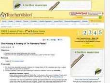
The History and Poetry of In Flanders Fields
Students examine the inspiration for the John Mc Crae's poem, In Flanders Field. They study sonnets and the use of tetrameter before discussing is considered to be a sonnet although it does not follow the pattern. They discuss the...
Curated OER
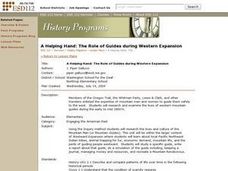
A Helping Hand: The Role of Guides During Western Expansion
Young scholars research and examine the lives and culture of western mountain guides during the early to mid 1800s. Students write reports about a guide they research, do a simulation of the guide by keeping a journal, managing money...
Curated OER
Peru Geography and the Environment
Fourth graders draw maps of Peru and examine how Peru is a geographically diverse country.


