Curated OER
Weather Predictions
Pupils record weather data and create a five day forecast. Students investigate the roles of meteorologists and identify symbols used on a weather map. After gathering weather data for a week, pupils will create a five day forecast based...
Curated OER
Climate Change Quiz
In these climate change worksheets, students read through the fourteen questions about climate change. Students select the correct answer to complete the quiz.
Curated OER
Ocean Currents Quiz
In this ocean worksheet, students complete a 13 question multiple choice on-line interactive quiz about ocean currents. Prior knowledge is assumed.
Curated OER
Waves Lesson Plan
Young scholars demonstrate an understanding of tsunamis and possible causes. In this investigative instructional activity students view a video and explore earthquakes and movement of tectonic plates.
Curated OER
Oceans and Weather
Students analyze the impact the ocean and its currents have on weather. In this oceans and weather instructional activity, students analyze data comparing inland and coastal weather, and analyze satellite data for evidence of El Nino.
Curated OER
Severe Weather - Deciding Where to Live
Learners recognize the variety and frequency of severe weather occurrences. They research the type of severe weather that may occur in their area as well as determine the frequency of occurrence.
Curated OER
Glacier Climbing
Students discover where glaciers exist and how they move. For this glacier lesson, students work in groups to create a glacier in a replica valley and observe its properties.
Curated OER
The Joy of Natural Disasters
Simulate a natural disaster to inspire problem-solving, collaboration, creativity, and teamwork.
Curated OER
Dinosaurs-Eoraptor
Young scholars explore the Eoraptor. In this dinosaurs activity, students read facts about the habitat and eating habits of the Eoraptor and illustrate a picture of the dinosaur.
Curated OER
the Potential Consequences of Climate Variability And Change
Students analyze the consequences of changing variables on a system. Changes in a model are measured and recorded and conclusions drawn based on the data provided in this six lessons unit.
Curated OER
Plotting Plates
Young scholars investigate plate tectonics and their correlation with natural phenomena like earthquakes and volcanoes. They use the internet to see real-time data about earthquakes and volcanoes. Students plot latitude and longitude...
Curated OER
Sunken Millions: 3rd Grade
In this PowerPoint, students participate in a game with a quiz show format in which they answer questions about water. Topics include the water cycle, bodies of water, characteristics of water, and how water relates to weather...
Curated OER
BOUNCING INFORMATION AROUND
Learners examine how satellite signals are sent and duplicate it with a mirror, flashlight and black paper.
Curated OER
Communicating Data
In this data worksheet, students match information with the best type of graph to display it. Students also make a chart and graph to display information in a given paragraph.
Curated OER
Reading Comprehension: Weather
In this comprehension learning exercise, students read a selection on the weather, then complete 3 short answer questions related to the selection.
Curated OER
Building A Topographic Model
Students visualize, in three dimensions, features represented by contour lines on a topographic map. They see that the different elevations shown on a two dimensional topographic map can be used to build a 3-D model.
Curated OER
From Where to Where?
Students find locations based upon their latitude and longitude coordinates. In this latitude and longitude instructional activity, students locate points on a grid and learn how to use an astrolabe.
Curated OER
Wild, Wild Weather: Severe Storms
Second graders research dangerous weather and how they can stay safe. In this environment lesson, 2nd graders view video clips and research the Internet to identify the different types of severe weather storms. Students complete a...
Curated OER
What Is El Niño?
Students access information at remote sites using telecommunications, identify impacts by reviewing past El Ni??o events, make and use scale drawings, maps, and maps symbols to find locations and describe relationships.
Curated OER
Shake, Rattle and Roll
Students explore how to locate the location of an earthquake and why earthquakes happen more frequently in some areas more than others.
Curated OER
A World of Myths
Students read and write myths. In this world mythology lesson, students read and analyze myths from various cultures and then recognize their attributes as they write their own myths to explain natural phenomena.
American Geosciences Institute
American Geosciences Institute: Earth Science Week: Analyzing Hurricanes Using Web and Desktop Gis
In this activity, students research hurricane data to discover their behavior and patterns. They map them across decades to see whether their frequency is increasing. They study Hurricane Andrew and investigate the relationship between...
CK-12 Foundation
Ck 12: Earth Science: Hurricanes
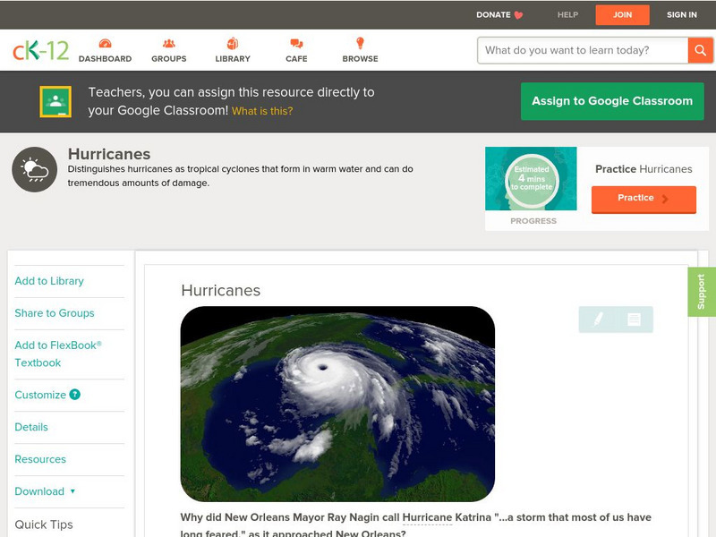
[Free Registration/Login may be required to access all resource tools.] Describes how a hurricane forms and its effects.
CK-12 Foundation
Ck 12: Earth Science: Hurricanes
[Free Registration/Login may be required to access all resource tools.] Describes how a hurricane forms and its effects.


