University of Wisconsin
Follow the Drop
Young surveyors look for patterns in water flow around campus. Using a map of the school (that you will need to create), they mark the direction of the path of water. They also perform calculations for the volume that becomes runoff. The...
Cornell University
Bacteria Take Over and Down
Bacteria outnumber all other forms of life on Earth. Scholars observe the growth of bacteria in petri dishes to understand their role in maintaining good health. Then, they observe the growth of bacteria after they introduce...
It's About Time
Volcanic Hazards: Flows
Did you know the largest volcano in our solar system is on Mars? Young scholars measure and experiment with how to predict lava and mud flows. This knowledge leads to better evacuation, safety, and preventative methods.
Space Awareness
Star in a Box
What happens to stars as they get older? A simulation takes pupils through the life cycle of stars based on their masses. The resource introduces the Hertzsprung-Russell diagram and the common relationships and life cycle patterns observed.
Concord Consortium
Leap Years and Calendars
How many birthdays do leap year babies have in a lifetime? Learners explore the question among others in a lesson focused on different calendar systems. Given explanations of the Julian, Gregorian, and Martian calendars, individuals use...
Curated OER
Indiana Tornado Project
High schoolers become familiar with the use of GIS for research, natural phenomena in Indiana, and analyzing collected information.
Curated OER
Rivers And Capitals
High schoolers become familiar with the use of GIS for research and become aware of the importance of rivers to cities. They also analyze the placement of cities and learn the names of rivers in the United States.
Curated OER
Can You Give Me Directions To the Game?
Students become familiar with the use and capabilities of GIS and use it for research and mapping purposes. They heighten their ability to estimate travel times by incorporating distance, mode of travel and urban congestion into the...
Curated OER
"Space" Investigations
Sixth graders understand the patterns of change observable on Earth as a result of the movement of the different bodies in the solar system. They identify the physical characteristics of the different components of the solar system.
Curated OER
Planet/Constellation Mobile
Pupils, through small group discussion, identify and share a rationale for shapes and patterns in the construction of a mobile that represents the solar system that makes them think of the creation of our solar system.
Curated OER
What Is That Bubblin' In My Back Yard?
Students are introduced to the GIS system. They create a map plotting local sites the Environmental Protection Agency has on its EPA Regulated Sites list. They identify a list of schools that are near potentially hazard sites.
Curated OER
Hoop Trip To The Planets
Students practice locomotor patterns already introduced while reinforcing facts about each planet.
Curated OER
Probing Under the Surface
Eighth graders use a measuring stick to determine the shape of the inside of the bottom of a box, then apply their knowledge to an additional situation. This task assesses students' abilities to make simple observations, collect and...
Curated OER
The Rifting of Pangaea and the Gettysburg Battlefield
Eleventh graders analyze and interpret an animated model of Earth’s rifting processes. In this Earth Science lesson, 11th graders connect Earth’s rifting processes with the Earth’s surface in the Gettysburg battlefield. ...
Curated OER
Agriculture in the Desert
Students explore human migration. In this human migration lesson, students investigate multiple factors contributing to the growth of major Arizona cities. Students discover the processes, patterns, and functions of human settlement.
Curated OER
Wind Circulation, Surface Currents and Climate
High schoolers describe connections between wind patterns, surface currents, and ocean climate zones. In small groups, they color the ocean climate zones in four different shades of blue. Students then answer questions like what four...
Curated OER
Weather: Like It or Not!
Second graders investigate daily weather changes. In this earth science lesson, 2nd graders identify the different terms used to describe weather. They use the outdoor thermometer to record data.
Curated OER
The Solar System: Go Green with the Sun!
Third graders learn how to use solar power. In this sun, technology and energy lesson, 3rd graders learn how the solar power from the sun can give off energy, learn about solar panels, discuss their uses and benefits, and design a...
Columbus City Schools
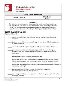
Force Field Physics
Attracted class members to an activity-packed journey through the science behind the invisible forces at work all around us. From jump rope generators to junkyard wars, there's never a dull moment when eighth grade physics scholars...
Curated OER
The Tennessee River: The Tie That Binds
Seventh graders examine the Tennessee River to see why it is still a major transportation artery in lieu of the age of modern transportation such as interstate highways, air cargo, and elaborate railway systems.
Curated OER
The Global Precipitation Measurement Mission (GPM) Lesson
Introduce your class to one of the ways that technology is benefiting humanity. The Global Precipitation Measurement Mission involves the data collected by nine satellites from different countries with a united focus on studying world...
Curated OER
Planets or Not, Here We Come!
Pupils, working in groups, research planets in terms of the size, temperature, number of moons, and potential for life. They use packets and worksheets as guides for their research. Students may role-play as aliens visiting their...
Curated OER
Ups and Downs
Students examine tidal currents. In this tides lesson students describe how the tides affect lives and explain why it is important to monitor them.
Curated OER
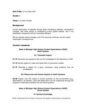
Is Your Spot Hot?
Eighth graders explore global warming. In this Earth Science lesson plan, 8th graders will look for Harbingers and fingerprints for different areas. The students will identify an area at risk and they will then create a...


