Other
Bscs: Earth's Changing Surface Lesson 2: Landform Detectives
Using relief maps, students will learn that landforms can be different from one place to another. Included are a minute-by-minute lesson plan, activities, and teacher discussion points and questions.
Other
Bscs: Earth's Changing Surface Lesson 1: Our Land
This hands-on lesson focuses on the land and its many different types of landforms and bodies of water. Included are a minute-by-minute lesson plan, activities, and teacher discussion points and questions.
Other
Bscs: Earth's Changing Surface Lesson 3: Grand Canyon Explorers
Students will learn that landforms can change over time in this lesson. Included are a minute-by-minute lesson plan, activities, and teacher discussion points and questions.
Math Science Nucleus
Discovering How Landforms Are Created on Earth
Young scholars compare water and ice erosion to discover how landforms are created.
Common Sense Media
Common Sense Media: Wondering About Landforms in Asia
Following a guided observation through Google Earth of a landform in Asia, students will be able to form questions that reflect what they have observed and what they want to know about that landform.
Alabama Learning Exchange
Alex: The Earth's Changing Surface
During this unit, students will identify the various landforms found on the earth's surface. Also, students will describe how these landforms are created and changed by the natural forces within the earth and on its surface, as well as...
Scholastic
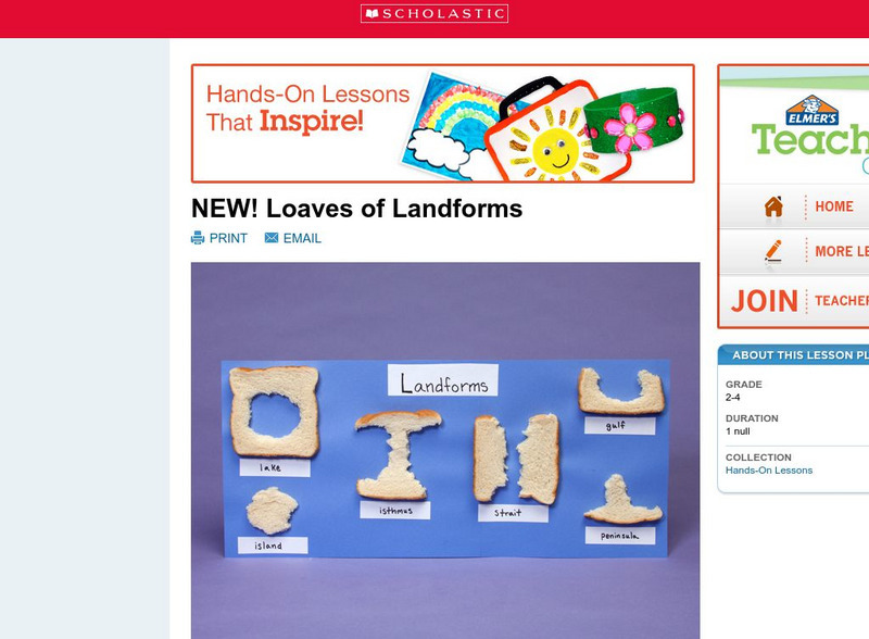
Scholastic: Loaves of Landforms!
A foundation in geography begins with an understanding of the terms geographers use to describe the features of Earth. This lesson is designed to help young scholars grow their vocabulary and learn to recognize common landforms in a...
Scholastic
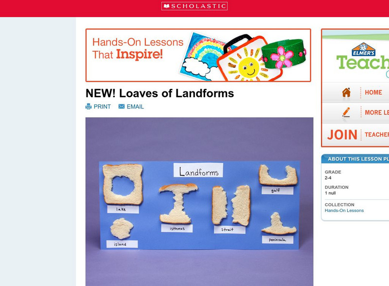
Scholastic: Loaves of Landforms
This is a comprehensive lesson plan to teach primary students about landforms. A foundation in geography begins with an understanding of the terms geographers use to describe the features of Earth. Help students grow their vocabulary and...
National Geographic
National Geographic: Shaping the Tallest Peak on Earth
This lesson builds upon a National Geographic film covering George Mallory's effort to climb Mount Everest in 1924. It looks at the physical features of mountains, and the landform features of Mount Everest that present challenges to...
Math Science Nucleus
Math Science Nucleus: Maps as Tools
A series of lessons in which young scholars learn about landforms. Includes interpreting landforms, creating landforms, and information on Angel Island.
National Association of Geoscience Teachers
Quaternary Glacio Fluvial History of the Upper Midwest Using Anaglyph Stereo Maps
Students examine the anaglyph stereo map and use textures to generate a surficial geology map of the Upper Midwest. They can then interpret the textures in terms of landforms, geomorphic features, and earth-surface processes, as well as...
Science Education Resource Center at Carleton College
Serc: Geologic Photo Field Trips for Introductory Physical Geology
Students participate in a series of virtual geology field trips by observing and describing rock outcrops, geologic structures, and landforms in field based photographs.
Science Education Resource Center at Carleton College
Serc: Global Land Vegetation
This Global Land Vegetation module is one of four Studying Earth's Environment from Space modules. It consists of three sections: class resources, computer lab resources, and a glossary and acronym List.
Science Education Resource Center at Carleton College
Serc: Geo Blocks 3 D Interactive 3 D Geologic Blocks
This interactive tutorial on visualizing geologic features contains animated block diagrams that show how the surface expressions of dipping layers, folds, igneous intrusions, and faults are related to subsurface structure and cross...
PBS
Pbs Learning Media: Hurricane Matthew Causes Weathering and Erosion
View videos and photos from the aftermath of Hurricane Matthew and see how the earth's landforms changed as a result of the heavy winds and rain. Weathering and erosion made a new landform and dramatically changed the coastline....
TeachEngineering
Teach Engineering: Sea to Sky
In this lesson plan, students learn about major landforms (e.g., mountains, rivers, plains, valleys, canyons and plateaus) and how they occur on the Earth's surface. They learn about the civil and geotechnical engineering applications of...
Alabama Learning Exchange
Alex: Wearing Away the Mountains
The Tennessee River Gorge outside Chattanooga is recognized as a protected biosphere reserve by the United Nations due to its immense proportion of species to acres. Understanding the formation of the gorge helps explain why so many...
Science Education Resource Center at Carleton College
Serc: Investigating the Geologic History of Southeast Minnesota
This activity is an inquiry-based, earth science field investigation of the geology of southeast Minnesota. Young scholars will make observations of rock outcrops and landforms in the region using maps, pictures, and field sampling, then...
Other popular searches
- Pictures of Earths Landforms
- Earths Landforms Reading
- Earths Landforms in Us
- Earths Landforms Answers
- Introducing Earths Landforms
- Earths Landforms in u.s.
- Landforms on Earth's Surface


