Curated OER
Continents on the Move
Students examine the tectonic plates of the Earth and how the landforms of Earth have changed position over time. In groups, they identify the evidence that the continents are still moving. To end the lesson, they practice measuring...
Curated OER
Quad Squad
Students pretend they have visited a forest research station on an overnight field trip. They study forest fires, use compass directions, read maps, interpret imagery, and think about the impact of fire on ecosystems.
Curated OER
Cookie Topography
Students construct a cross section diagram showing elevation changes on a "cookie island." Using a chocolate chip cookie for an island, they locate the highest point in centimeters on the cookie and create a scale in feet. After tracing...
Curated OER
Water Works Wonders
Students examine where water is found in the world, how we use it, and the various forms it takes. They observe the refraction of light through a prism, record the day and night sky over a week's time, and create a topographic model of...
Curated OER
Rivers, Maps, and Math
Middle schoolers use maps to locate and label the major rivers of North and South America. Using the internet, they identify forests, grasslands, mountain ranges and other landforms on the continents as well. They compare and contrast...
Curated OER
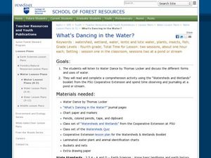
What's Dancing in the Water?
Students learn about watershed, as well as the different forms and uses of water. In this water forms lesson, students brainstorm water sources and uses. Students read the book Water Dance and discuss water examples. Students complete a...
Curated OER
A Rocky Situation
Second graders conduct experiments with rocks to observe weathering. They read books, examine websites and watch a video to examine how rocks break down into soil.
Curated OER
Introduction to Topographic Maps
Tenth graders create a topographic map and see how it represents different elevations. In this topographic maps instructional activity students read and interpret topographic maps.
Curated OER
Saskatchewan's Population Distribution
Pupils explore landforms, vegetation, climate and population distribution in Saskatchewan. After discussing an atlas of Saskatchewan, students create their own relief map and climagraphs of Saskathewan. Using specified websistes,...
Curated OER
The Moon
Third graders identify the phases of the moon. They use the internet to see the different phases of the moon on different dates. They form their own opinions from the information they have read and justify their opinions to their...
Curated OER
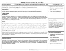
What Would Happen If ... A Study of a Scandinavian Glacier
Young scholars read an article about changes is the landforms in Scandinavia. They identify the main ideas. They eliminate or combine to make 4-7 main ideas. Finally students write about what they predict happen share, and discuss.
Curated OER
"Tri-County" Project--Ground Water
Students explore data on some of the landforms in Nebraska to distinguish between porous and nonpremeable soils. The state's groundwater is investigated.
Science 4 Inquiry
Edible Plate Tectonics
Many people think they can't observe plate tectonics, but thanks to GPS, we know that Australia moves at a rate of 2.7 inches per year, North America at 1 inches per year, and the Pacific plate at more than 3 inches per year! Scholars...
Curated OER
Greeks Around the World: A Case Study on Greek Diaspora
Students gain an understanding of the concept of Diaspora relating to Greeks. They use guided discovery to apply the geographic inquiry model to an examination of the reasons for Greek Diaspora.
Curated OER
Earthquake!
Learners gain an understanding of earthquakes. They examine vocabulary associated with earthquakes, how earthquakes happen, and preventive measures taken to diminish damage or harm in the event that an earthquake should happen.
Curated OER
Factors That Affect Climate
Fifth graders use captured portions of the Internet ("mininets") to perform research into climate. They create graphs of the data recorded using latitude as the independent variable and temperature as the dependent variable.
Curated OER
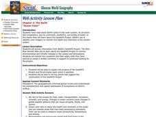
Ocean Color
Students examine NASA's SeaWiFS Project Web site to explore how the SeaWiFS Project monitors environmental and climatic changes in the oceans and atmosphere. They answer questions and write a summary in support of continued funding for...
Curated OER
Deforestation
Learners identify the different tropical rainforests in the world using a map. In this ecology instructional activity, students describe the different methods of deforestation. They create a memo and present it to class.
Curated OER
A Nation Divided
Young scholars compare the physical and human characteristics east and west of the 100th meridian to answer twelve questions. They write a summary of their findings.


