Curated OER
Understanding Treaties: Students Explore the Lives of Yakama People Before and After Treaties
Students role play positions in the Walla Walla treaty negotiations. They identify the significance of the Sacred Circle and other beliefs of the Native Americans. They discover the complications the tribes faced after the treaties...
Curated OER
Weather and its Effect on the Environment and Settlement
Students, after choosing two diverse cities, collect data on weather for a month and construct a graph on temperature and precipitation. After collecting population data of said cities, and graphing it, they plot population on a large...
Curated OER
Geological Development of Indiana and the Movement of Peoples Across the State
Fourth graders examine the geological development of the state of Indiana. Using the internet, they interact with the United States Geological Survey. They identify earthquake zones and energy resources in the state. They work...
Curated OER
Temperature and Daily Life: Mexico City and Indianapolis
Students compare the effect of temperature on daily life of a citizen in Mexico City, Mexico with that of a citizen of Indianapolis, Indiana.
Curated OER
Geological Development of Indiana and the Movement of Peoples Across the State
Students are introduced to the geological development of the state of Indiana. Using the internet, they visit the U.S. Geological Survey and locate the earthquake zones in the state. In groups, they locate and identify the energy...
National First Ladies' Library
Our Nation Grows
Young scholars demonstrate the importance of symbols, especially the flag, to the identity of the American nation. They use the internet to trace the design timeline of the American flag.
Curated OER
Endangered Animals
Learners listen to a teacher led lecture on jaguars, their habitats, and how they became endangered. Using a specified web site, they choose an endangered animal to research. After gathering information, students participate in...
Curated OER
LA CENERENTOLA (Cinderella)
Students work in groups to create a map key. The map key represents the diversity of each of the Cinderella stories previously read. They explore the cultural dimensions and contributions of the arts.
Curated OER
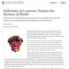
Halloween Art Lessons: Explore the Mystery of Masks
Halloween art projects take a mysterious turn as students discover the mystery and magic behind mask traditions around the world
Curated OER
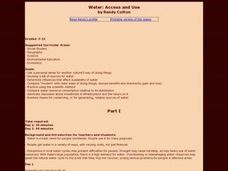
Water: Access and Use
Students get a personal sense for another culture's way of doing things. Develop a list of sources for water. Practice using the scientific method. Examine means for conserving, or for generating, reliable sources of water.
Curated OER
Great Basin Tribes- Use of Land for Sustenance
Students explore four Native American tribes from Nevada. In this Native American history lesson, students identify and generate important corresponding attributes of the Southern Paiute, Northern Paiute, Washoe, and Western Shoshone...
Curated OER
Westward Expansion : Mapping
Fifth graders travel along exploring the expeditions of John F. Fremont. In this Westward expansion lesson, 5th graders gain understanding of the events that shaped the west through the use of maps. Students use mapping skills to...
Curated OER
Exploring the Science of Water in Art: Water Cycle Lesson Plans
Water cycle lesson plans provide an opportunity for teachers to collaborate, and students to discuss this important resource.
Prince William Network
Migration Headache
During this game, kids become migratory shorebirds and fly among wintering, nesting, and stopover habitats. If they do not arrive at a suitable habitat on time, they do not survive. Catastrophic events are periodically introduced that...
Prince William Network
Migration Math Madness
A great way to incorporate math into life science, this lesson has learners measure migratory routes on a map and calculate the actual distance that shorebirds on the routes would cover. Learners compute the distance covered in both...
Prince William Network
The Incredible Journey
Divide your school gym into breeding grounds and non-breeding grounds so that your zoologists can play a game simulating the seasonal migration of shorebirds. Players pick one of the included game cards and follow its directions, which...
Curated OER
Map on the Wall
Young scholars examine the Ogallala aquifer water storage facility, identify rivers that refill the aquifer, and locate major cities near by. Students make maps of the area.
Curated OER
Chart Making for Navigators
Students discuss the importance and function of nautical maps for sailors. They, in groups, take soundings of a simulated bay in a shoebox and develop a nautical chart that enable them to navigate the shoebox safely.
Denver Art Museum
The Poetry in Non-Events
The photograph, Nellie and her Italian Soda is viewed and discussed by the class. They are instructed to use the photograph as inspiration to write a poem about non-events, or things that are beautiful in every day life. Pupils use a...
Curated OER
Food on the Map
Learners work together to examine the tastiest towns in the United States. After discovering the names of the equipment, they identify the seven continents. They take a survey and locate the cities and states of the foods mentioned.
Curated OER
The Magic of Cranberries
Students research climatic and soil conditions for growing cranberries and illustrate how cranberries grow. They research how cranberries are used past and present and create an a-b-c book on cranberries.
Curated OER
Should Soil Be Sterile?
Students determine if the sterilization of topsoil is beneficial to seed germination and plant growth. They grow plants alongside control groups, make and record observations of plant growth and measure plant biomass.
Curated OER
Animals, Animals, Everywhere
Fourth graders participate in a variety of activities dealing with animal characteristics and classifications in this multi-task lesson. They use graphic organizers, make booklets, and make models.
Curated OER
Canada and its Trading Partners
Students identify the relationship between Canada and its trading partners. They use two data sources, Canadian Statistics and E-STAT, on the Statistics Canada website to explore the growing importance of trade in general.


