Curated OER
Mapping the Bone Field: An Area and Scale Exercise
Here is an excellent cross-curricular lesson. Learners relate multiplication to area by making a grid on graph paper, and then creating the same grid in real space outside in the school yard.
Curated OER
Linguistic Diversity. Languages in Canada - Elementary
Create a language mosaic to reveal the linguistic diversity in your community. Pupils interview a person with a home language other than English and contribute to a bulletin board display representing the variety of languages spoken. The...
iCivics
Win the White House
Here is a unique and engaging approach to learning about the steps a presidential candidate must take during a campaign. Learners role play the part of a candidate in this online interactive, taking part in a presidential debate and then...
Curated OER
Where is Flat Stanley?
Students create a story map of the basic elements and significant events of the book Flat Stanley. Students brainstorm places they would like to visit if they had been flattened and then, write about an imagined experience. Students...
Curated OER
MAP UNIT
First graders investigate how maps are used to identify different locations. They will also appreciate how there are different types of maps for their purposes. Finally students study how maps contain symbols that represent real places.
Curated OER
Changing Images of Childhood in America: Colonial, Federal and Modern England
Students compare and contrast maps of New Haven, Connecticut from today and the past. After taking a field trip, they draw sketches of the types of architecture and discuss how the buildings have changed over time. They read journal...
Curated OER
Do You Know What You Just Read?
Students answer reading comprehension questions using the "story grammar" technique. They listen to a story and then answer questions using the technique: main character, setting, main events, and resolution. Students complete an...
Curated OER
Putting the World in Perspective
Students work in small groups to: make a mental map of the world by tearing paper shapes of the seven continents and locating them on a flat surface in their relative positions, compare their finished mental map to a reference world map,...
Curated OER
Colonial Vacation Planner
Looking for a good lesson on the Colonial Period for your upper-elementary class? Then, this lesson is for you! They use website designs, U.S. travel publications, and maps to plan a family vacation to states which were part of the...
Smithsonian Institution
Who's in Camp?
Pupils complete readings, a group activity using cards, and a writing activity to better understand people's lives during the American Revolution. The resource emphasizes people such as the militiamen, women, officers, and children,...
Curated OER
Using Color as a Pre-Writing Tool
To better understand how to compose a clear and well-organized paper, learners read short passages, write summaries, and make colored graphic organizers. This is a fully developed three-day lesson with suggested assessments.
Curated OER
Teaching Elementary School Social Studies
Students identify possible social studies themes that can come from the video, "Voyage of Discovery". They list the five themes of geography. They develop elementary-level interdisciplinary unit plans for social study content. They...
Curated OER
Creating Life Maps (Elementary, Reading/Writing)
Students create a personal life timeline to better explain how a historical timeline is effective in studying history. They also write a poem about themselves.
Curated OER
Journey to Japan: An Elementary Geography Standards-Based Unit on Japan
Second graders compare and contrast Japanese customs and culture to those of Americans through research in this year long study. They determine the basic needs of all people in spite of cultural differences.
Curated OER
Making a Region Map of a State
Fourth graders create salt maps of a state and indicate its regions. They include topographical elements including mountains, valleys, lowlands and major water bodies and a compass rose.
Curated OER
Map It Out!
Students open their Alabama history book to the chapter on the Civil Rights Movement noticing how the chapter is broken into headings. They read a passage and as a class, create a story map focusing on the main ideas and details.
Curated OER
A Bird's Eye View of our 50 States
Third graders focus on state birds as they learned absolute location (latitude/longitude) of each state, as well as their relative location (bordering states).
Curated OER
Mapping the West
Students determine how Americans' perception of the geographical features of the West changed following the Lewis and Clark expedition. They analyze historical maps of the West.
Curated OER
THE GULF STREAM
Students explore how to describe the Gulf Stream, how Benjamin Franklin charted it, and correctly plot it on a map.
Curated OER
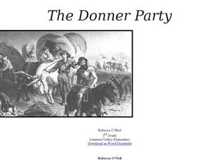
The Donner Party
Who is the Donner Party? Find out why this group of pioneers lives in infamy. A lot of information is provided in this resource, but you will have to copy and paste the text to acquire the handouts. Learners will look at primary sources,...
Curated OER
Sense Poems
Students explore 5 senses poetry. In this poetry writing lesson, students visualize a special day and brainstorm related vivid adjectives and phrases. Students create mindmaps of the five senses to go with their visualization and write...
Curated OER
A Soldier's View of the American Civil War
Study and research the American Civil War in this explanatory writing lesson. Middle schoolers complete six activities to learn about the American Civil War and soldiers' views of the war. The lesson includes several options to complete...
Curated OER
Site and Situation: Right Place at the Right Time
Students analyze geographic details. In this research skills lesson, students research maps as well as primary and secondary sources to analyze growth, population, and manufacturing in Altoona, Pennsylvania following World War II....
Curated OER
An American Legacy-Lewis and Clark’s Corps of Discovery Study
Fifth graders travel with the Corps of Discovery. In this ancient civilizations lesson, 5th graders research print and Internet sources about the Lewis and Clark expedition. Students prepare PowerPoint presentations to share their...


