Curated OER
Create a Weather Newscast
Fourth graders explore and study basic weather terms, strengthen research skill on the web and create a weather newscast. They choose a weather site on the web, copy weather maps and create a videotape based on a written script to...
Curated OER
Blazing the Trail
Learning about proportions through measuring and mapping distances is the focus of this real-world math instructional activity that doubles as an activity. Mathematicians complete a course designed to measure and map locations in order...
Curated OER
Pennsylvania Colony
Learners research the main reasons for the colonists moving to the Pennsylvania colony. They analyze maps, label a bubble map, list similarities/differences of immigrants then and now, and create a colonial newspaper advertisement.
Curated OER
Interactive Atlas
Second graders examine the different ways people move from place to place in a neighborhood. Using the interactive online atlas MapQuest, they identify the various ways people move around their own neighborhood by creating a map and...
Curated OER
A Flip of Life in the 13 Colonies
Fourth graders create a flip book illustrating the 13 original colonies. They study the growth and development of each of the three groups of the original colonies. They use maps to observe and interpret geographic information and...
Curated OER
Not Just for Gods and Goddesses:
Students use dictionaries, encyclopedias, art, computers, and books to study the Gods and Goddesses of Ancient Greece. In this Ancient Greece lesson plan, students research maps, stories, Olympic games, and more about Ancient Greece.
Curated OER
Nunavut, Our Communities
Students locate the communities of Nanavut on a territorial map and identify community characteristics. They research the online Atlas of Canada
Curated OER
The Built Environment-An Integrating Theme
Students observe, record, and present knowledge of their local built environment while conducting a walking tour of their community. They develop written and photo journals, drawings, time lines, graphs, and charts to engage in...
Curated OER
Freedmen's Bureau
Students examine the African American experience after they received their freedom after the Civil War. They complete a Mind Map, read and analyze a poem, and write a paragraph using key vocabulary words. They analyze the impact of the...
Curated OER
Aquifer Model
Students, after researching and brainstorming about aquifers and locating aquifer maps of Texas, participate in the building of a model of an aquifer complete with a pumping station. They also answer a variety of questions at the...
Curated OER
Rubber Duckies and Ocean Currents
Students explore marine life by conducting a rubber duck experiment. In this water currents lesson plan, students practice identifying latitude and longitude coordinates on a map and define the currents of major oceans. Students discuss...
Curated OER
Flight Paths of Orbiting Satellites
Learners examine the path a satellite follows as it orbits the earth. In this space science lesson, students use a globe as they illustrate a satellite in its orbital plane, then plot points on the satellite's path on the globe to see...
Curated OER
Open Sesame: A Magical World of Reading
Third graders, through six lessons, study tales of Ali Baba and the Forty Thieves and Aladdin and the Lamp from The Arabian Nights.
National First Ladies' Library
Brrrr! Expeditions to the North and South Poles
Students examine the first successful explorations of the North and South Poles, through a study of the four men who accomplished them. They present the fruits of their research on posters, or with PowerPoint presentations.
Curated OER
Regional Landforms and Native People
Third graders study the Native American tribes of Maidu and Miwok by studying Internet artifacts, culture, language, music, storytelling, architecture, food, clothing, crafts and geology.
Curated OER
Dancing with Dionysus
Sixth graders research Ancient Greek culture by acting in a play for the festival of Dionysus. In this Greek culture lesson, 6th graders study an ancient Greek map and the Sarcophagus Dionysus from the Walters Art Museum website....
Curated OER
Discovering Fossils
Students dig for and discover fossils in a classroom setting. They dig on a tarp to find, map, assemble, and photograph their discoveries.
Curated OER
Story Stretching: Tall Tales in North America
Students are introduced to tall tales. In this introductory tall tales unit, students explore the tall tales of Casey Jones and Johnny Appleseed. This unit includes many interdisciplinary lessons including graphing skills and geography.
Curated OER
Let's Write Around the World
Students participate in an ongoing writing project about the seven world continents. In this continents writing lesson, students work on an interactive game to write about the seven continents. Students locate the continents on the map....
Curated OER
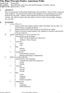
The Díne (Navajo) Native American Tribe
Students participate in a variety of activities to become familiar with the Navajo Indians. In this Díne (Navajo) Native American tribe lesson, students understand where the Navajo tribe lived and find them on a map. Students discuss the...
Curated OER
All Around the Neighborhood - Part 3
Second graders illustrate the roles, responsibilities, and skills of community members and write a paragraph that summarizes the importance of those roles, responsibilities, and skills. They are asked: "What is a role?" Students are...
Curated OER
Oregon Trail Diary
Students write a diary. In this writing and creativity instructional activity, students pretend they are moving west and keep a diary about their adventures. Students study real-life scenarios about families who made the trip out west...
Curated OER
Brick by Brick
Young scholars use their previous knowledge of the Pyramid Lake War to help them analyze different primary sources of Fort Churchill. In this source analysis instructional activity, students work in groups to study 4 different primary...
TPS Journal
Sourcing a Document: The First Thanksgiving
How reliable is a painting of the first Thanksgiving if it was created 300 years after the fact? Learners assess the validity of a primary source image to determine what it can actually reveal about this event.


