Curated OER
Educational Technology Clearinghouse: Maps Etc: Europe (Physical), 1915
Physical map of Europe showing major landforms and waterways, including the Alps, the Apennines, the Urals, the Russian Heartland, the Pyrenees, the North Sea, Mediterranean, Black Sea, and the Volga, Danube, Rhine, and Seine Rivers.
Curated OER
Educational Technology Clearinghouse: Maps Etc: Physical Europe, 1916
A physical map of Europe from 1916 showing color-coded elevations and water depths for the area extending from Iceland to the Ural Mountains in Russia Proper, and the Arctic Circle to the Mediterranean Sea. Land elevation colors range...
Curated OER
Educational Technology Clearinghouse: Maps Etc: Land Elevations of Europe, 1906
A physical map of Europe showing land elevations from below sea level, lowlands, elevations over 1,000 feet, and elevations over 4,000 feet. Plains, highlands, major rivers, and political divisions are shown.
Curated OER
Educational Technology Clearinghouse: Maps Etc: Europe (Physical), 1868
A map from 1868 of Europe, showing the physical features, climate, and commercial resources of the region. Mountain chains are represented by lines of varying thickness, with the broader the line, the greater the elevation. The highest...
Other
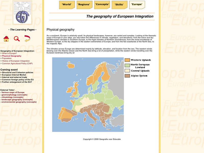
The Learning Pages: Geography of European Integration
This page has a map showing the 4 different types of land located in Europe. Information is provided on Europe as well as links to more maps and information.
Curated OER
Etc: Maps Etc: Physical Features of Europe, 1901
A map from 1901 of Europe, showing the physical features of the region. This map is color-coded to show general elevations from sea level to over 6,500 feet, mountain systems, drainage divides, lakes, rivers, coastal features, and the...
National Geographic
National Geographic: Looking Back, Looking Forward
Lesson reviews what learners have learned in the unit on European cultural and physical landscape. Students compare maps, questions and ideas from the beginning of the unit and identify new questions for research.
Curated OER
Etc: Maps Etc: Physical and Cultural Geography of Europe, 1915
Six maps of Europe showing the average rainfall, the major climate zones, agricultural products (rye, corn, wheat, rice, and sugar beets), industrial products (iron, textile, and coal), ethnic groups, and religions.
Curated OER
Educational Technology Clearinghouse: Maps Etc: Europe, 1901
A map from 1901 of Europe, showing the political boundaries at the time, capitals and other major cities, mountain and terrain features, lakes, rivers ,islands, and coastal features of the region. The physical division between Europe and...
Curated OER
Educational Technology Clearinghouse: Maps Etc: Europe, 1870
A physical and political map showing country boundaries of Europe as they existed in 1870, including major cities, rivers, and landforms.


