National Humanities Center
National Humanities Center: Toolbox Library: Prosperity, American Beginnings: 1492 1690
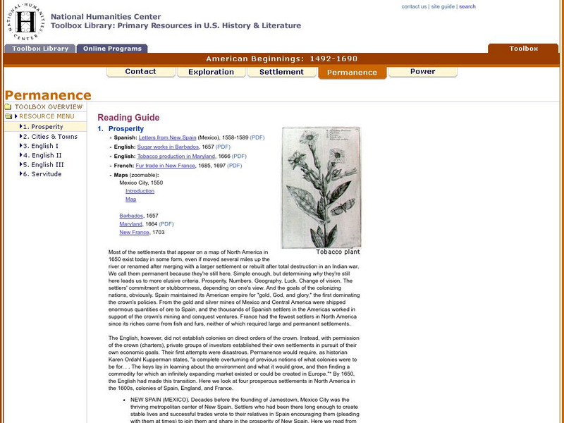
Four original source accounts, and four related maps, of successful English, French, and Spanish settlements in North America and the Caribbean that explain the qualities of these settlements and their reasons for permanence and prosperity.
Other
World Socialist Web Site: A Journey Through Africa's Civilizations
From the World Socialist Web Site, this is a review of Harvard professor Henry Gates' book, "Wonders of the African World." It includes interesting details of Gates' attempts to piece together a view of precolonial African history. (4...
National Humanities Center
National Humanities Center: Toolbox Library: The Spanish, American Beginnings: 1492 1690
Two maps and four accounts of the Spanish exploration of North America that reflect the goals of the conquistadors and fascination with the land they examined-and the brutality of their treatment of native peoples.
National Humanities Center
National Humanities Center: Toolbox Library: First Arrivals, American Beginnings: 1492 1690
Numerous visual images of artifacts from English settlements at Jamestown and at Plymouth, and from Spanish settlement in Hispaniola, and three original accounts of each of those early settlements that describe the possibilities and the...
National Humanities Center
National Humanities Center: Toolbox Library: English Iii, American Beginnings: 1492 1690
Three seventeenth-century buildings, two portraits, and three original accounts from Virginia and the Carolinas about the qualities and conditions of life in these southern English colonies that led to success and growth.
National Humanities Center
National Humanities Center: Toolbox Library: Servitude, American Beginnings: 1492 1690
Two examples of indenture contracts and three accounts of indentured servitude, including positive as well as admonitory views, in the Chesapeake English colonies.
PBS
Perceptions of African Identity: Swahili Coast
From the PBS series, a history of the Swahili coast of East Africa, including the island of Zanzibar.
Museums Victoria
Museum Victoria
Museum Victoria is Australia's largest public museum organization and is responsible for the care of the state's collections and conducting research.
Independence Hall Association
U.s. History: The Beginnings of Revolutionary Thinking
The American Revolution was close to 200 years in the making. Read about the philosophies and attitudes toward government, as well as the diverse populations who came to the British colonies, that eventually fomented rebellion.
Other
American revolution.org: Sins of the Fathers: Religion and Revolution
An academic essay describing the ways in which "religion is an active if not a determinative" cause for the American Revolution. The essay describes three influential areas: (1) religion and liberty, (2) religion and community, and (3)...
Louisiana Department of Education
Louisiana Doe: Louisiana Believes: World Geography: Colonization of Africa
Students develop and express claims through discussions and writing which examine the effect of colonization on African development.
Open Door Team
Open Door Web Site: Britain and the Scramble for Africa
Briefly describes Britain's motivations for imperializing African regions. Includes the text of a speech given by Lord Cruzon entitled, "The True Imperialism."
University of California
Antillians: The Growth of Slave Trade
Easy-to-read, colorful maps that show the triangular slave trade routes from 1451 to 1870.
University of Calgary
University of Calgary: Latin America & the Conquistadors
Information about the way the Spanish conquistadors were able to conquer the indigenous people they met.
Curated OER
Etc: Maps Etc: Africa Before the Berlin Conference, 1884
This is an interesting map of Africa showing the continent before the Berlin Conference of 1885, when the most powerful countries in Europe at the time convened to make their territorial claims on Africa and establish their colonial...
Curated OER
Etc: Maps Etc: Africa Before the Berlin Conference, 1882
A map of Africa as it was known in 1882 before the Berlin Conference of 1885, when the most powerful countries in Europe at the time convened to make their territorial claims on Africa and establish their colonial borders at the start of...
Curated OER
Etc: Comparative Projections of Asia, 1800 1899
A map using comparative map projections of Asia, as part of a hemisphere and on a Mercator's projection, to illustrate European misconceptions of land claims during territorial colonialism. In the 19th century, European powers were...
Curated OER
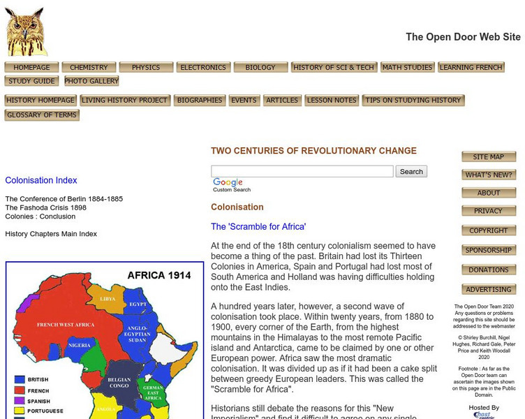
Educational Technology Clearinghouse: Maps Etc: Africa Prior to Wwi, 1914
A political sketch map of Africa just prior to WWI in 1914, showing the colonial possessions of European powers established at the Berlin Conference of 1885. The map shows the territorial claims of the British, French, German,...
Curated OER
Maps Etc: The Colonization of Africa, 1870 1910
A map showing the European colonization of the African continent before and after the Berlin Conference of 1885, when the most powerful countries in Europe at the time convened to make their territorial claims on Africa and establish...
Curated OER
Etc: Maps Etc: Physical and Political Map of Africa, 1879
Map of pre-colonial Africa, showing the predominately native countries and territories of the African continent in 1879. The counties include the Barbary States of Morocco, Algeria, Tunis, Tripoli and Fezzan, the Egyptian territories of...
Curated OER
Etc: Dev of Colonies and Early Western Explorations, 1700 1775
A map of eastern North America showing the early development of the European colonies and westward exploration to the Mississippi River. The map shows the routes of several early explorers with dates of exploration, including La Salle,...
Curated OER
Unesco: Australia: Australian Convict Sites
The property includes a selection of eleven penal sites, among the thousands established by the British Empire on Australian soil in the 18th and 19th centuries. The sites are spread across Australia, from Fremantle in Western Australia...
Curated OER
Unesco: Peru: Historical Centre of the City of Arequipa
The historic centre of Arequipa, built in volcanic sillar rock, represents an integration of European and native building techniques and characteristics, expressed in the admirable work of colonial masters and Criollo and Indian masons....


