Curated OER
The Weather Forecast
Students observe a daily paper to see the temperature forecast looking at a paper thermometer with today's predicted temperature colored in. They predict today's temperature, and paste the second color on the same thermometer to show...
Peace Corps
Weather and Water in Ghana
Young scholars investigate the climate of their region. Students research statistics and conduct interviews. Young scholars take a virtual tour of Ghana and discuss its climate. Students consider water conservation and the role it plays...
S2tem Centers SC
Investigating Chance Processes of Probability
How likely is it that the school cafeteria will serve chicken tomorrow? Discover the concept of probability with the roll of the dice. Pupils evaluate the liklihood of several statments about everyday life. Then, a mathematical...
National Wildlife Federation
Ghost Town
Around 93 percent of the reefs on Australia's Great Barrier Reef have been bleached, and almost one quarter of them are now dead. Scholars research the sea temperatures, especially around the areas with coral reefs, to make connections...
Curated OER
Dynamic Earth
Students complete an experiment to study tsunamis and its around the Earth. In this earthquakes and tsunamis lesson, students participate in a demonstration to learn how earthquakes impact sea waves. Students study the P, S, and L waves...
Curated OER
Heat, Wind and Storms Affect Air Quality
Students study heat and wind's affect on air quality. For this air quality lesson, students locate an article about air pollution. Students research a solution for the air pollution problem and use a model from nature to help them solve...
Curated OER
The Science of Hurricanes
Students are introduced to the science of hurricanes in an effort to highlight how forces change the speed and direction of motion.
Curated OER
Naming the Clouds
Fourth graders examine how water condenses into clouds and identify the different types of clouds using the same system devised over 200 years ago. They listen to a book about clouds, and create a Cloud Key. Next, they record their...
Curated OER
Myths and Legends on Natural Disasters: Making Sense of Our World
Young scholars explore different natural and manmade disasters through a webquest. In this earth science lesson, students explain their causes. They also discuss how disasters affect society.
Curated OER
Track a Tsunami
Learners comprehend tsunamis, where they are likely to occur, and that underwater earthquakes cause them. They discuss what can be done to protect people form a tsunami, such as using computerized bupys, wave simulation machines,...
Curated OER
Tsunami Simulation Experiment
Pupils examine an article about tsunami warning systems and discuss why they are important. They conduct an experiment that shows how the velocity of a wave in water changes with the depth.
Curated OER
Countdown to Disaster
Students discover the potential dangers of weather in their hometown. In this environmental lesson, students research Hurricane Hugo and the devastation it caused South Carolina in 1989. Students record weather data from their city and...
Curated OER
Picnic Possibilities
Fourth graders plan a picnic using weather data. Using accumulated weather data from various sources, they create a graph of the weather conditions in their region for a given period of time. Students interpret this data to predict the...
Curated OER
Surface Meteorological Observation System (SMOS)
Learners investigate local surface weather conditions. They log weather conditions for thirty days, develop a graph, plot cloud cover, and compare/contrast the graphed lines of various weather factors.
Curated OER
How Do Weather Conditions and Lunar Cycles Affect Fishing Success?
Pupils use weather measuring devices to record and study weather conditions at different locations, during different times. They attempt to draw conclusions about the relationship between weather conditions, lunar cycle and fishing success.
Curated OER
Surface Meteorological Observation System (SMOS)
Students monitor local surface weather conditions for at least 30 days. They interpret the data by graphing it and detemining percentages.
Curated OER
Creating Climographs
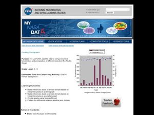
Students use satellite data to compare precipitation and surface temperatures on different islands. In this satellite lesson students create graphs and explain the differences between weather and climate.
Curated OER
Storm Clouds-- Fly over a Late Winter Storm onboard a NASA Earth Observing Satellite
Students study cloud data and weather maps to explore cloud activity. In this cloud data lesson students locate latitude and longitude coordinates and determine cloud cover percentages.
Illustrative Mathematics
Telling a Story With Graphs
Turn your algebra learners into meteorologists. High schoolers are given three graphs that contain information about the weather in Santa Rosa, California during the month of February, 2012. Graph one shows temperatures, graph two...
KOG Ranger Program
Fire Behavior in Forests
Understanding the ways a fire will act is a key factor in fire safety and fire prevention. Young campers focus on how the weather and terrain can affect the behavior of a fire with topographic maps and different scenarios.
Curated OER
Comprehension: Answering Questions then Rereading the Text to Identify Details in Support of the Answers
Even first graders can be exposed to good reading strategies and comprehension skills. The teacher demonstrates how to read informational text, look at the questions, reread the text, locate answer, then locate supporting details to...
Curated OER
Using Vegetation, Precipitation, and Surface Temperature to Study Climate Zones
Using NASA's Live Access Server, earth scientists compare the temperature, precipitation, and normalized difference vegetation index for four different locations. They use the data to identify the climate zone of each location using...
Curated OER
Comparing Visual Interpretations and Actual Events: War & Battle
A Venn Diagram is used to compare artistic and historical representations of a single event. Young analysts view the provided images, read textbook descriptions, and discuss the validity of each representation in terms of bias and...
Curated OER
History's Thermometers
Ancient coral beds give scientists clues to past ocean temperatures in much the same way that tree rings indicate historical weather conditions. High school scientists examine coral oxygen isotope ratios and plot the data as a function...


