Curated OER
Mars Geologic Mapping
Learners identify and interpret photographic details of a Martian surface image, design, and create a simple features map. They identify and interpret the geologic history of a part of Mars' surface and then, analyze and discuss the...
Curated OER
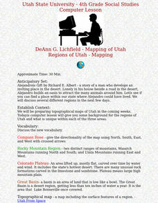
Regions of Utah - Mapping
Fourth graders draw a rudimentary map of the state of Utah, dividing it into the three regions: the Great Basin, the Colorado Plateau, and the Rocky Mountain Region.
Curated OER
Studies of the Eastern Worlds: Cultural Maps
Seventh graders look for similarities and differences in the culture of Eastern World countries by looking at the art from each country. They test their hypothesis and assumptions through further research in the media center. Finally...
Mathematics Assessment Project
Optimizing Coverage: Security Cameras
Are you being watched? Class members determine where to place security cameras protecting a shop. They then evaluate their own and several provided solutions.
Curated OER
Continents and Oceans on the Move
Students create an awareness of the vast percentage of water covering the earth. They relate similarities/differences between topographical maps and other maps of various time periods. Students examine how to use a topographical map.
Curated OER
Home on the Range
Students use maps and mathematics to determine the appropriate panther population in a given area. In this Florida ecology lesson, students research the area requirements of male and female panther and use a map to help calculate how...
Curated OER
The Solstices
Compare surface temperatures when the solstice occurs in the different hemispheres. Young scientists draw conclusions from their investigation of data collected using spreadsheets and a globe.
Polar Bears International
Top of the World
Learn about polar bears and the Arctic circle with a lesson about the countries and conditions of the region. After examining how the area differs from Antarctica, kids explore climates, animals, and geographical position...
Curated OER
Locating Patterns of Volcano Distribution
Pupils examine patterns of volcanic distribution worldwide, use tables to plot and label location of each volcano on map, lightly shade areas where volcanoes are found, and complete open-ended worksheet based on their findings.
Curated OER
World Map and Globe
Students explore symbols. In this beginning map lesson, students identify common picture symbols. Students place post-it notes with symbols drawn on them in the appropriate place on a map.
Curated OER
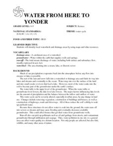
WATER FROM HERE TO YONDER
Students identify local watersheds and drainage areas by using maps and other resources. They are given copies of the water cycle. Students discuss the movement of water in the environment. They observe, record and transfer information...
Curated OER
Surface Water Supplies And The Texas Settlements
Students engage in a instructional activity that is concerned with the allocation and finding of water resources. The location of different settlement areas is considered as one looks how the water is distributed. They map some of the...
Curated OER
Finding the Mother Lode
Young scholars engage in a paper treasure hunt to find a lode deposit of gold using the placer deposit concentrations of metals found in stream sediments. They use topographic maps and metal concentrations to assist them. Students...
Curated OER
Mapping your watershed
Students investigate the importance of watersheds around the world. By visiting resource links, students can locate watersheds and their sources in the USA and Russia and analyze their effects on the surrounding topography. This lesson...
Curated OER
Building a Topographic Model
Students explore Mount Shasta and various locations on Mars to examine ways geographical data can be represented. They study topographic maps and translating data from 2-Dimensions to 3-Dimensions.
Curated OER
Did You Feel That? Earthquake Data Chart
Students plot earthquakes on the world map using coordinates of longitude and latitude. They designate the earthquakes magnitude with a symbol which they include in the map key.
Curated OER
Analyzing Meteorological Data From Mars
Students compare real-time Earth and Mars measurements for temperature, wind speed, humidity and atmospheric pressure by accessing Internet-data resources from NASA. They access real-time weather data and maps for their school location.
Curated OER
It'll Go With the Flow...
Students construct a water table elevation contour map and consider the direction and rate of groundwater flow to predict the actual runoff pattern. They discuss their findings and evaluate a hypothetical landfill site based on data...
Curated OER
Ocean Planet: Sea Secrets
Students identify ocean features and draw a profile using data points on a map. Through discussion and research, they discover the importance of oceanography and plot a profile of the ocean floor in search for a vessel full of precious...
Curated OER
Crash of Flight 111
Students identify the locations on a map of the airplane crashes discussed in this lesson plan. After watching a video, they discuss the importance of an investigation after a plane crash. They use the same information as the...
Curated OER
Eagle Creek Park (A Hike)
Young scholars plot a hiking course using aerial photos and a topographic overlay and find the latitude and longitude of absolute locations. They measure the total distance of a hiked area and figure the area of the ground walked using...
Channel Islands Film
Arlington Springs Man: Lesson Plan 2
West of the West's documentary Arlington Springs Man and a two-page scientific article about the same topic provide the text for a reading comprehension exercise that asks individuals to craft a one page summary of information gathered...
Curated OER
Measuring the Earth
Students identify types of arcs and angles in a circle, find the measure of arcs and angles, and solve real world problems involving lengths of segments in circles, lengths, and areas.
Curated OER
Geological Forces and Topography
Students discuss and research the Earth's geological processes. In this geology lesson plan, students study maps of Utah and the United States to learn about geological features. Students then complete the research cards for each area of...


