Curated OER
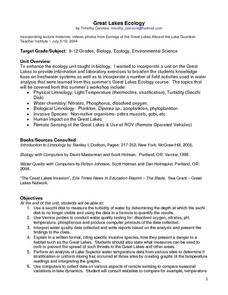
Great Lakes Ecology
Eighth graders identify the Great Lakes, and describe the habitat of life of a loon. They are able to point to and explain one of the major river systems that enters the Great Lakes with a focus on the Clinton River and the food webs...
Curated OER
What Do Maps Show?
This teaching packet is for grades five through eight, and it is organized around geographic themes: location, place, relationships, movement, and regions. There are four full lessons that are complete with posters, weblinks, and...
Curated OER
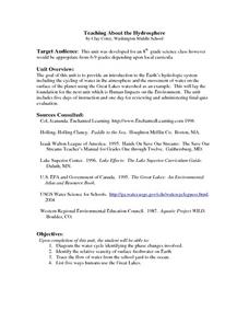
Teaching About the Hydrosphere
Eighth graders are introduced to the Earth's hydrologic system including the cycling of water in the atmosphere and the movement of water on the surface of the planet using the Great Lakes watershed as an example.
Curated OER
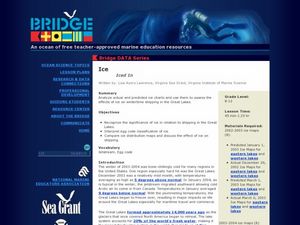
Iced In
Introduce junior oceanographers to ice conditions in The Great Lakes. The ice map links are no longer available, so you will not be able to have your class perform the mentioned data activity. You can, however, access the Canadian Ice...
Curated OER
United States Map - Lesson 11
Young scholars explore lakes of the United States. In this geography instructional activity, students identify noteworthy lakes on a map of the United States.
Curated OER
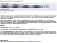
Marquette and Joliet Explore the Mississippi in 1673
Students locate and name the St. Lawrence River, the five Great Lakes, and the Mississippi River on a modern map. They find Quebec, Michilimackinac, Wisconsin, and Chicago on that map. They find the same places on a 1681 map.
Curated OER
How the Great Salt Lake Relates To Us
Third graders name at least three resources that come for the Great Salt Lake. They describe at least one product that is made from each resource. They name and locate on a map at least five different geographic regions where Great...
Curated OER
North Carolina Salt Dough Map Social Studies Project
In this lesson, North Carolina Salt Dough Map, 4th graders create a salt dough map of North Carolina, Students use dough to form the shape of the state of North Carolina. Students label the three regions of North Carolina and all of...
Curated OER
The Lake Effect
Fourth graders conduct an experiment demonstrating the effects of water and air temperature on precipitation. They create graphs demonstrating their findings using Claris Works for Kids.
Curated OER
Maps Can Help Us
First graders explore the geography of Montana by analyzing geographic maps of the area. In this Native American reservation lesson plan, 1st graders discuss the similarities and differences between reservations in the state of Montana....
Curated OER
The Great Lakes Plain Regions
Fourth graders explore the Great Lakes Plain region of Indiana. They discuss the key differences in the three regions of Indiana. Students discuss the landmarks, resources and other attributes of the Great Lakes Plain region and they...
Curated OER
The Aztecs - Mighty Warriors of Mexico
Upper elementary learners identify the Aztecs as the builders of a great city and rich civilization in what is now Mexico. They locate the Aztec Empire and its capital on a map and place the Aztecs in the chronology of American history....
Syracuse University
Erie Canal
While canals are not the way to travel today, in the first half of the nineteenth century, they were sometimes the best way to move goods and people. Scholars examine primary sources, including maps and pictures, to investigate the role...
Curated OER
An Early American Culture
Students identify the locations of the Hopewell culture. In this map skills instructional activity, students use a globe to mark several locations of the Hopewell culture.
Curated OER
Michigan Food: From Farm to You
Students recognize Michigan on a map and understand how its climate is affected by the Great Lakes. In this Michigan food lesson, students play a trivia game to identify the produce of Michigan. Students relate the climate in each part...
Curated OER
Summertime Travel
Third graders write about a summer event they participated in. In this paragraph writing lesson, the teacher models how to write about a place they have visited. Students then write their own paragraphs. Students will point out on...
Curated OER
Mystery State #51
In this mystery state worksheet, students answer five clues to identify the state in question. They then locate that state on a map.
Curated OER
Where is the Water?
Students explore freshwater ecosystems. In this geography lesson, students brainstorm all the lakes and rivers they know then mark them on a map. Students will then mark all the major freshwater resources on each of the seven continents,...
Curated OER
Osprey Journey
Students investigate the migration route of one bird, Osprey B4, using information gathered from satellites to track birds over a two-year period. They coimpare their graphs with maps of B4's migrations that have been plotted by...
Curated OER
Early Explorers
Fifth graders study early explorers. In this World history lesson, 5th graders draw an outline of a map labeling each part, build geographical features out of dough, and paint each of the land and water features.
Curated OER
Ancient Highways-Native Byways of Salmon Lake State Park
Eighth graders investigate the concept of the trail system used by the Native Americans. They compare and contrast the trails to modern transportation roadways of today. Students also define the types of information archaeologists use to...
Curated OER
Finding Your Way Around the I & M Canal
Fifth graders utilize a map of the I&M Canal (imbedded in this plan), and perform a series of tasks. They calculate distance, find specific points of interest and solve a set of story problems about the canal.
Curated OER
A Funny Taste
Learners participate in a demonstration that illustrates the relative amounts of salt in various bodies of water including the Dead Sea, Sallt Lake, Ocean water and distilled water. They taste and compare various mixtures.
Curated OER
Come On Over To Maya Place
Fifth graders analyze the Mayan culture. For this Mayan culture lesson, 5th graders study the Mayan culture noting similarities and differences between the Mayan culture and their own. Students examine hieroglyphic writing and the Mayan...


