Curated OER
Trees and Their Parts
Students research trees and their parts. In this forestry instructional activity, students participate in various learning stations to identify trees by matching the photographs of the tree to the correct name.
Curated OER
Wisconsin Snapshots
Fourth graders study Wisconsin's culture and heritage. They research the state's symbols and identify leaves common to the Wisconsin area. They create a leaf booklet and visit the state park. They visit local farms and create nature maps...
Curated OER
How Big Is A Tree?
Middle schoolers estimate the height of trees on the school campus, and measure their circumferences. They develop a map of trees on the school site, conduct their measurements, and record the results on a data table.
Curated OER
Living With Fire
Students identify effects of treatment weather on behavior of a wildland fire. They view simulation game that predicts effects of forest management on fire behavior.
Curated OER
Soil, Forest, and Land Conservation
Students discuss the demands on the rainforest and devise a management plan that satisfies competing uses. They then construct a diorama to show the location of the various sites.
Curated OER
Forest Stewardship
Students go on a nature walk. In this forest stewardship instructional activity, students brainstorm a list of things found in the forest, go on a nature walk and discuss forest stewardship.
Curated OER
Uses of a Tree
Students identify and explore the resources we use that come from trees. In this reading comprehension lesson, students sort word cards about resources that come from trees into groups based on the type of resource.
Curated OER
A Walk in the Woods
Eighth graders observe and identify the different levels of the forest. In this forest zones lesson students observe, identify and name a variety of forest components and describe how humans impact the forest ecosystem.
Curated OER
Applications of GIS
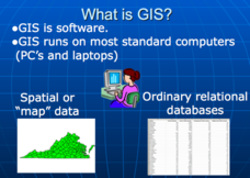
Don't be concerned that the title slide of this presentation mentions Virginia's Geospatial Extension Program; this slide show is very informative for any technology-focused curriculum when considering global information systems. It...
Curated OER
Trees and Their Parts
Learners visit five learning stations to explore various aspects of trees. They look for tree names, match visual pictures to the written words of tree shapes, and observe the benefits of fencing and preserving new cut from wildlife.
Curated OER
How Does Your Soil Stack Up?
Students examine the soil in their local area and create a soil profile. They record observations in the field and the classroom. They create their own display of the soil profile as well.
Curated OER
Does One Tree a Forest Make?
Students take a walk around the schoolyard looking at and identifying the trees. One leaf for each tree is collected. A chart is developed that represents the population of trees on the school ground. They keep journals and write an essay.
Curated OER
Our Forests Need Fires?
Young scholars consider how forest fires are both damaging and beneficial to forests. In this earth science lesson, students are read the book Fire! In Yellowstone by Robert Ekey and watch "Fire Ecology" and "Two Sides of Fire"...
Curated OER
No Magic Borders: Haleakala Style
Young scholars discuss borders and boundaries. They discuss pollution and the fact that boundaries cannot stop pollution and that pollution affects even protected wildlife and plants. They participate in an activity in which they must...
Curated OER
Exploring Our Watershed System
Learners study watersheds and examine how they are composed. In this watershed system instructional activity students explain how water enters a watershed and the concept of stream order.
Curated OER
Wood A Natural Renewable Resource
Students discuss the harvest of trees as a renewable resource. In this renewable resource activity, students evaluate the importance of how man harvest trees and uses wood as a renewable resource.
Curated OER
Etc: Maps Etc: United States Economic Regions, 1900
A map from 1912 of the United States showing the principal industries of the region. The map is color-coded to show the areas of fishing grounds, industrial centers, coal mining areas, petroleum fields, and iron ore fields. This map...
Curated OER
Etc: Maps Etc: Forest Map of the United States, 1910
A map from 1910 of the United States showing the forest regions of the Pacific, Rocky Mountains, Northern Forest in the Great Lakes and New England areas, Southern Forest along the Gulf and East Coast, and the Hardwood Forest. The map...
Curated OER
Etc: Maps Etc: Forest Areas of the United States, 1901
A map from 1901 of the United States showing the principal forest regions. The map is color-coded to show heavily forested areas and areas where forests occur in more or less open areas.
Curated OER
Etc: Maps Etc: Organized Protection Against Forest Fires, 1922
A map of the United States from the U. S. Department of Agriculture (1922) showing the funds distribution at the time dedicated to forest fire prevention compared to the funds needed to adequately protect forest land. The map shows areas...
Curated OER
Educational Technology Clearinghouse: Maps Etc: Forest Regions, 1898
A map from 1898 of the United States showing the forest regions in the contiguous 48 states. "Fully one third of the timber cut in the world each year comes from the forests of the United States. Indeed, lumbering is carried on so...
Curated OER
Educational Technology Clearinghouse: Maps Etc: Chestnut Blight, 1904 1922
A map of the United States from the U. S. Department of Agriculture (1923) showing the range of chestnut forests and extent of chestnut blight in the Northeast from 1904 to 1922.
Curated OER
Etc: Maps Etc: United States Forest Regions, 1901
A map from 1901 of the United States showing the forest regions, coded to show heavily forested and moderately forested areas. Areas of typical forest types are shown, including pine and hardwoods, spruce, birch, and maple in the...
Curated OER
Etc: Maps Etc: Western Forests and Woodlands, 1911
A map from 1911 of the United States showing the distribution of western forests and woodlands. Solid black represents continuous forests, dotted areas represent woodland, or areas that have a thin, scattered growth of forest vegetation.


