Curated OER
Collage/Assemblage
Students identify different shapes and patterns. They locate France on a world map and examine the works of artist, Henri Matisse. They discover shapes that are related to Math.
Curated OER
European Explorers of North and South America
Sixth graders explore the connection between the geography of America and the migration of the Native Americans to the American continents to the future conquering of the continents by the Europeans. They discuss the causes and effects...
Curated OER
An Exploratory Approach to the Teaching of French in the Middle School
Students review the most recent vocabulary list of French words. Using literature by Victor Hugo and Guy de Maupassant, they discover the history and culture of France. Using a map and the text, they locate the cities and regions of...
Curated OER
Canadian History
Students conduct research on the history of early Canada. They create timelines of important dates, write biographies of Canadian explorers, consider the importance of geography and religion in Canada's settlement and examine both...
Curated OER
If These Walls Could Talk: Seeing a Culture Through Human Features
Students read Talking Walls and discuss the walls presented and their importance to the culture. In this geography lesson, students locate and label each country/continent discussed in the book on a world map. Students take a walk and...
Curated OER
Countries of the World
Learners in a ESL classroom examine a world map and study the various countries' names. The study the cultures of selected countries and create a vocabulary list. Finally they label an empty map with the countries' names and a short...
Curated OER
A Moroccan Fairy Tale vs. European Folk/Fairy Tale
Second graders explore world geography by reading two different fairy tales. In this cultural storytelling lesson, 2nd graders read Snow White and the Seven Dwarves and the Moroccan story The Girl Who Lived with the Gazelles. Students...
Curated OER
Landmarks in Paris
Third graders create a map of France. They use computers to view an "in flight" movie about Paris. They research Paris using books and the internet. Students practice using the program "Comic Life." They import illustrations for each of...
Curated OER
Locating The Cold War
Students identify major players in the Cold War and place them on a world map. They identify the two superpowers location on the map as well as their allies. Students analyze how the world divided itself.
Curated OER
The Letter Ff: Alphabet Theme
Students complete several cross-curricular activities to learn the letter Ff. In this letter recognition lesson, students complete activities that include geography, music, physical education, science, seasonal, space science, and online...
Curated OER
Europe 1914
In this Europe 1914 map worksheet, students note the 9 regions of the Europe labeled on the map and their relevance to World War II.
Curated OER
Transportation in Canada
Students investigate the effect human activities have on the environment. In this geography lesson plan, students compose an article using data analysis about the environment. This article requires some homework assignment.
Curated OER
Frantz Fanon: Black Skin, White Mask
Students examine the history and geography of Martinique and Algeria, with an emphasis on broader issues of race and colonialism. They list some reasons that violence is or isn't a legitimate force in the struggle for people's freedom.
Curated OER
Europe after World War I
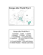
In this Europe after World War I map worksheet, students note the 11 regions of the Europe labeled on the map.
Curated OER
Winter Olympic Torch Traveling Across Italy
Students react to statements about the 2006 Winter Olympics, then read a news article about the Olympic torch's journey through Italy. In this current events lesson (written prior to the 2006 Winter Olympics), the teacher introduces the...
Boston University
Scramble for Africa
For this fantastic simulation, your young historians take on the roles of imperialistic European countries in the nineteenth century and then "scramble" to carve up the continent of Africa! This is a very hands-on activity that will help...
Curated OER
Winter Olympics History Year by Year
Investigate the history of the Winter Olympic Games. After researching this event and compiling necessary statistics, pupils use a graphic organizer to chart their findings. A template for a chart is included in this resource. Have your...
Curated OER
What They Left Behind: Early Multi-National Influences in the United States
Students examine how the European voyages of discovery influence American culture even today. They map eighteenth century Europe's impact on the United States.
Curated OER
Malia
Fourth graders begin their examination of the Hawaiian Islands. Using their island bookmarks from a previous instructional activity, they work together to put the information into a book. They identify the physical and human...
Curated OER
A Month of Mapping Literature
Explore the world through literature! With push pins to mark where each story came from, learners examine cultural differences, geographical location, and how those elements affect story content. This instructional activity could use...
Curated OER
Paris Peace Conference: Writing a Treaty to End World War I
How did World War I end? Tenth graders role play as experts from countries that were involved in World War I. They write a treaty to end the war and compare it to the Treaty of Versailles.
Curated OER
Navigation
Learners explain that globes are the best way to show positions of places, but flat maps are portable and can show great detail. They make a mercator projection of the route Lewis and Clark took on their journey.
National First Ladies' Library
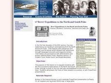
Brrrr! Expeditions to the North and South Poles
Students examine the first successful explorations of the North and South Poles, through a study of the four men who accomplished them. They present the fruits of their research on posters, or with PowerPoint presentations.
Curated OER
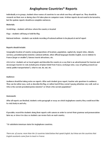
Anglophone Countries Report
Fifth graders make reports on Anglophone countries and report to the class. In this Anglophone countries report students take note of presented material. Students answer questions related to the reports. students write a...
Other popular searches
- France Geography Worksheets
- Paris, France Geography
- France Geography Landform
- France Geography Land Form
- Geography France
- France Geography Word Search
- France Geography Middle Ages
- France Geography Wordsearch
- France Geography Vaucluse
- France Geography Vacuoles
- Paris France Geography
- Physical Geography France


