Curated OER
American Civilization
Students review map and globe skills. They gather background to the story of Christopher Columbus' voyage.
Curated OER
Partition of Africa Questions
In this colonial Africa worksheet, students study a map of Africa from 1885-1914. Students then respond to 9 short answer questions based on the information presented in the map.
iCivics
Win the White House
Here is a unique and engaging approach to learning about the steps a presidential candidate must take during a campaign. Learners role play the part of a candidate in this online interactive, taking part in a presidential...
Jackson Public Schools
Summer Reading Activities
Provide parents with the tools they need to bridge the summer learning gap with this collection of fun activities. Whether it's creating an alphabet poster with illustrations for each letter, playing a game of sight word concentration,...
Florida Center for Reading Research
Phonemic Awareness: Phoneme Segmenting, Phoneme Counting Sort
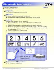
Pre-readers use the provided cards to say and sort based on the number of phonemes in each word.
Reed Novel Studies
Underground To Canada: Novel Study
Julilly dreams of freedom after being taken from her mother by a slave trader. Will she ever be free again? A resource focuses on the first chapter of Barbara Smucker's book Underground to Canada, and includes 10 vocabulary...
Angel Island Immigration Station Foundation
Culminating Writing Project - Reporting on Angel Island
The unit study of Angel Island Immigration Station concludes with scholars using information from the previous lessons to craft a news story about the Angel Island program.
Curated OER
Freeform Pennsylvania Map
In this Pennsylvania map worksheet, students research, study and label twenty important cities, physical attributes and the neighbors that surround Pennsylvania on a Pennsylvania map.
Curated OER
Claiming Land
Students examine several European maps with conflicting representations of the same geographic region. They uncover why different European nations produced different maps. In addition, they determine the role maps played in helping...
Curated OER
Slavery and the Underground Railroad
Fourth graders study slavery escape routes of the Underground Railroad on maps, read an account of an escape and then write narrative essays about a fictional slave's escape.
Curated OER
First Amendment: Bill of Rights
Twelfth graders explore the First Amendment and the rights that are protected by the First Amendment. They discuss how the First Amendment is important to their daily lives. Students research the amendment and complete a concept map.
Curated OER
Map of Asia
In this map worksheet, 3rd graders will study a map of Asia. Students will use this map to label and/or familiarize themselves with various aspects of the continent.
Curated OER
Map of Antarctica
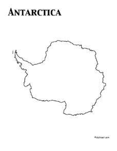
In this map worksheet, 3rd graders will study a map of Antarctica. Students will use this map to label and/or familiarize themselves with various aspects of the continent.
Curated OER
Causes of the Civil War: Missouri Compromise, Compromise of 1850 and Kansas Nebraska Act
How did the Missouri Compromise, the Compromise of 1850, and the Kansas-Nebraska Act contribute to the growing tensions that led to the Civil war? To better understand the events that led to the Civil War, young historians engage in a...
Curated OER
The Earth, Sun, Moon, And Stars
Fifth graders explore the solar system. In this solar system unit, 5th graders investigate numerous projects while rotating through learning centers. Students write about space and construct a space shuttle model. Students practice map...
Curated OER
Sequential Directions
Students demonstrate how to give clear directions when drawing a map to a specific location. In this map skills activity, students create a map to a location, such as their school, and write down clear directions to the destination.
Curated OER
Australia Map Resource Sheet
In this Australia map resource worksheet, students use the map of Australia to supplement their study of the country. They see a map labeled with Australian cities, and the surrounding countries and water bodies.
Curated OER
Movement of Air Mind Map Activity
Students explore the movement of air. In this air lesson, students discuss and give examples of air ventilation. Students compare outdoor and indoor air quality. Students create mind maps as a visual representation of...
Curated OER
Using Star Charts and Maps
Students study star charts and describe locations of objects. In this scientific models lesson students use coordinates and identify characteristics.
Australian Centre For the Moving Image
Dreamworks Animation Character Design
Dive into animation creation using Dreamworks® animated films. Compare and contrast characters, wonder and ponder why the plot is so important, and think of background and themes as your creativity unrolls onto paper.
Curated OER
The Underground Railroad
First graders read a book about Harriet Tubman and the Underground Railroad. In this underground railroad lesson, 1st graders learn songs and code words that the slaves used to communicate with one another. Students discuss how all...
Curated OER
Map a World of Facts
Students mark ten places on a world map while they follow fun facts on the included printable sheet. They research using a variety of resources to determine the location of the ten places.
Curated OER
Europe Map Quiz (Easy)
In this online interactive geography quiz worksheet, students respond to 35 identification questions regarding the countries of Europe.
Curated OER
How Has Colonialism Led to Multilingualism in Africa
Prepare yourself for a top-notch presentation on colonialism in Africa! Discussed are the reasons for African multilingualism. Maps and a country-by-country look at various colonists that made their mark on the African continent are...


